
Subscribe to continue reading
Subscribe to get access to the rest of this post and other subscriber-only content.
EBC (2021), then Alaska (2024), then Croatia and Scotland (2025), and now 2026
Subscribe to get access to the rest of this post and other subscriber-only content.
At the conclusion of day 4, I ask myself where days 1 – 3 went. (updated through Day 3 on Thursday, 4/17)
For anyone with the slightest inclination toward rowing, Jim Dietz’s and Mark Wilson’s AARC is an experience not to be missed wherever it may be held. With Sibenik (pronounced “shibenik”) as a base camp, we have spent half of each day practicing, reviewing videos, and taking about the finer points of correct rowing technique and why they matter. The other half of the day we have explored the wonders of a locale rich in European history dating to the early Middle Ages.
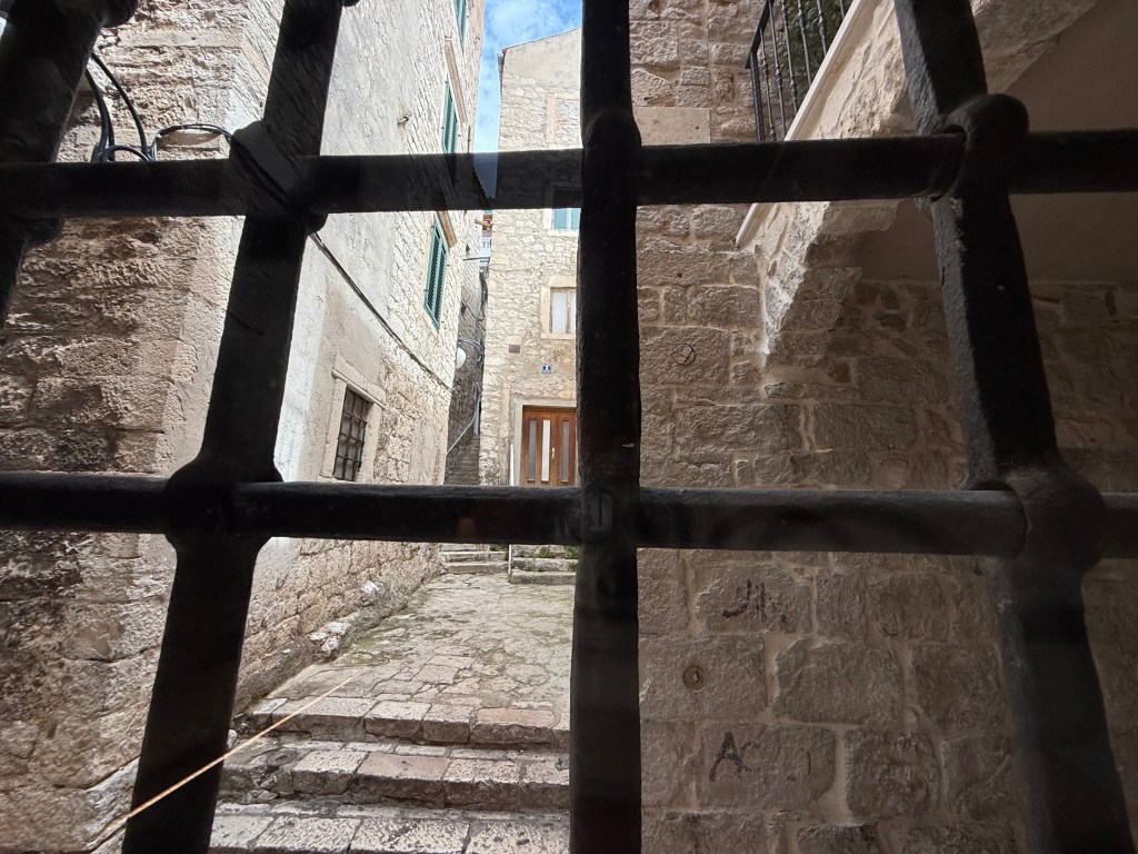
DAY 1 (4/13): From Split to Shibenik and an introduction to rowing camp
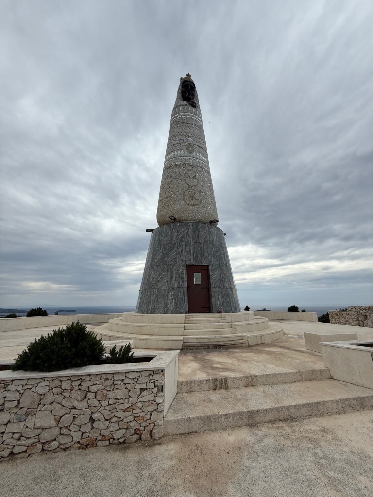
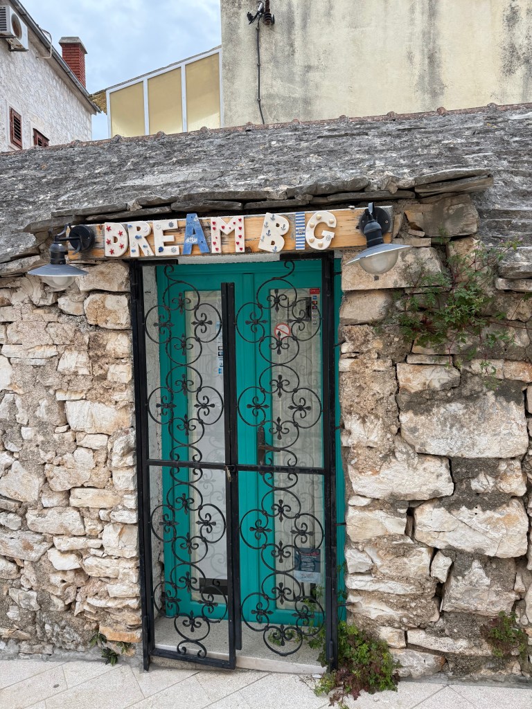
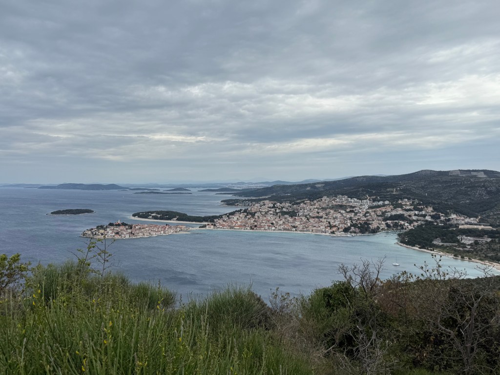
Left: Madonna and Child overlooks the village of Primosten. It’s a sister monument to one 80 miles away in Livorno Italy. Middle: (hearkening of Bainbridge Island Rowing’s decades-long fundraising campaign) a small business in the village of Primosten. Right: I bird’s eye view of Primosten from the monument.
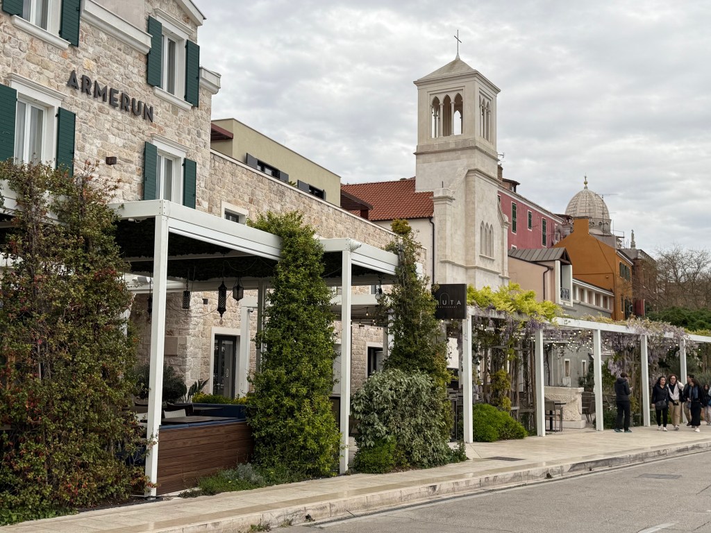
Left: Hotel Amerun; Right: Walkway visible from the stairway well in the hotel.
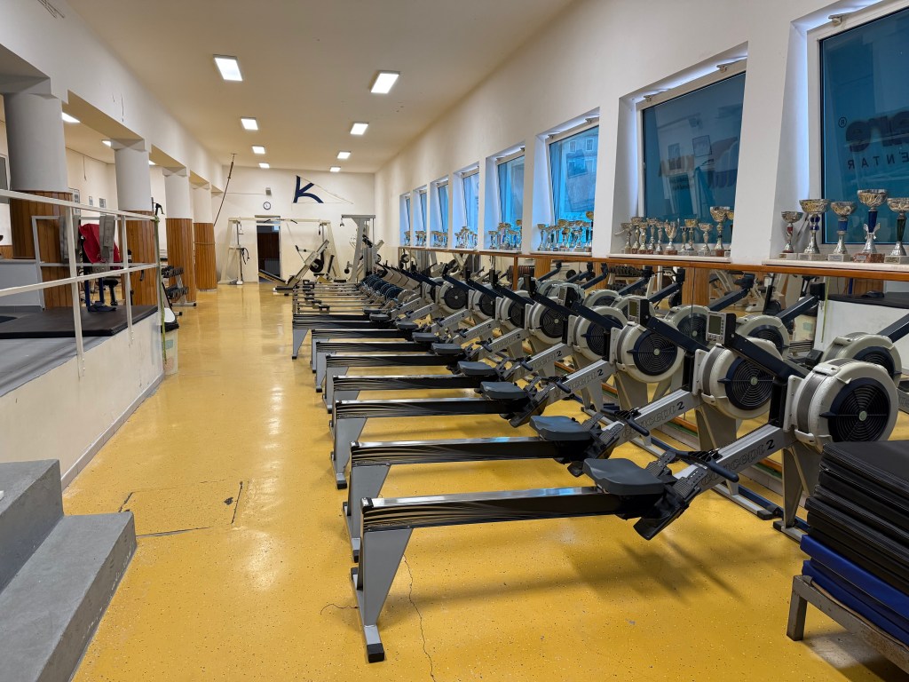
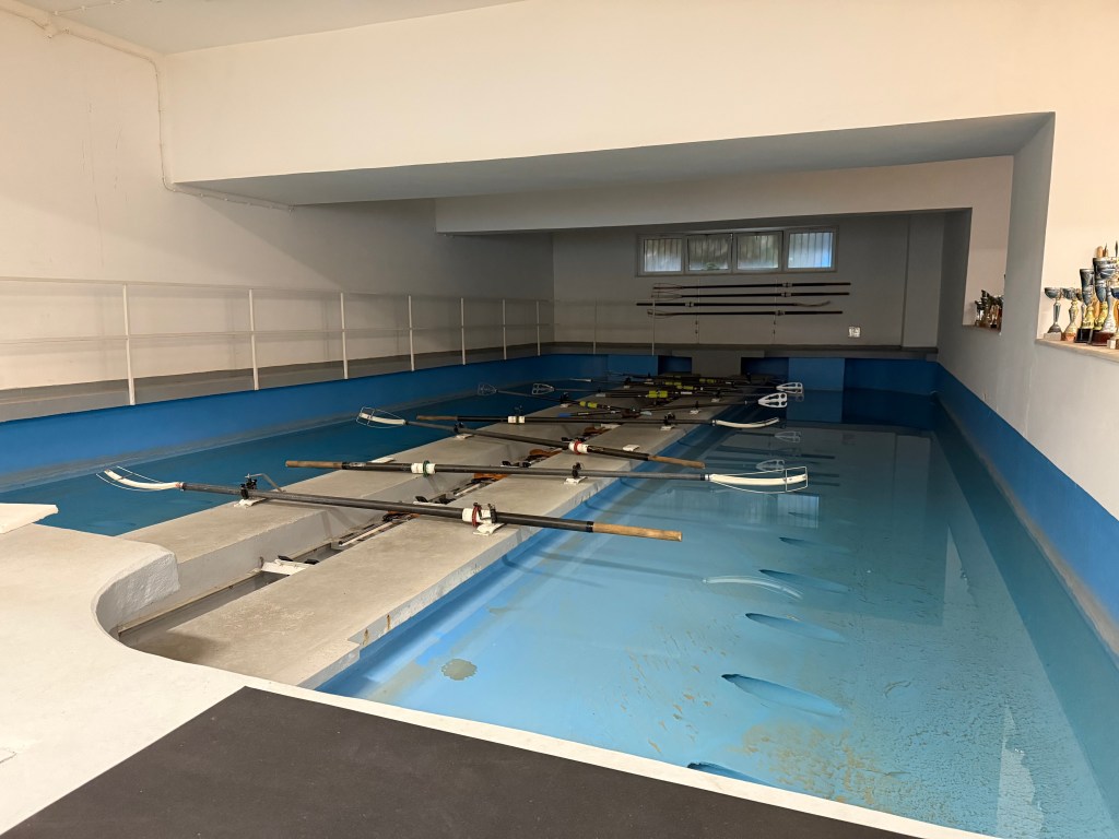
Equipment we would soon become well-acquainted with! Concept2 and Row-Perfect rowing machines and a rowing tank.
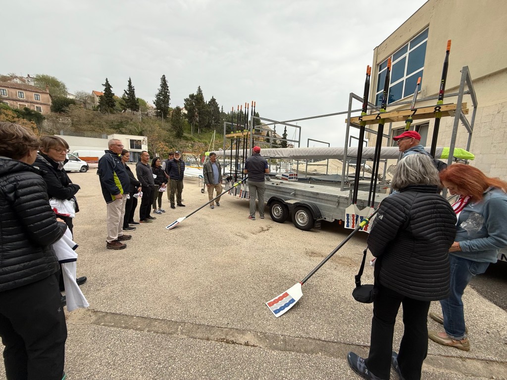
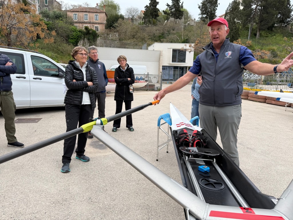
Scull assignments and adjustments … and WHY the adjustments unique to each rower are needed. Jim Dietz in red ball cap left. Mark Wilson in similar cap on right.
DAY 2 (4/14): On the water for the first time – for a few hours – in coxed quad gigs. And a phenomenal tour of Shibenik and Fort St Nicholas on its outskirts.
It’s challenging to write about all we learned today on the water, even for such a short time, and during subsequent video review (about two and a half hours). Initiation of the catch at maximum compression and maximum blade angle and completion of most of the leg drive before starting body swing and followed arm pull achieves the longest stroke possible with the greatest power input for the fastest boat speed. Keeping the back straight, pivoting at the hip, reduces the potential for back injury and yields the best leverage during leg drive and body rotation. Metrics of success are keeping the chin up during the stroke, pulling through to the sternum with level hands and elbows out, and tapping down on the handles with forearms for a clean release. Most of our training was done with blades square.
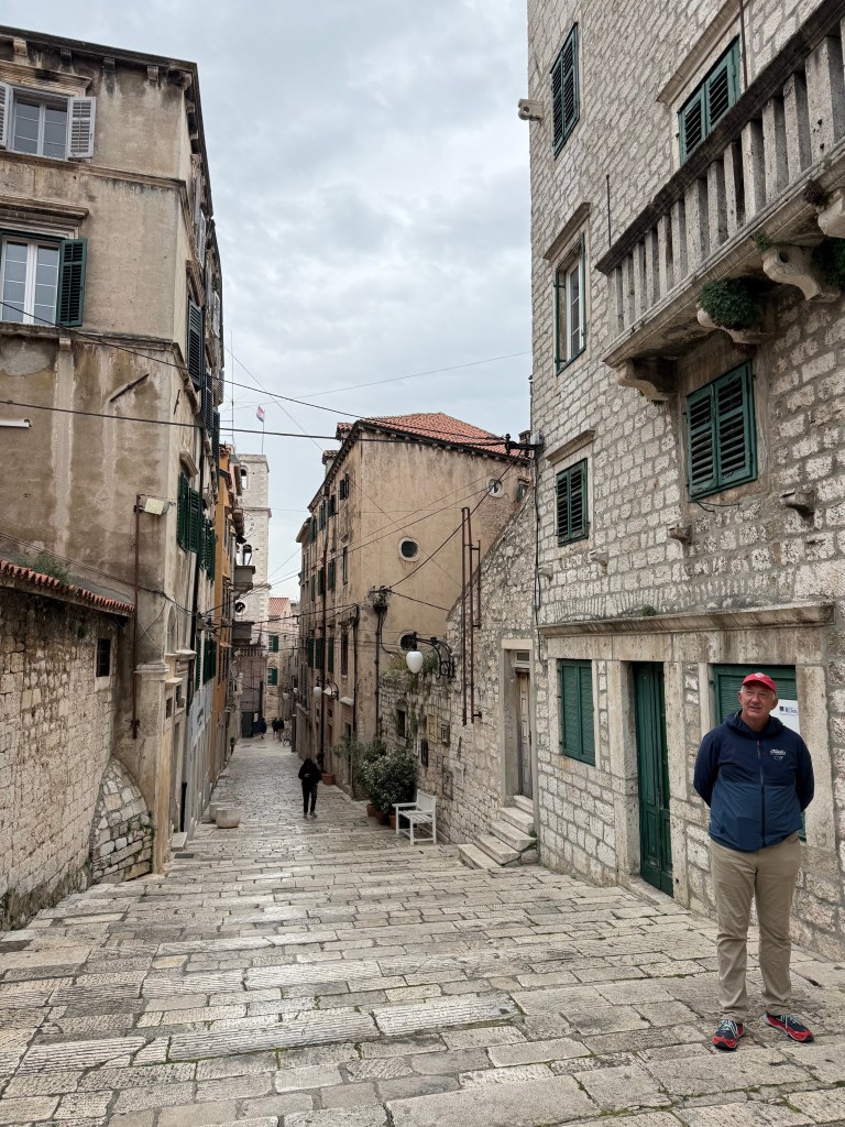
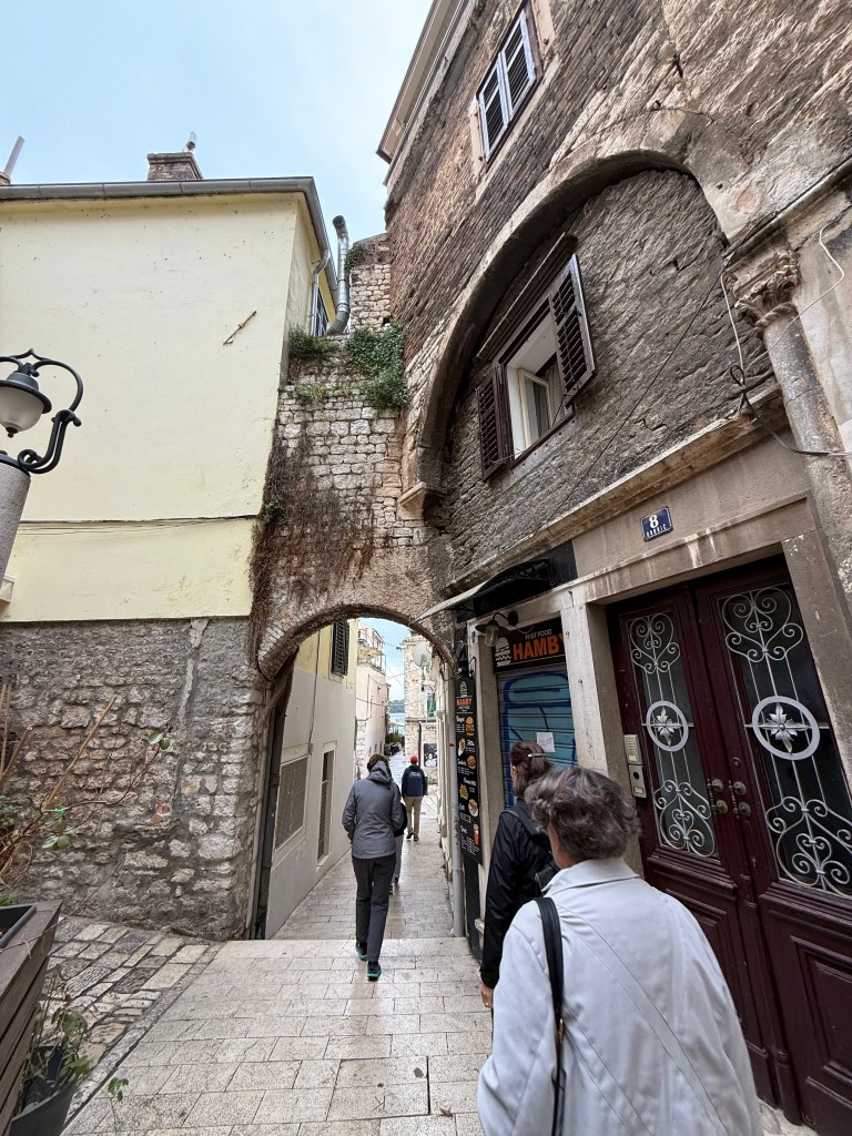
Ante Caric, a professional tour guide, gave us a superb walk-around tour of the town of Shibenik.
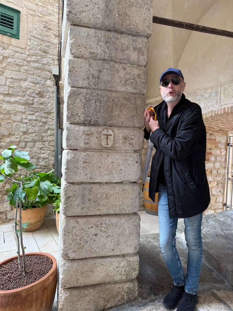

Ante Caric points out a form of the Knight’s cross which appears at wide intervals throughout town – a reminder of duty to Christian ideals. Right: Latin mottos are seen above doors throughout town This one states “recte faciendo neminem timeas” which translates to “by doing the right thing, may you not fear anyone.”
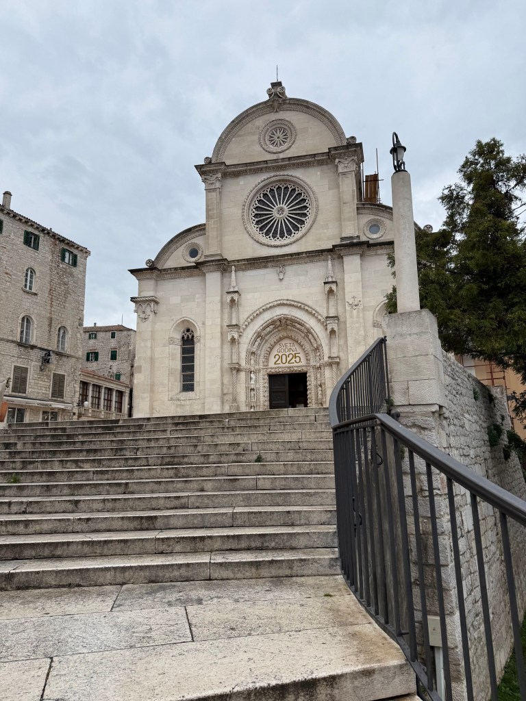
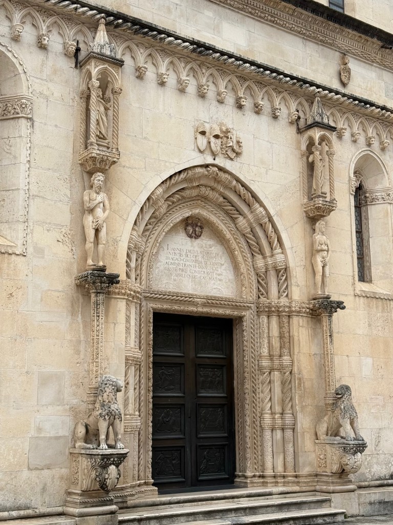
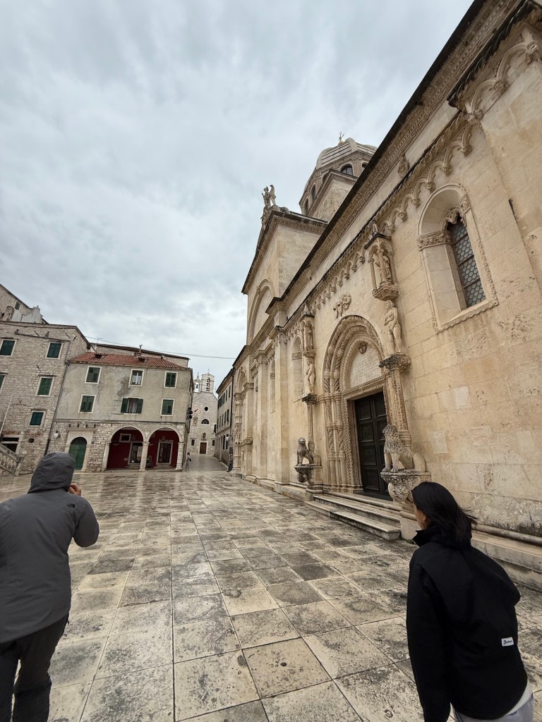
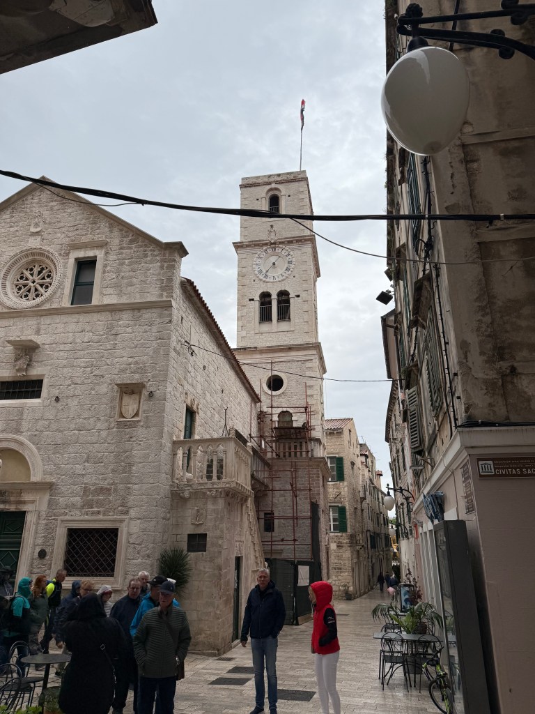
The prominent and largest of 24 churches in Sibenik adjoined by a large courtyard across from which sits a government building.
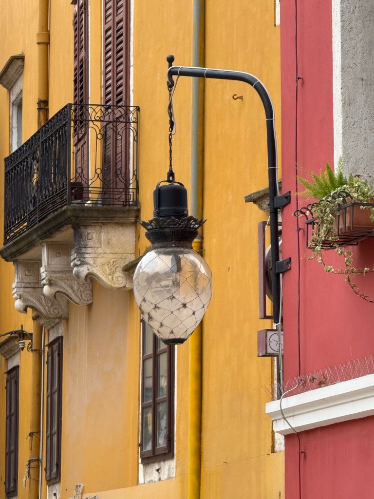
In 1895, Nicolai Tesla, working with engineers, completed a hydro-electric plant on the Krka River and brought the first AC-powered street lights to any city. The one on the left is a close-to-original design while the white lamps on the right are modern versions of similar form.
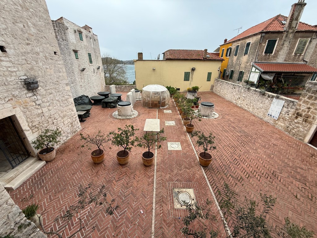
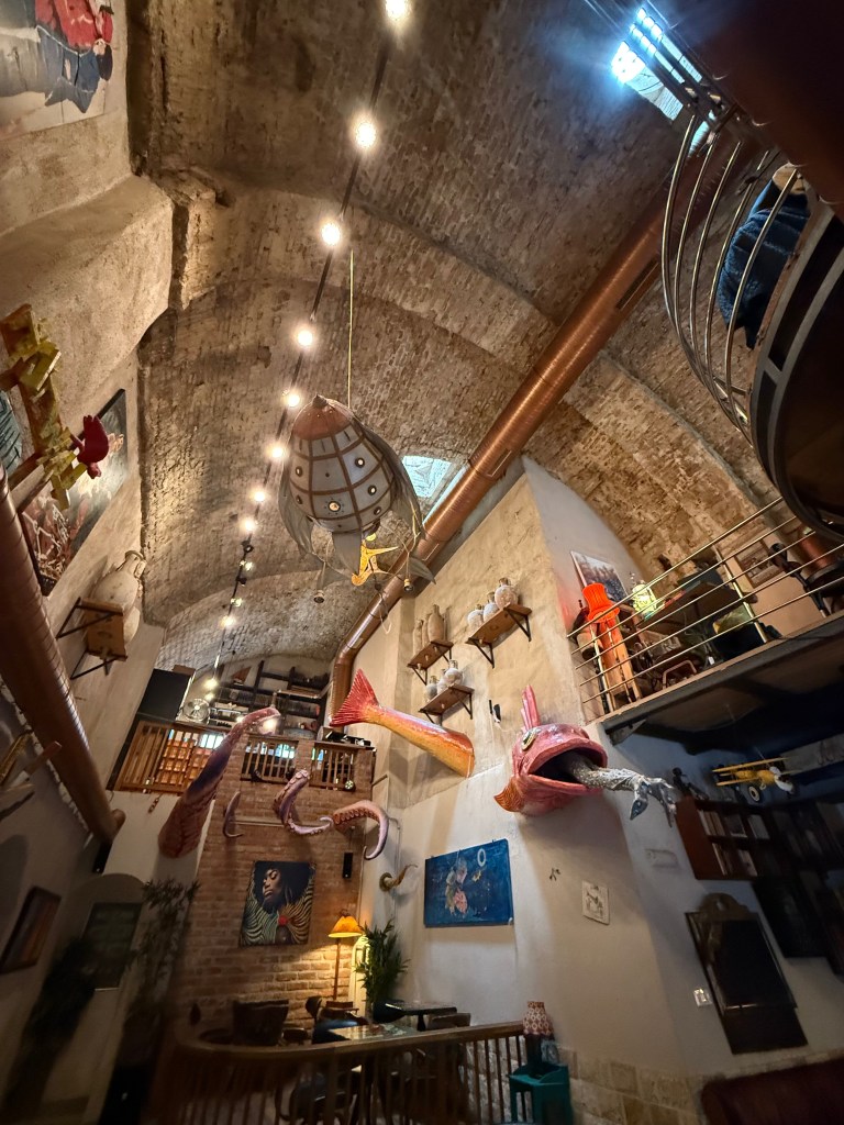
Many centuries ago, the city built two adjoining, huge long cisterns with semi-cylindrical roofs to collect fresh water. Left: four water drains held gravel and sand to filter the water. Four stubby access towers served to retrieve collected water. Today, Azimut, a popular bar has filled both rooms with tables and chairs and a band stand, and offers trivia nights to locals.
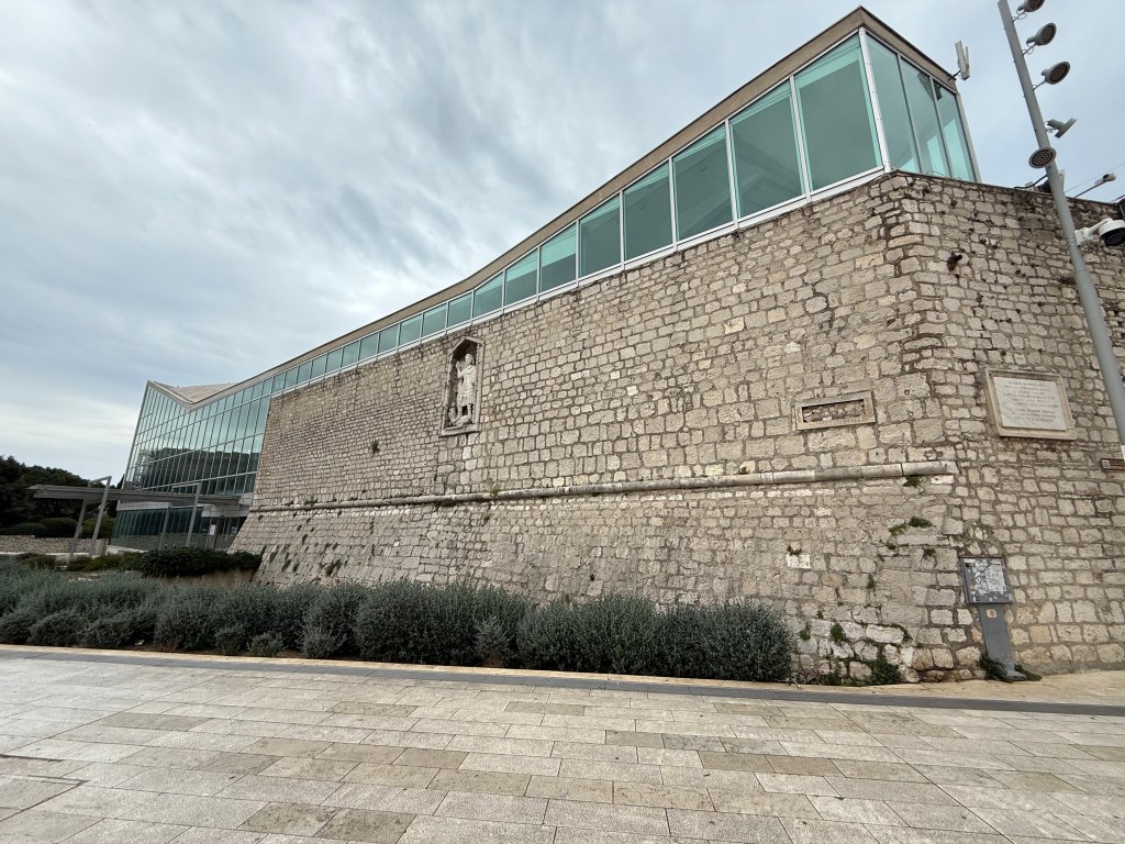
Left: remnants of a wall that surrounded the original city appear in places throughout town. Right: A large portion serves as a wall of the local library.
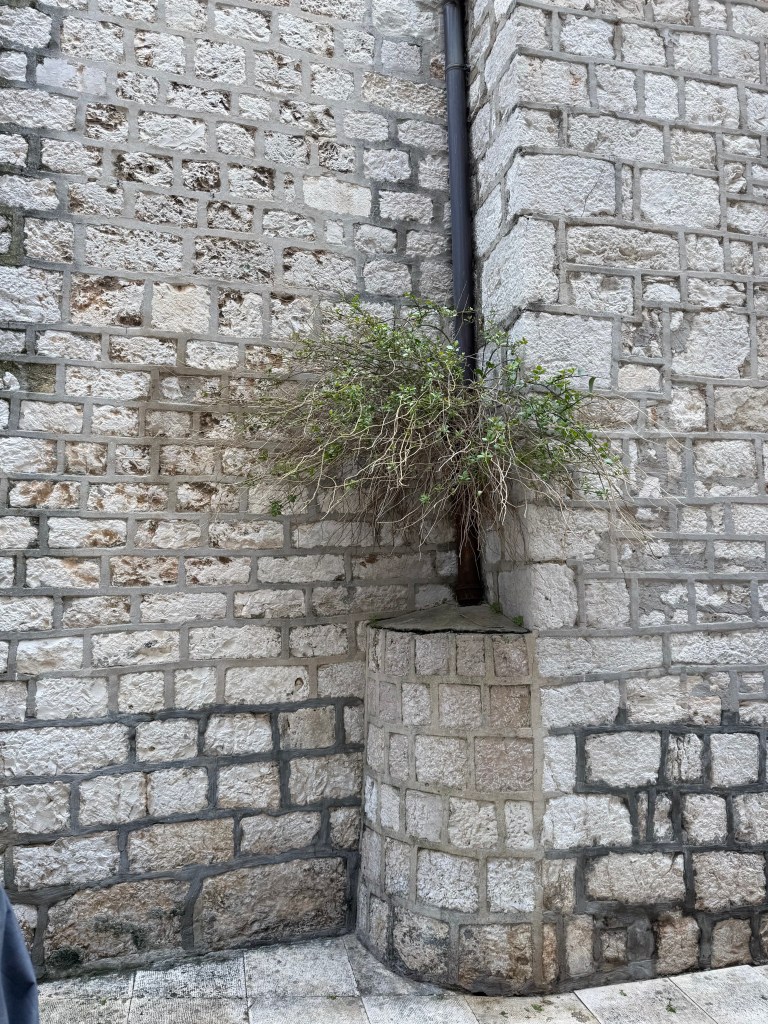
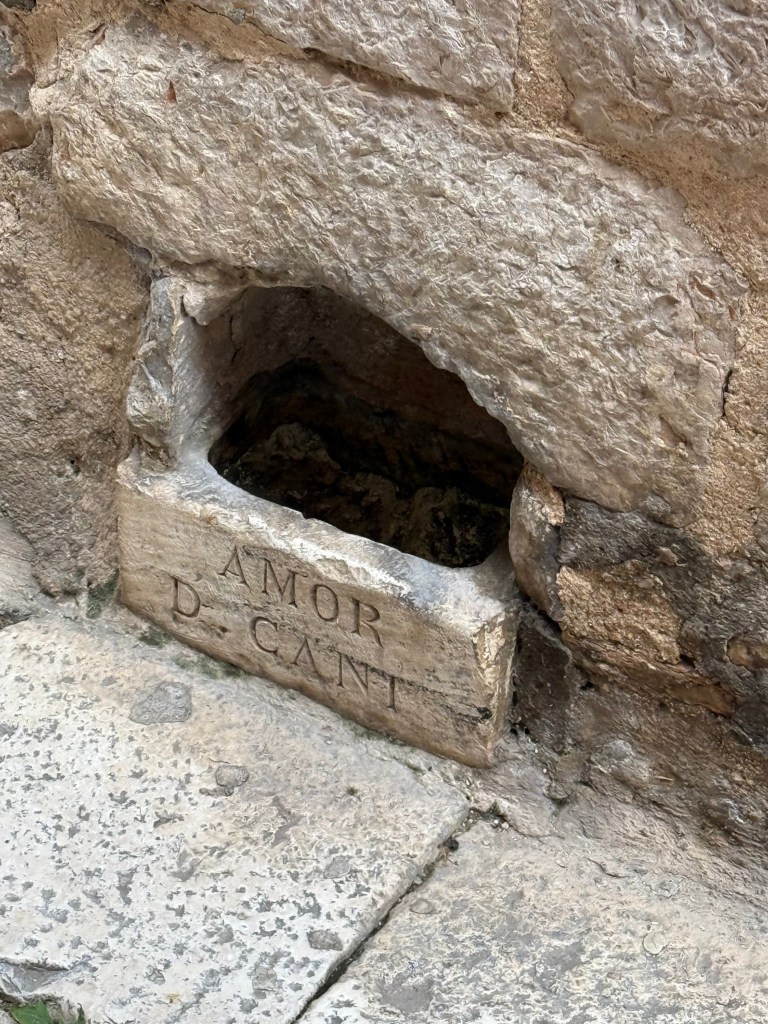
Left: Caper bushes are common in town likely planted by birds. Right: pet-friendly water troughs appear at ground level of one building along one of many wandering corridors.
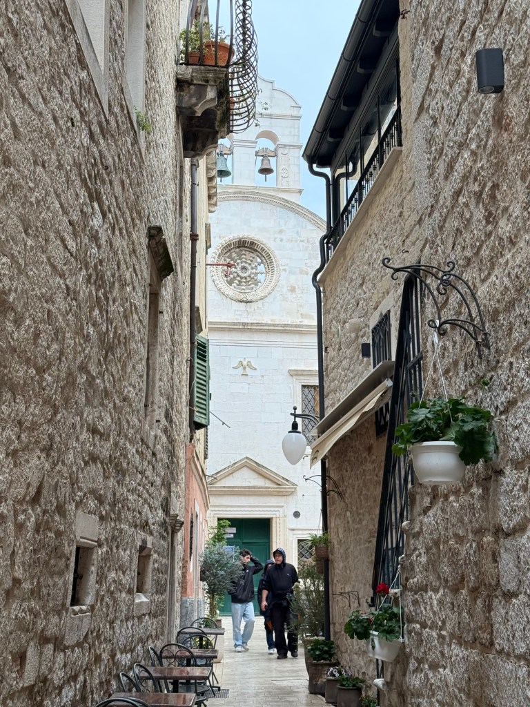
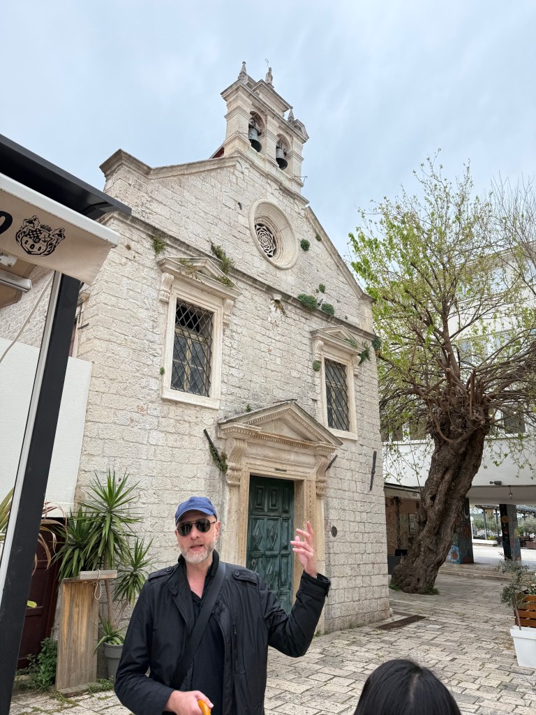
Four more Sibenik churches. Ante describes the Church of St Christopher (Patron saint of travelers) below – an old one that was outside the city’s wall. The huge mulberry tree to its right was planted at the time the church was built.
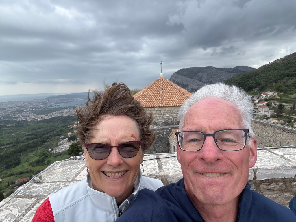
[posted 4/17]: DAY 3 (4/15): ‘Hugo’ winds have howled since early yesterday – a focus on erg and tank training. And a tour of Stella Croatica Park and the Klis fortress.
I have never rowed in a tank before, so today was interesting. We practiced exactly the same movements, sequences, and technique in the tank that we spent comparable time in the morning on ergs. A sequence would go something like this – all square-blade: sit tall at the release as if someone were pulling on your hat; arms away (“1”); body prep (“2”); one stroke legs-only (after which you are already at body prep); repeat 2-3 times. Each stroke begins with a “patient” approach to the full catch in unison and lifting hands slightly right at max compression to place the blade in the water “earlier” before starting leg drive. Then single stroke with swing (add body rotation) pausing at the release (after which you are already at arms away). Then “2” (body prep). Similar repeats. Then complete a single full stroke and finish alternately at the release, at arms away, and at body prep. Then proceed with three- and five-stroke sets concentrating on sitting tall, keeping chin up, forcing yourself to complete MOST of the leg drive before beginning body rotation followed by pulling with one’s lats. Finishes are directed by the coach and keep the rower on his/her toes. Release/arms away/body prep.
We did these exercises in unison on both the ergs or in the tank. There is ample time doing things this way to a) warm up and b) refine and reinforce one’s technique. Jim and Mark took videos of us during early the earliest session which we reviewed as a group. They encouraged us to set up a video with TV or, as we had at the Krka rowing center, a mirror so we could watch our movement and timing. Most of us rowed the oar in every stroke (i.e. were late dropping blades in thus passing max compression and starting the drive before blades were buried.)
It is astounding how much easier it is to achieve decent splits rowing correctly! We are thinking of banding together with Tim and Kathleen Fowler who’ve attended two sessions with Jim and Mark and conjuring up modifications both for Learn to Row sessions AND masters warm-ups both on ergs in the winter and on-water. The dividends will be huge. Very exciting!
Our first stop after lunch was Stella Croatica Park where the processes of oil extraction from lavender and from olives are thoroughly described and demonstrated. There is a laboratory there for research and training purposes and a product sales building where one can purchase soaps, oils, candied fruits and nuts, jams, etc. Pretty delectable, so we are bringing much home to share!

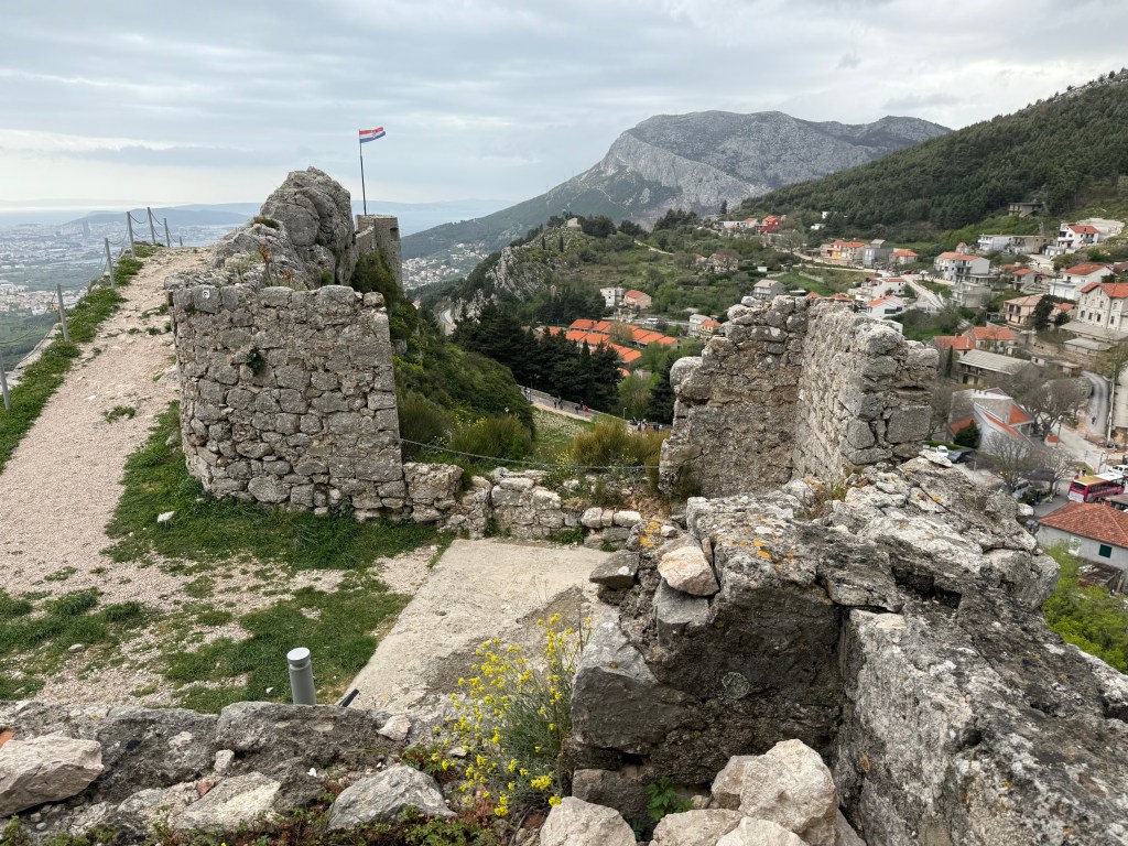
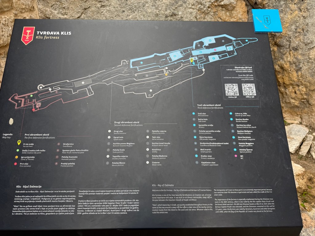
The Klis fortress was strategically built on a long, steep ridge between two tall mountains with arable plains to the north and sloping down to the sea near Split to the south. As it changed hands from Venetians, Croats, and Turks from the seventh century through the Middle Ages and Renaissance, it was expanded and otherwise modified. Wikipedia provides an extraordinary list of of nearly continuous conflicts affecting the region through both World Wars and the War of Croatian Independence that makes for interesting reading. https://en.wikipedia.org/wiki/List_of_wars_involving_Croatia The War of Croatian Independence took place between 1991 and 1995 involving Croat forces loyal to the Government of Croatia who declared independence from the Socialist Federal Republic of Yugoslavia (SFRY)—and the Serb -controlled Yugoslav People’s Army.
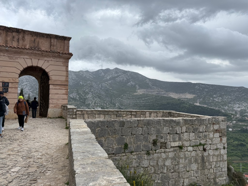
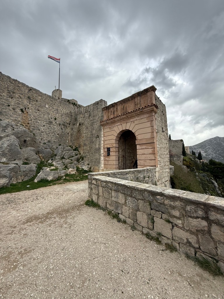
Three pictures of lower parts of the fortress above. Middle: looking southwest toward Split. It was an extraordinarily windy day – as has been the entire week – as one can see from the flag in the picture at the right!! Daily steady winds have ranged from 20-35kt gusting from 40-55kts.

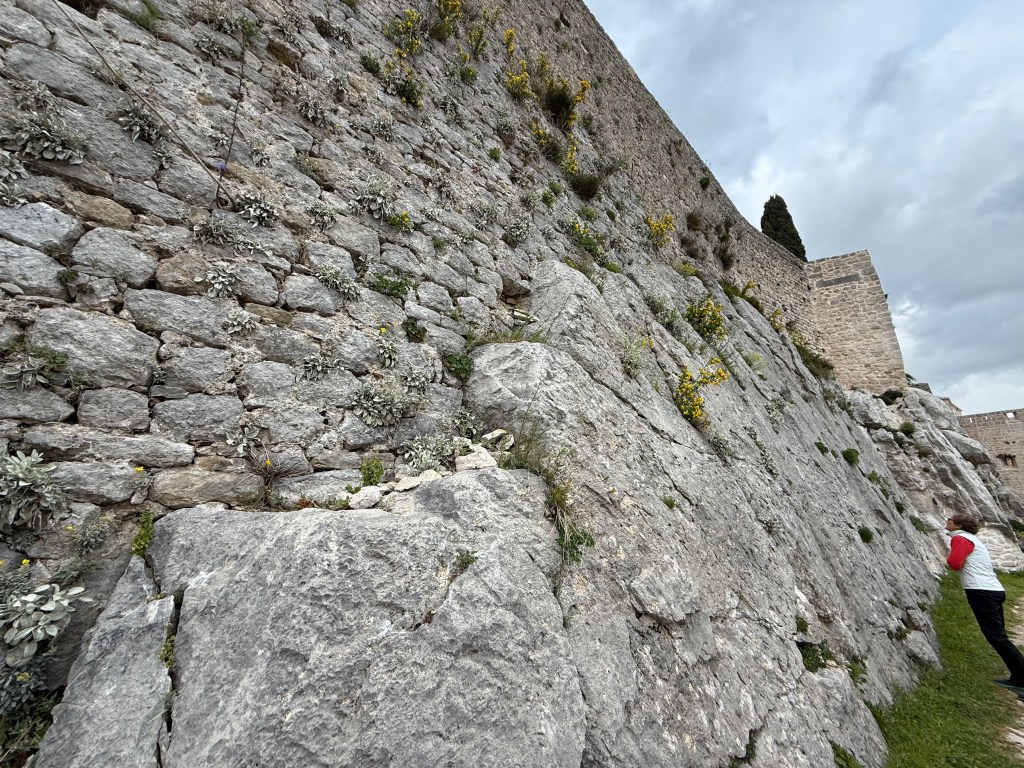
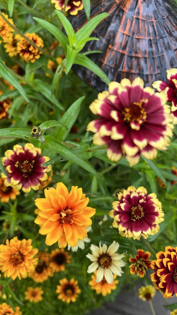
Spring brings about flower blossoms from most nooks and crannies in the rocks. There are three defensive walls of the fortress on the south side, but the north side is steep and tall enough to defy any hope of a successful attack.
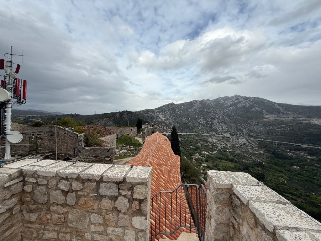
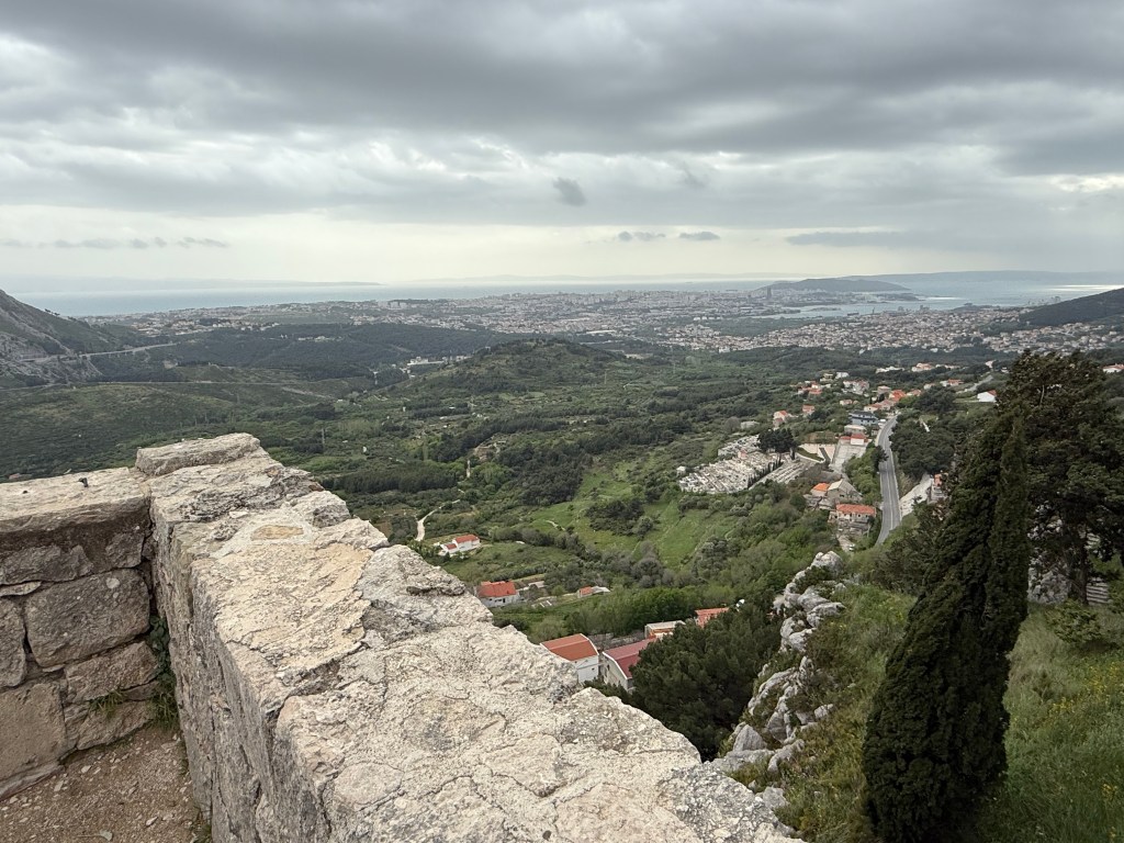
Wind effect is obvious! Observe the fascinating geology across the valley to the south from the highest point in the fortress at the bottom.

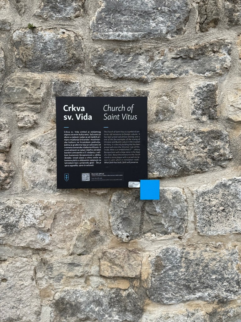
The Church of St Vitus is tiny and beautiful.
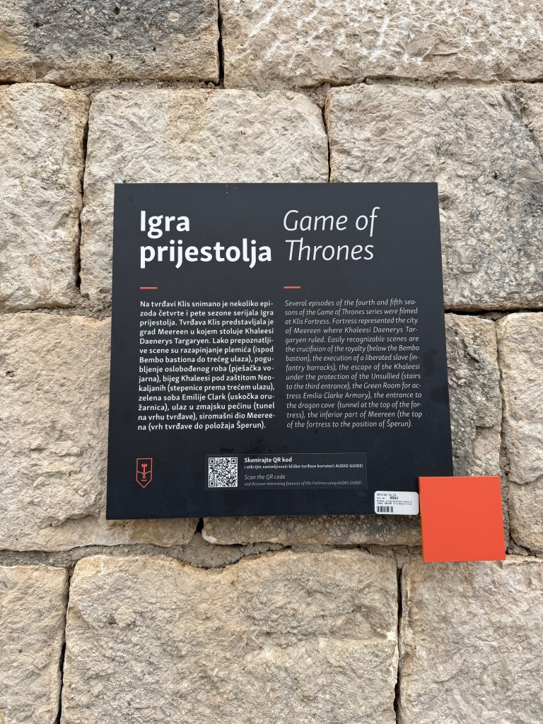
Yep – portions of The Game of Thrones were shot here. We need to watch it!
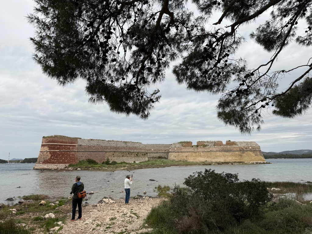
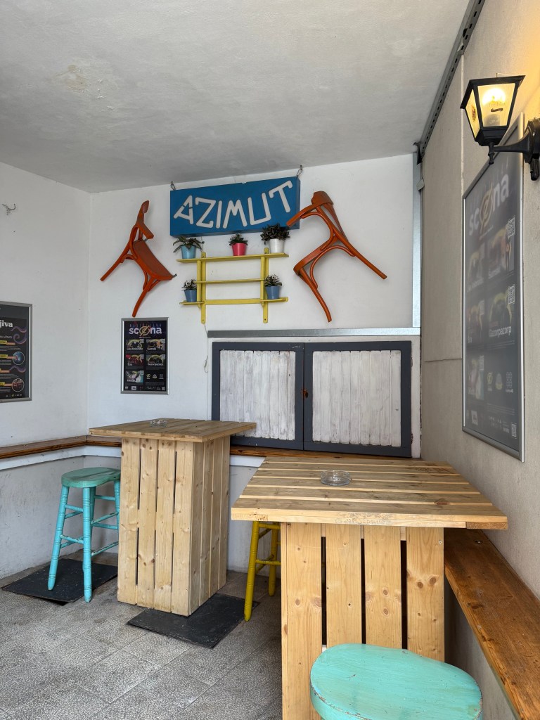
Left: Fort St Nicholas near Split. Right: entry to Azimut – the very cool pub within the two huge cisterns described above.
DAY 4 (4/16): On the water a second time briefly. And a visit to National Park Krka (as in Krka River) and Skradin (coming soon!)
DAY 5 (4/17): Blown out our last day! Excellent warmup and workout on ergs to include multiple 2 minute-on 1 minute-off pieces. We sought to carefully control and gradually, with each piece, reduce our average split by 1 (I did a few!) second(s). We then watched historical videos taken by Mark and Jim and discussed rigging (adjusting span) and oars. (coming later!!)
Subscribe to get access to the rest of this post and other subscriber-only content.
Subscribe to get access to the rest of this post and other subscriber-only content.
Our four month Southeast Alaska cruise aboard our Catalina 400 Mk2 sloop was perhaps a substantial prelude as we step into decade number seven.
We have carefully planned two trips this spring and early summer, the first coming up next week to Croatia where we will attend a week-long All American Rowing Camp and cap that off with a full week sailing a skippered, guided Lagoon 42 catamaran around islands in the east-central Adriatic sea with our good friends Earl and Lindy Weintraub. Ulterior motives include trying to bringing Jim Deitz, Mark Wilson, and an All American Rowing Camp session to Bainbridge Island Rowing down the road and complete groundwork for obtaining an International Certificate of Competence to skipper a charter sloop in the Adriatic also down the road.
Our second trip rings of Southeast Alaska. In our preparations for last summer’s adventure, we became acquainted with a gentleman sailor of considerable repute named John Neal. We will be attending John’s last ten-day Mahina Offshore Sailing Expedition (Leg 5 of 6) in the Outer Hebrides of Scotland from 13 to 22 June. I guess we hadn’t had enough with two ‘interesting’ overnight passages last August! Objective? Determine with greater certainty our dream of biting into off-shore sailing. Our good friend and amazing travel (and rowing) companion Chrys Hansen will join us both for the Mahina expedition and a week-plus cruising around the Scottish Highlands afterwards. Whisky (and of course great hiking, birdwatching, and sightseeing) anyone?
The lure of trade wind sailing, so well-portrayed by Matt and Amy aboard their SY Florence, remains strong. We have flirted with sailing to San Francisco or LA, thence to Hawaii for a few months, flying home, then back to cross the Pacific a second time to Sitka before returning home (old hat!). Or sailing down the Washington-Oregon coast and up the Columbia River to the Grand Coulee Dam and back. Nuts you say?
I have no idea presently just how easy it will be to regularly post cool pictures mixed with commentary in either Croatia or Scotland, but we shall find out in a little more than a week!
Thursday, 22 August
Effingham Bay to Turtle Bay by way of Wouwer Island, Broken Group Islands, Barkley Sound: (48-52.0N 125-21.3W) (48-55.0N 125-19.7W)
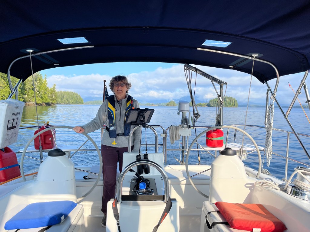
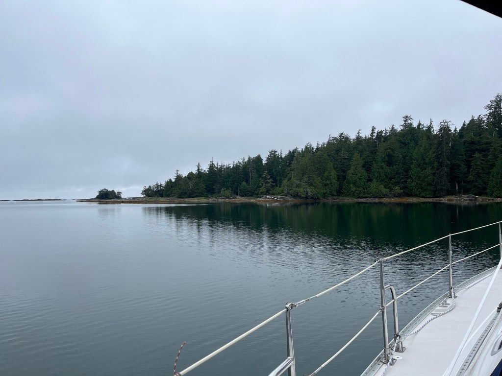
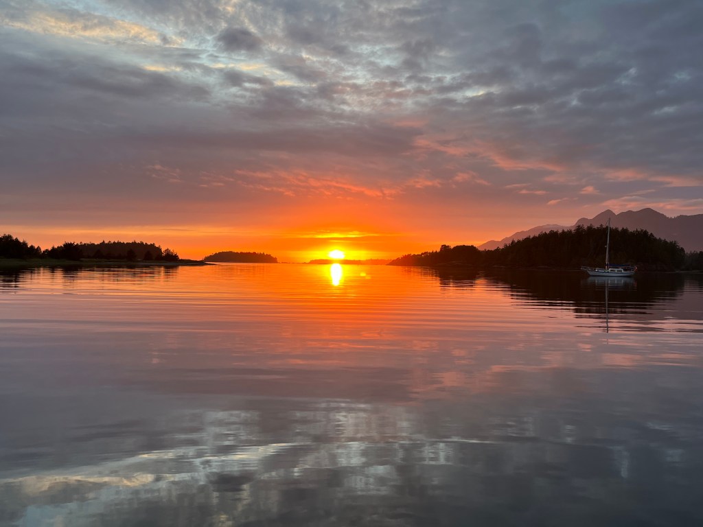
So much rain has fallen in the past few days, first circumnavigating Estevan Point to Quiet Cove and over twelve straight hours last night of heavy downpour, that the anchor light flooded out. We are thankful for not also having wind since anchoring in Effingham Bay. The predictions were for partly cloudy conditions with light winds later today, and, praise be, that materialized. We appreciated the change after the longest continuous and hardest rain in the past four months. Growing webs between the toes we are.
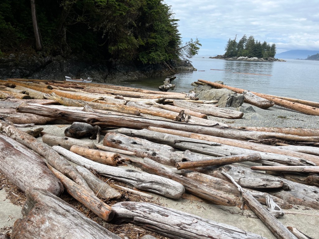
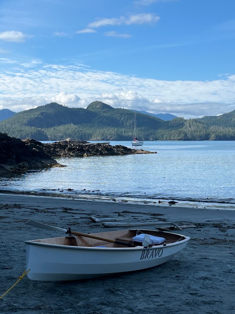
Three events spiced the day. Upon anchoring where we had intended to anchor the night before south of Wouwer Island, we assembled and launched Bravo for a fun spin on the motor first through an east-west gap in big rocks (video) and out to a very large rock (video) that was supposed to be home for Steller’s and California Sea Lions (none found), then back in the gap (video), to a tiny log-free slot in an otherwise log clogged beach on Batley Island.
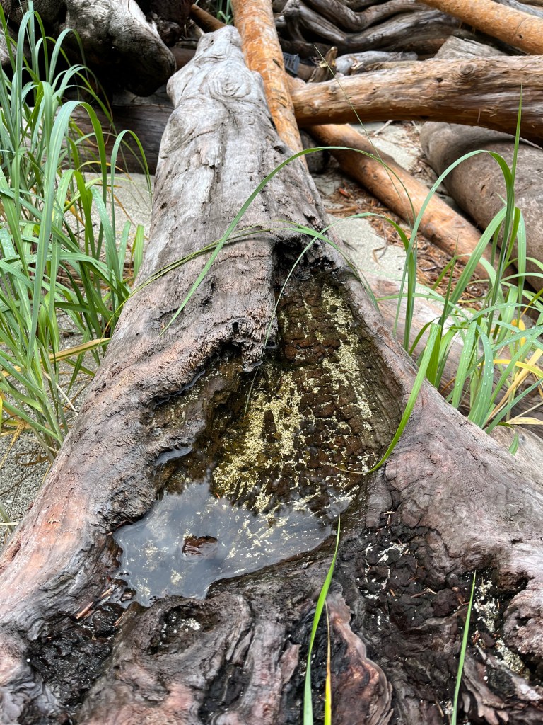
From there, we took a short walk across Batley to an incredible small and log- and kelp/seaweed-filled cove that was hosting bountiful bug meals (video) to perhaps four species of sandpipers (video). And I’d forgotten binoculars(!) Being still for twenty to thirty minutes, many of the dozen or so birds gravitated to within twenty feet of us. Size and coloration suggested a mix of Western, Semi-palmated, and Least Sandpipers on one hand. Vocalizations by and coloration of others suggested – most likely – Solitary and Spotted Sandpipers though solid coloration lines sorely tempted me to call out the Common Sandpiper. Their Eurasian range made that unlikely though it was given as a “Similar” to the Spotted Sandpiper.
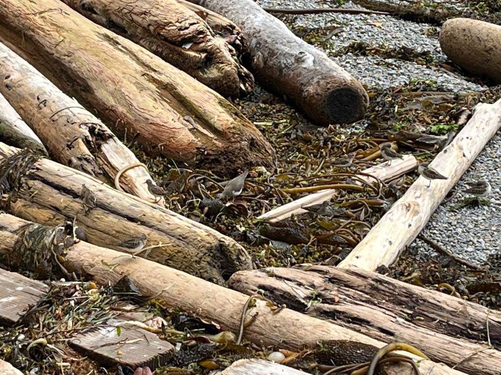
These birds are difficult to pick out in pictures. In the video one can at least see them move! These birds were stuffing themselves to the point many needed intermittent naps.
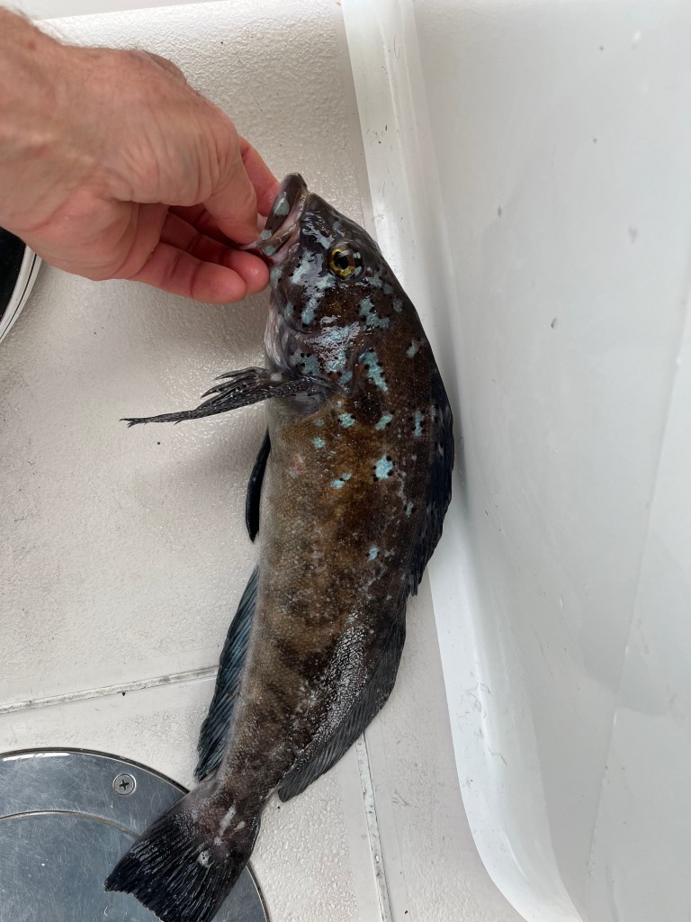
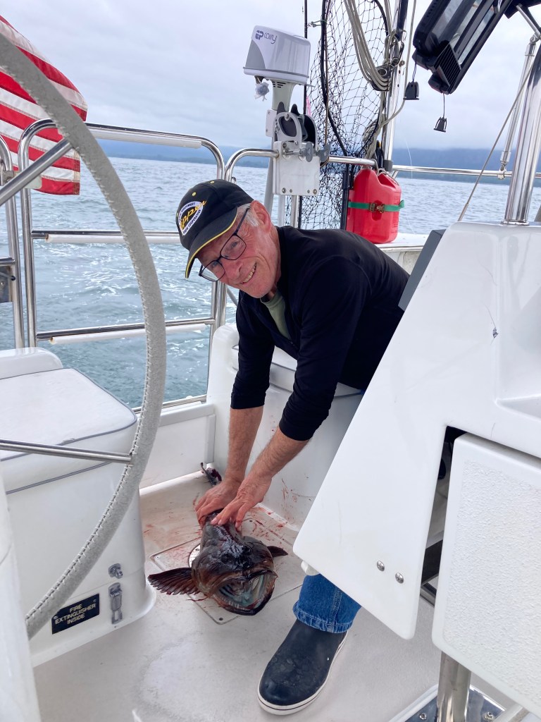
Fishing was third on the list. Steve Riehmann’s and Ron Watt’s advice to fish high spots again paid off twice, and for the first time since landing several Dolly Vardens at the Haines dock two and a half months ago, I landed two fish using (previously frozen) herring with a heavy weight. Pictures don’t do either fish justice. Both were beautiful, and my soft side balked at slicing them up. The first was – I believe – a Greenling based on fin structure though I have yet to find a picture of one with blue spots. The second was a very bright orange Rockfish.
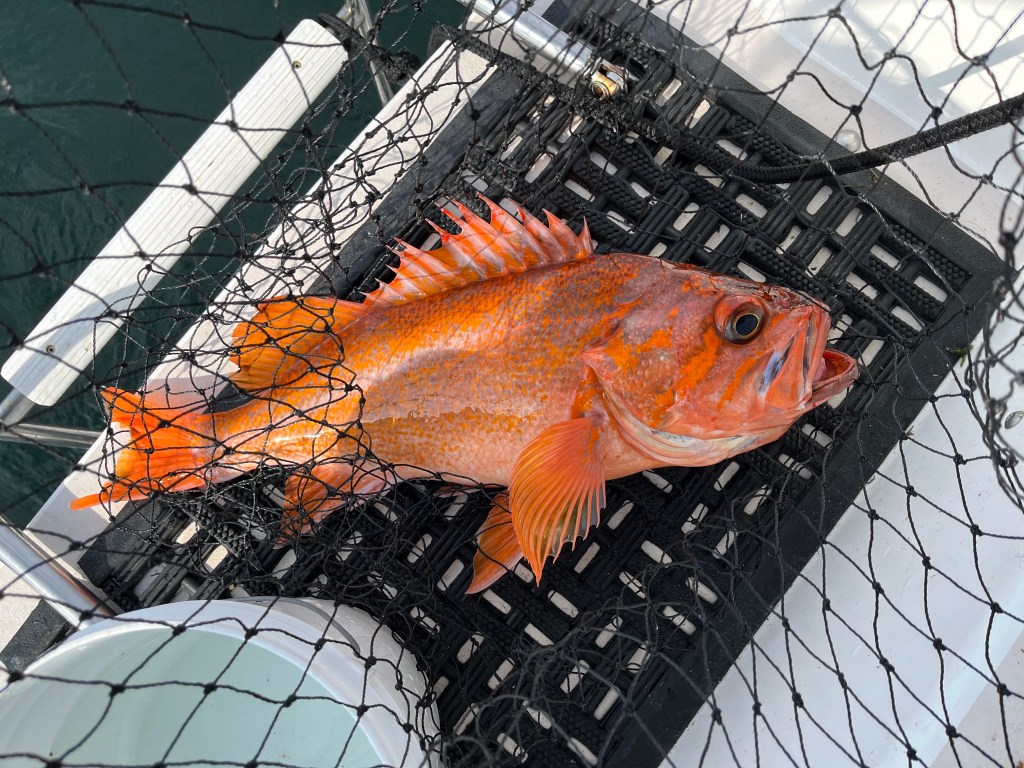
We dined on the former and vacuum-sealed and froze the latter after anchoring in Turtle Bay surrounded by Turtle, Walsh, Dodd, and Willis Islands … and, at one point, EIGHT other vessels at anchor. The fish was most delicious – some of the best we’ve eaten – despite a plethora of thin bones in the meat.
We turned on the steaming light at night.
Friday, 23 August
Turtle Bay to Jaques-Jarvis Lagoon (48-55.3N 125-16.5W)
Today started as an auspicious day, exactly four months to the day after our departure from Bainbridge Island and day “five” counting down to our return home. It turned out to also be a day in which I lost my composure … while fishing of all things! I had just landed another smaller Cabezon while fishing with one of my remaining frozen herring over a high spot north of Jarvis Island and suddenly had another fish on. Being me, I also was fishing using a yellow guppy on a second rod. Darned if it wasn’t a small Yelloweye Rockfish – which one is not supposed to keep. Having complicated matters fishing two rods at the same time, as we slowed, I needed hands on four things at once – throttle and steering, reeling in the second rod, grabbing a net, AND fetching the release gear in my tackle box to quickly return the Yelloweye to deep water. Haste makes waste. Having not practiced using the release mechanism, the fish slipped off it TWICE before I got it to work (sort of). In the process, the net fell overboard to Davey Jones Locker (DJL). While I eventually succeeded in running the fish down to 110 feet, when I released it, all that came back was the weight and not the release hook which was probably left with the fish. It joined the net in DJL. Whether the fish survived will remain a mystery. My self-generated frustration had skyrocketed making things unpleasant. Solution: I went back to fishing with the three no longer frozen herring I had left. Out of that, I caught two more rockfish and lost a fish in-between.
We ducked into the tricky Jaques-Jarvis Lagoon and dropped the hook so I could start fish processing.
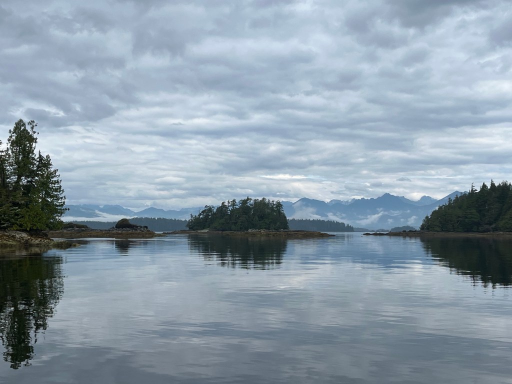
Having completed that, we took a ride in Bravo at high tide using the EP Carry motor – as the rain resumed – and motored across the channel to see if anyone had taken up residence in the Nettles Island bay in which we had planned to stay. Finding no one there was nice, but instead we decided to hole up in the J&J Lagoon, run the generator and dehumidifier, and enjoy a quiet night. I took a 360 video in the afternoon in flat gray light. More appealing was a video of scintillating minnows on glassy water.
I shot this video of J&J Lagoon the next morning as the sun came up.
(Jacques-Jarvis Lagoon 360)
If you guessed this might be a place in which to find Common Loons, Kingfishers, and Western Flycatchers, you’d be right. Motoring into the lagoon we came across eight Common Loons – the largest flock since our trip north last spring.
Saturday, 24 August
Jaques-Jarvis Lagoon to … Port Renfrew: (48-33.4N 124-24.5W)
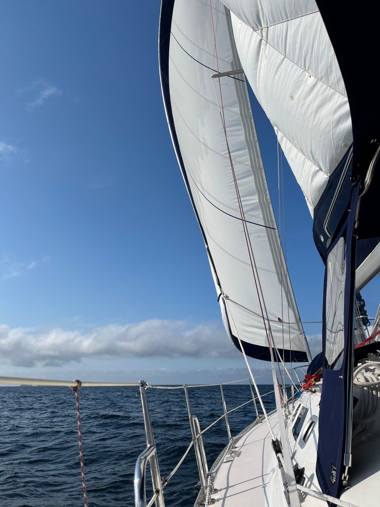
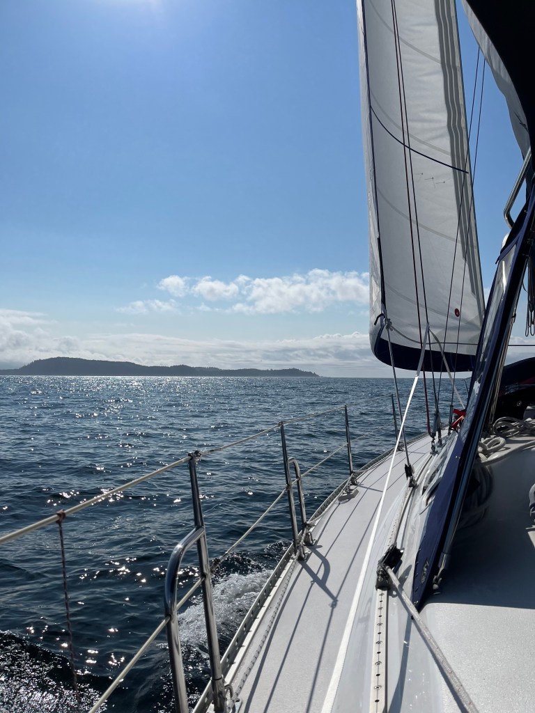
We awoke to almost clear skies and a growing southwest breeze. After pulling Bravo for the last time this trip, we departed the lagoon to mostly blue skies and found both kayakers and sport fishing boats east of Jacques Island on Imperial Eagle Channel. As we entered the channel and raised sails in a 12kt breeze, we counted over 35 fishing boats at work.
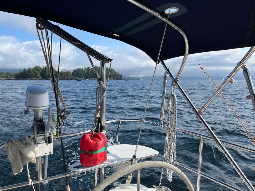
Such wonderful sailing conditions quickly made us change our minds about stopping in Dodge Channel a mere 6 miles away. Set close-hauled and aiming east-southeast, we headed for sea and Port Renfrew 35 miles away.
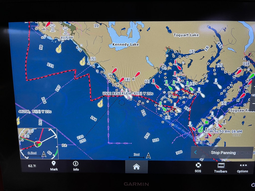
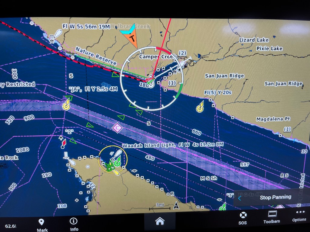
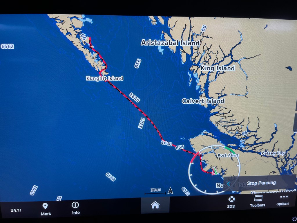
The below track shows our up-wind passage from Tofino through Barkley Sound and the Broken Group Islands. (None of the yellow UVIC buoys are there anymore)
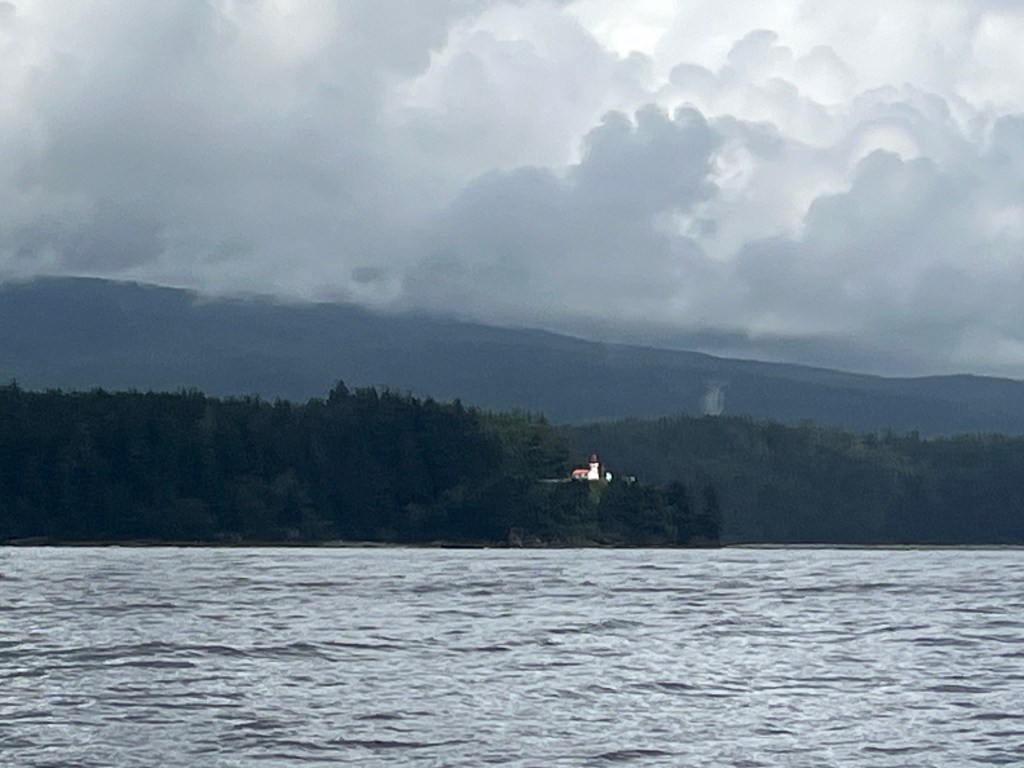
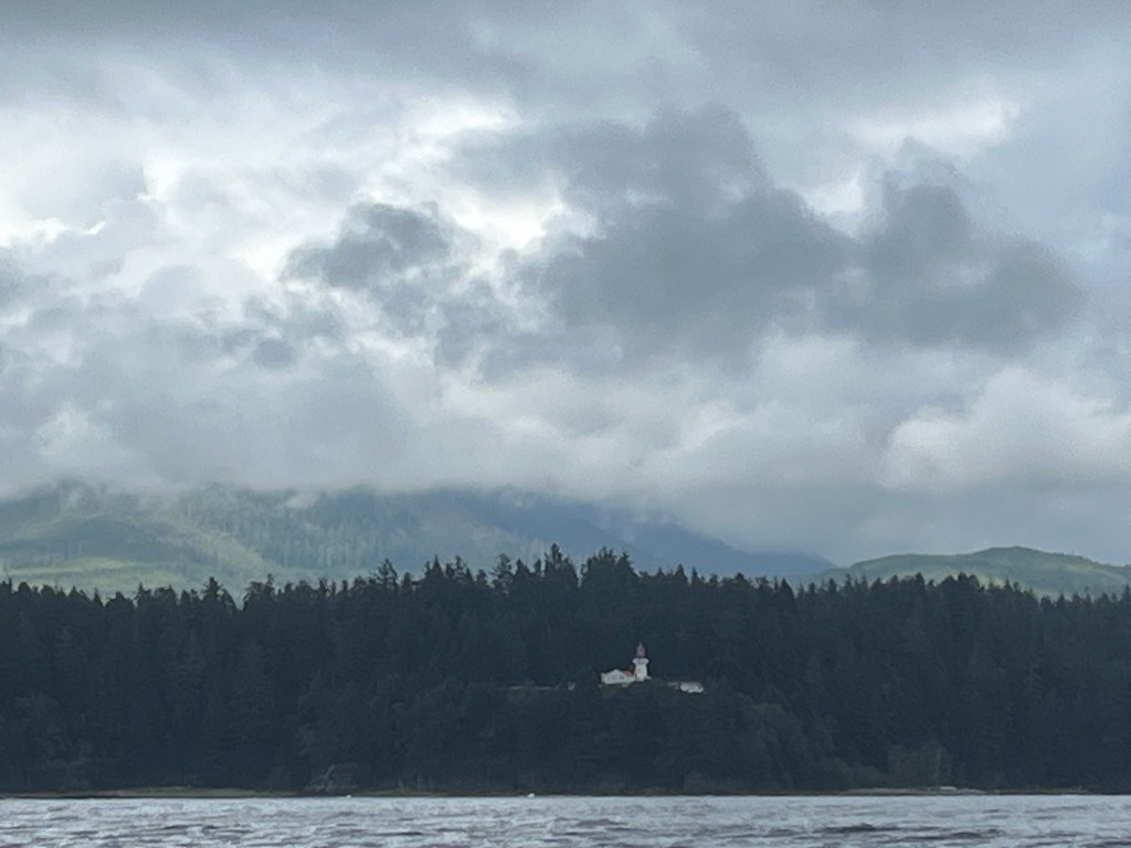
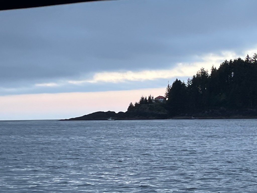
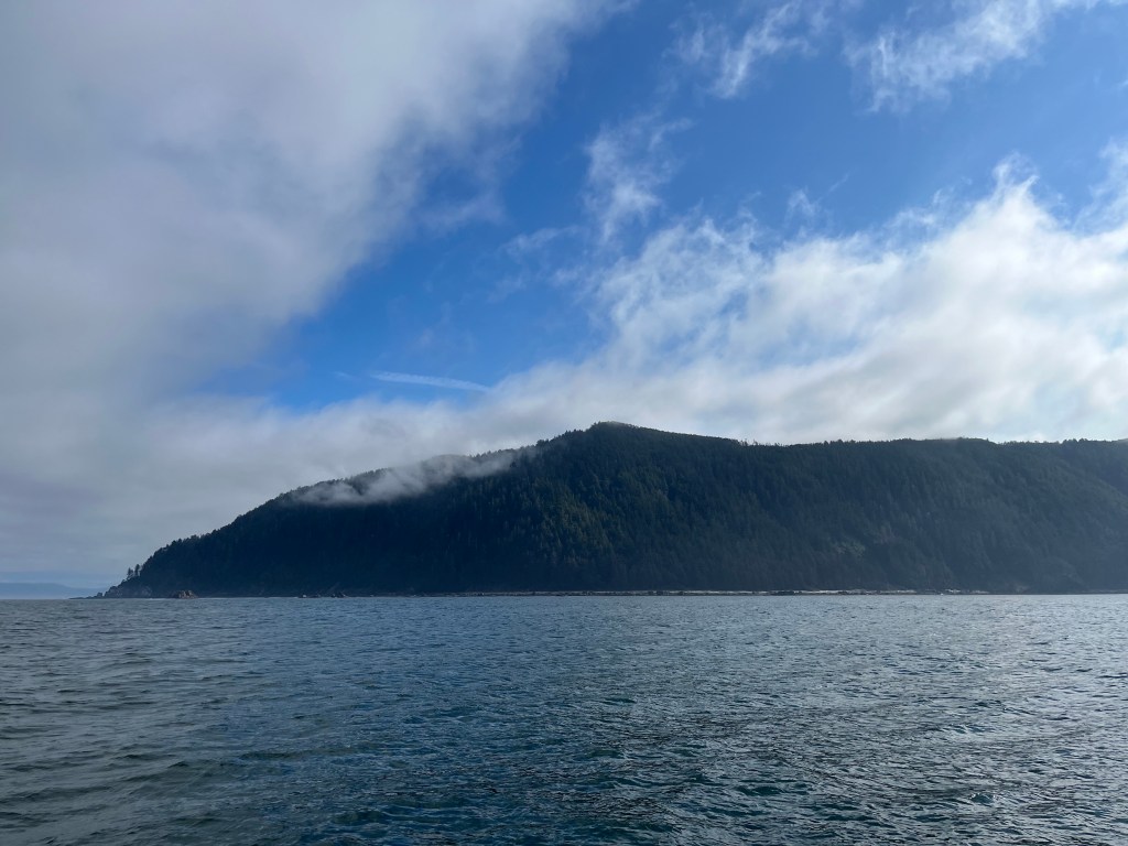
While sagging and shifting winds gave us fits a time or two, we were able to motor-sail close-hauled into the Strait of Juan de Fuca and admire three handsome light stations: Point Beale (1130am), Point Pachena (1230pm, (these two shown below, left and right respectively) and Carmanah Point (3:15pm).
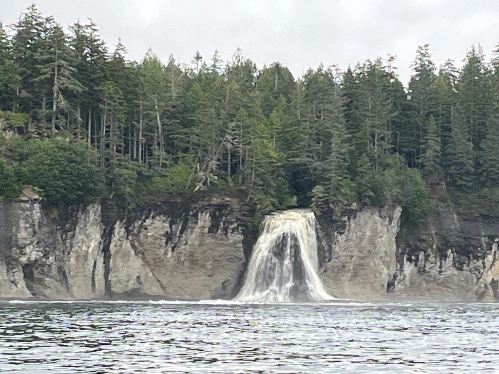
In addition, and most surprisingly, we sighted numerous waterfalls (video) along this coastline before and after visiting Port Renfrew.
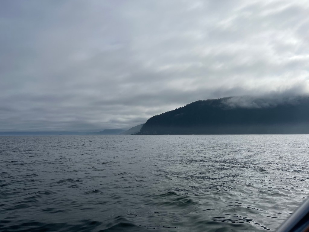
Cape Flattery loomed from the gloom south at 3:30pm.
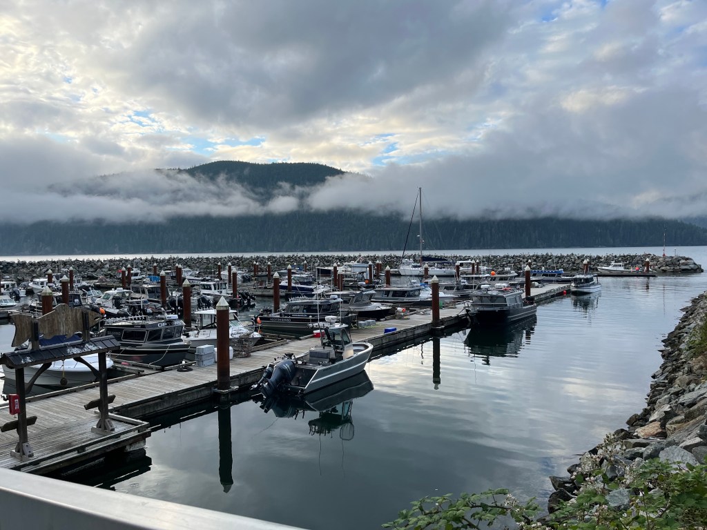
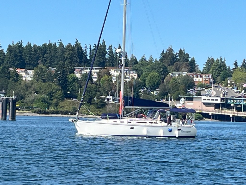
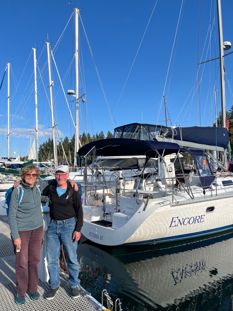
Just in time for dinner, we moored at the Pacific Gateway Marina at Port Renfrew. Who knew, the large-ish body of water here at the west end of the Strait of Juan de Fuca is actually Port San Juan on the chart, and the head of the bay is called Snuggery Cove. Encore presence in the marina was hard to miss.
Sunday, 25 August
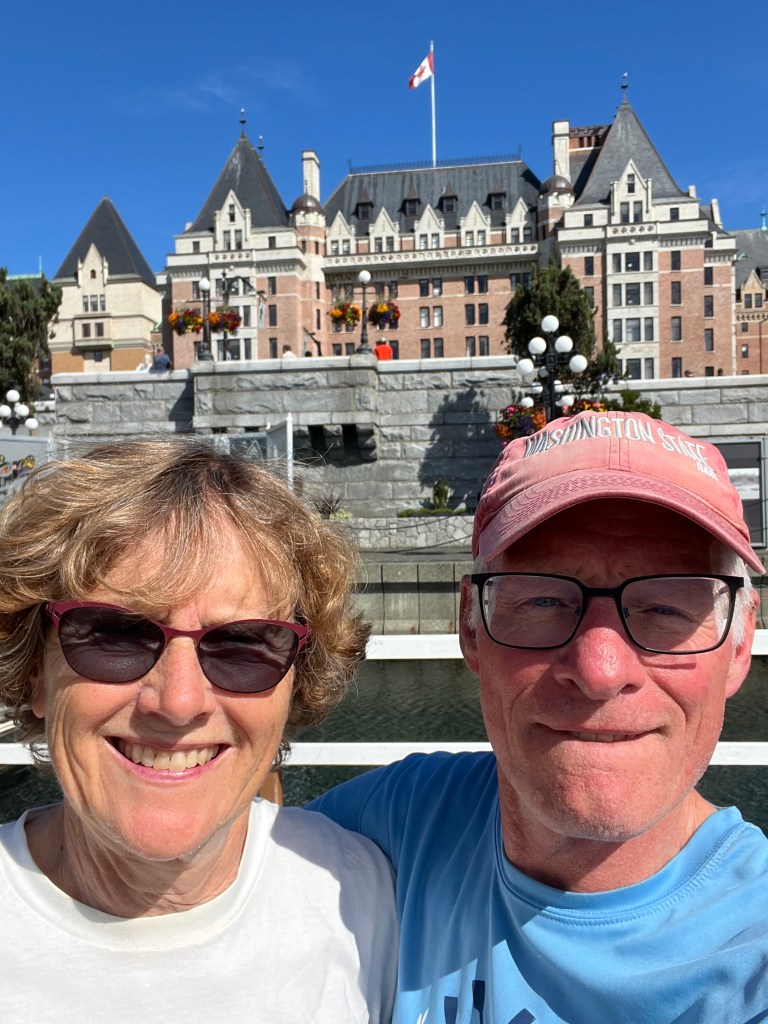
Port Renfrew to Victoria: (48-25.3N 123–22.2W)
Today was another magical day of sorts on big water east-bound for Victoria. We set off at 0530 to catch a flood tide that stayed with us three fourths of the way to Victoria nudging Encore along three quarters of a knot or so faster than its mighty Yanmar could push her. We encountered very little vessel traffic in the early hours of the day.
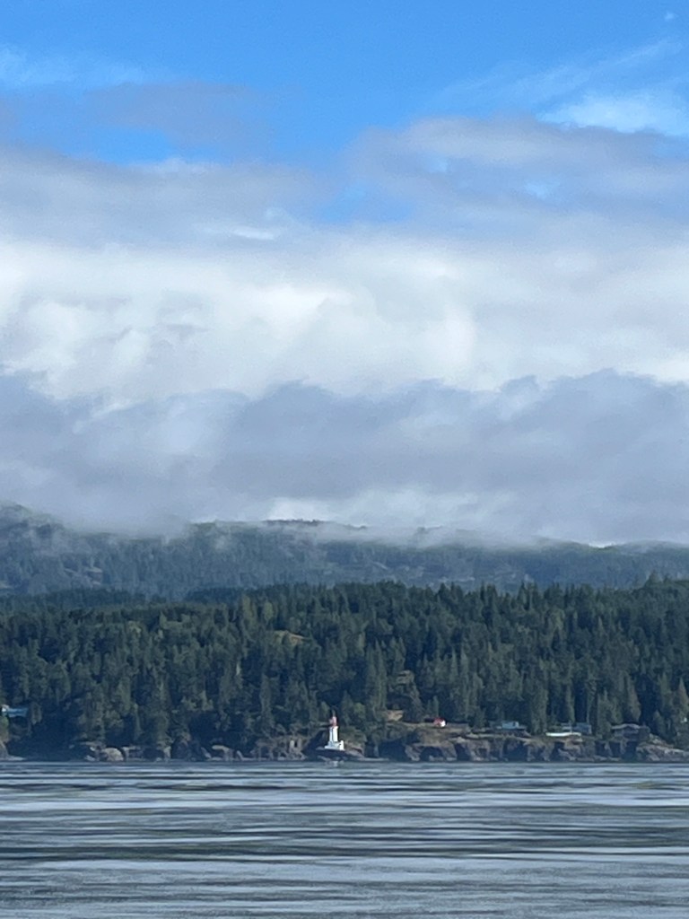
At 0830 we came across well over two dozen Humpback Whales feeding all over the north side of the strait, some quite close necessitating speed and heading changes, others distant. Approaching noon, we passed the Sheringham Lighthouse to port …
And at noon we came across several dozen fishing boats … and whale watching boats, surely enough indicating the presence of Orcas and therefore salmon. We flew the Whale Awareness flag for a short bit and dropped a Coho Killer lure with ten ounce weight off the transom. That effort bore no fruit, expectedly. And suddenly we were in fog that grew thicker quickly to the point of limiting visibility to 100 feet. I turned on the radar on at 1:30pm and it stayed on until we entered Victoria Harbor at which point the fog lifted completely. If ever there were a situation where radar made a difference, that nearly two-hour period was it.
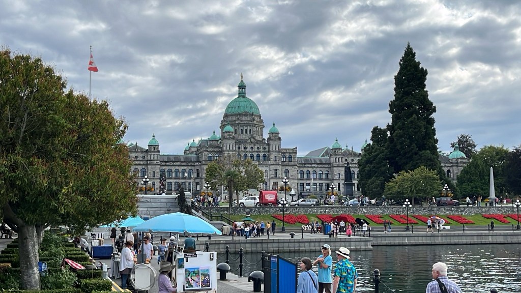
We moored at D dock, Causeway Marina … without having to first check in with Canadian Customs for the first time ever.
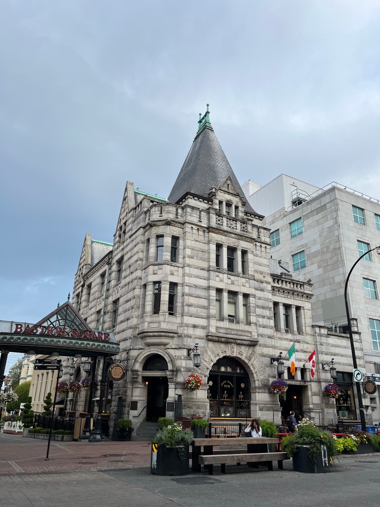
Later, after a Black and Tan at The Irish Pub (above), we dined at Pagliacci’s down town and slept like the dead … after a Sunday evening blues band finished playing at a waterfront stage nearby at around 9pm!
Monday, 26 August
Victoria: (48-25.3N 123–22.2W)
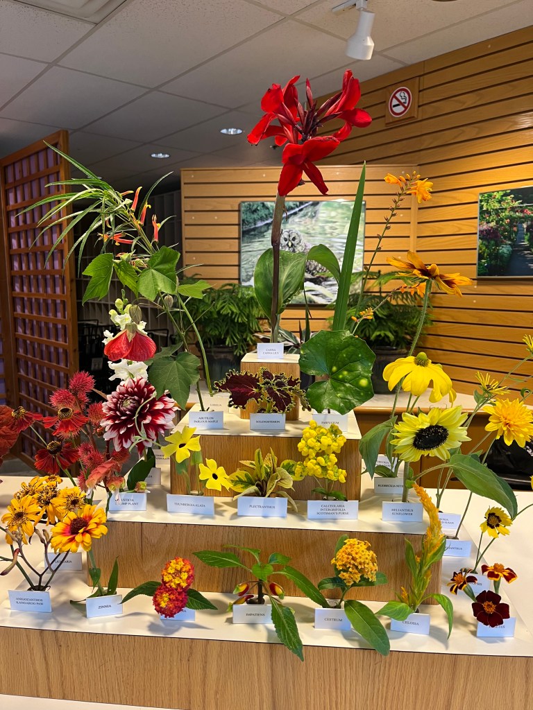
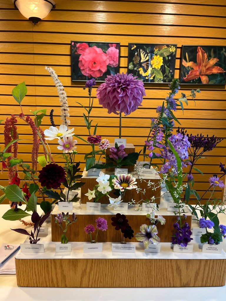
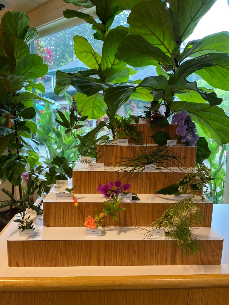
No visit to Victoria is truly complete without a visit to Butchart Gardens. After taking breakfast at Milano Cafe, we hopped on a bus to the gardens where we spent nearly four hours wandering amongst myriad different plants mostly in bloom.
Tonight we met Glen and Cheryl, (SV Indigo Wave – a beautifully tricked out 46 foot Island Packet) whom we had met in our second visit to Petersburg, and enjoyed a fabulous meal at one of their favorite places, The Courtney Room, downtown.
Tuesday, 27 August
Victoria to Bainbridge Island, Eagle Harbor Marina (47-37.0N 122-30.8W) BRINGS TO A CLOSE A 124-DAY ADVENTURE!
A nice confluence of strong southwest wind and a suitable ebb tide under clear pre-dawn skies staged us for a fast departure from Victoria at 0520 with reasonable hopes of a quick crossing of Rosario Strait to engage in at least a good portion of the following flood tide into Admiralty Inlet.
Encore handled the seas well, and we laughed at how mild 22+ kt winds on that body of water felt compared with crossing to Vancouver Island just over two weeks earlier. Flying up to the ocean cauldron (video) at Point Wilson Light at 10kts, progress screeched to 5kts just past Marrowstone Point Light. One day in the future I must play with this current because, having suffered demoralizing low-5kt progress for an hour thereafter, suddenly we were back up to just over 7kts. Note to self: the water must have been shoved north to Whidbey Island before turning back southeast. Winds which had driven Encore hard gave up the ghost at Marrowstone and were not felt again in earnest until we reached halfway down Bainbridge Island. Too late!
We gave friends a heads-up about our ETA at Point No Point along with a picture …
… and they were there to greet us and help us tie up.
Thus ends our 124 day adventure. (Interesting reflection calligraphy of “Encore.”) We are grateful to have completed the trip and to be home and looking forward to seeing our grandson … and other things like rowing and getting back in (a different kind of) shape(!) And we are super-grateful to have made a bunch of new sailing friends including Scott and Karen (Tuuli), Ron and Peggy (Solstice), and Nick and Laura (Ardent) who were with us at the Catalina Rendezvous in Roche Harbor and joined us as the big adventure began, and Glen and Cheryl (Indigo Wave), Sean and Kate (Petrichor) – and 5th place in this year’s Race 2 Alaska!, Ron and Jo (Interim), Tom and Elaine (and Bodie) (Belle), Charlie and Geo (Longtemps), John and Jane (Salish Aire), Kevin and Karen (Salish Dream), and finally Peter (Wayfinder) whom we met at Nuchalitz Inlet, Esperanza Inlet.
By the numbers, below is a summary of our final month aboard Sailing Vessel Encore and the total for our cruise.
“What’s next?” some may ask. We did spend a lot of time talking about additional sailing adventures. As much as we admire Matt and Amy’s round the world example (Sailing with Florence, a Major inspiration for our trip – look them up on YouTube), that’s not in our cards. We’ve been counseled that the harder parts of sailing we accomplished, including passages, are as difficult as anything we’d see crossing most oceans. That much is comforting! We worked well as a team aboard in cramped quarters. Also good. We will very likely take long trips in the future, but probably not four-monthers like this one.
Subscribe to get access to the rest of this post and other subscriber-only content.
Subscribe to get access to the rest of this post and other subscriber-only content.
Sunday, 11 August
Browning Inlet to Winter Harbor: 50-30.7N 128-01.7W
A short 30-minute trip at noon put us dockside at Winter Harbor Outpost at which we enjoyed paid-for the WiFi by which I sent my last posting. I realized a day late that I had a pretty cool track of our crossing on the new NavStation Garmin.
A Winter Harbor fishing guide taught me useful lessons in distinguishing Flounder from Halibut and taking fillets without first gutting the fish. He also pointed out the need to only cut at most seven pieces from the two fillets off a Halibut one of which had to contain the tail and pectoral fin from one side so that length could be determined. One is allowed two Halibut under 90cm and one over 90cm. Salmon processing must keep the tail. Good to know … now. And now to catch a Halibut….
Sunday evening, we learned, was a community fish fry to which all were welcomed. It was the lead cook, Joe’s, birthday to whom we all sang Happy Birthday. The charming store owners, husband and wife, hosted the event at their wharf overlooking Winter Harbor. All comers were represented, residents (of which there are only 6-8 in Winter Harbor), fishermen (most of whom were Ukrainian, sports fishermen, part-time residents (a couple from Alberta and their adult son), and travelers (us.) What a friendly, fascinating mix of generous people.
And we didn’t take a single picture during our visit to Winter Harbor. A sad first.
Monday, 12 August
Winter Harbor to Middle Bunsby Island: 50-06.2N 127-55.3W
Weather Gods were on our side heading out of Winter Harbor to the Brooks Peninsula with Cape Cook and Solander Island at and off its western tip. With a 6am start, we passed Cape Parkins lighthouse at 0646 and motor-sailed between Cape Cook and Solander at 1000 paralleling long-period southwesterly swell. Tufted Puffins, Leach’s Storm Petrels, and sandpipers of some sort were prevalent along with gulls.
Cape Parkins lighthouse in the dawn
Brooks Peninsula (left); Cape Cook (right)

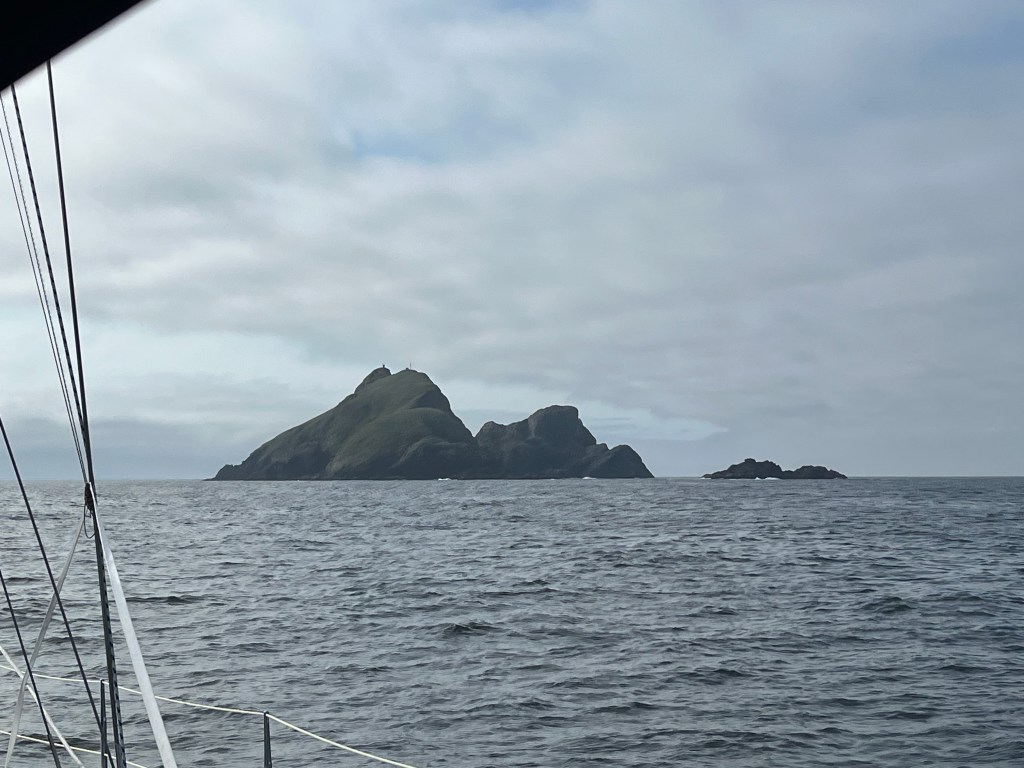
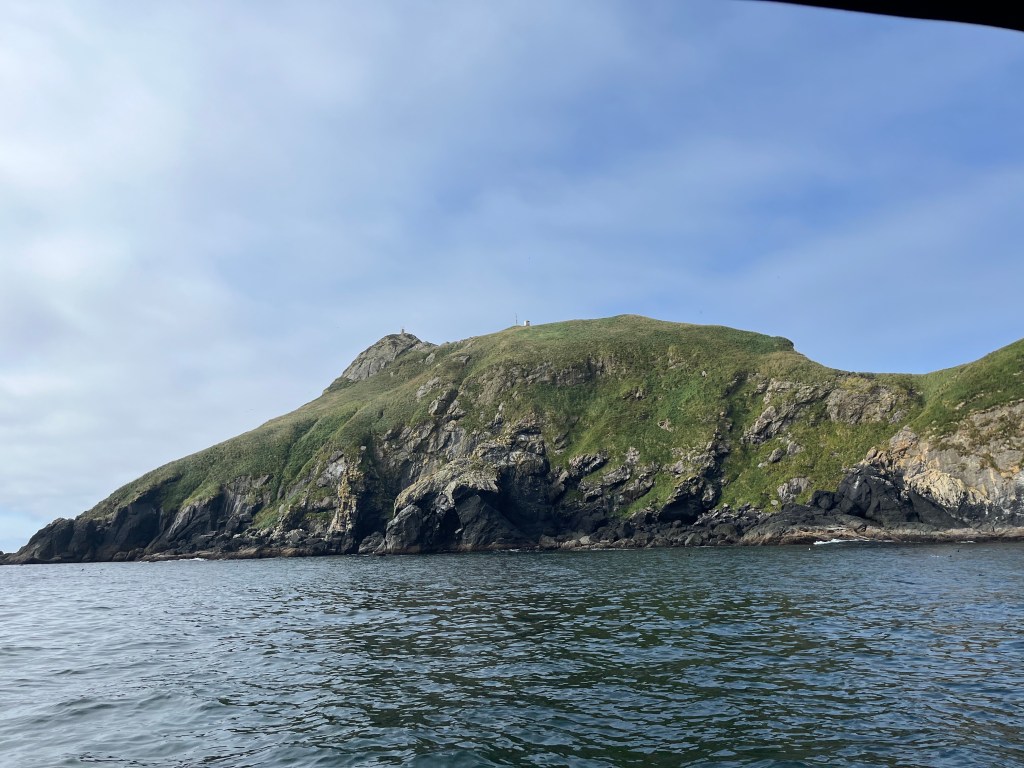
Different perspectives on Solander Island: (middle – approach; left – between Cape Cook and the island; right – passing in calm seas and sunshine!
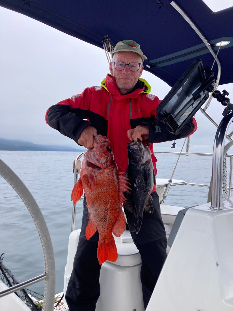
Using the sonar-layer on my chart plotter, I noticed some submerged high points in otherwise deeper water south of Clerke Point – the opposite corner of Brooks Peninsula. Having learned that these were the kind of places at which to catch fish, I first trolled, motoring slowly, then jigged with the motor off. On the first cast, with lure not even out of sight, a Black Rockfish hit my lure. And I missed it only to have it strike a second time – its last! With one fish aboard, I lowered my lure to the bottom as we drifted bare pole southeast at less than a knot. Less than ten minutes later, I hooked a much bigger fish, a handsome Red Snapper or perhaps Canary Rockfish. Engine on, I proceeded to fillet and skin both fish, vacuum-packed the Snapper, refrigerated the Rockfish for dinner, and cleaned up the after cockpit having made less of a mess than ever before. I didn’t gut these fish which was the trick I’d learned watching a fishing guide at Winter Harbor.
Middle Bunsby Island (below) afforded us a protected anchorage surrounded by oodles of rocks and islets. We saw three kayakers who were camping on one of the islets paddling around that islet.
Tuesday, 13 August
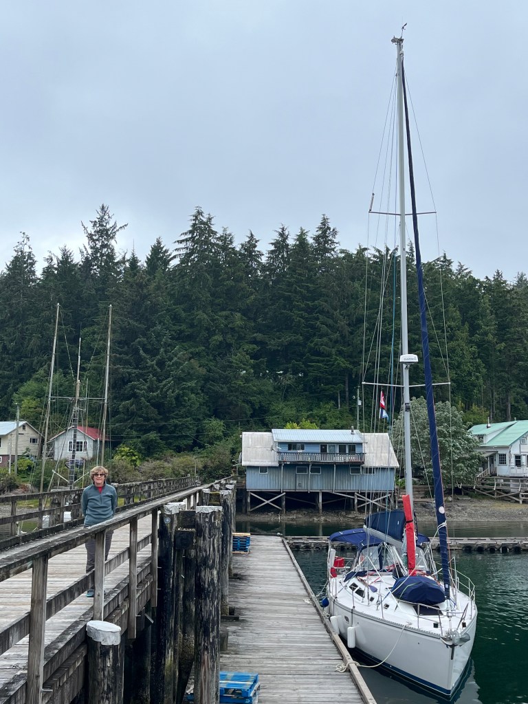
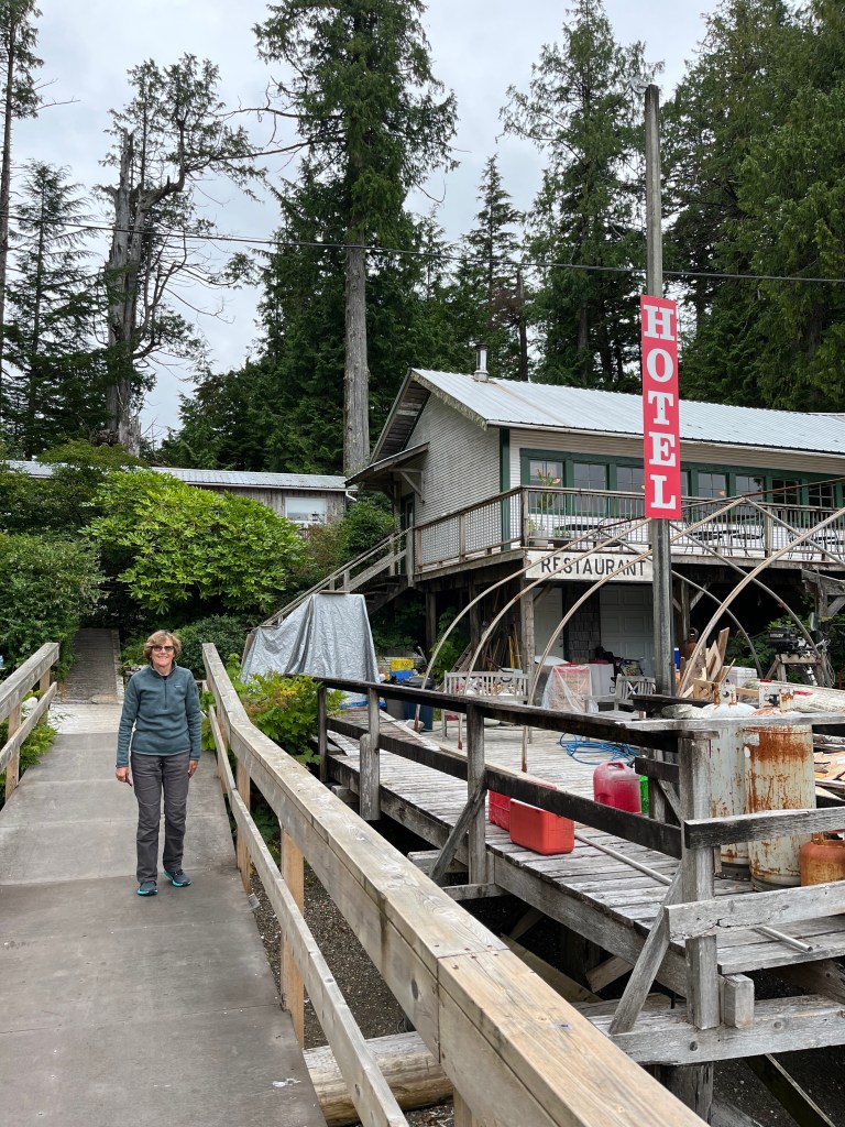
Middle Bunsby Island to Walters Cove in Kyuquot Sound (pronounced Kee-YOO-kit): 50-01.6N 127-22.5W
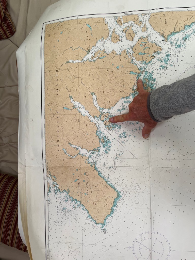
It was fun to again make use of paper charts Dean Dale had given me for the west side of Vancouver Island. Though smaller scale, these charts afford MUCH easier route planning than digital means.
Ah the lure of free WiFi … only to learn that Java the Hutt coffee shop, a short 0.5km walk from the government dock to which we moored on a well-worn foot path) is now only open Tuesday (thank God) through Saturday, 4:30-8:00pm. Dang it. Typing this aboard Encore.
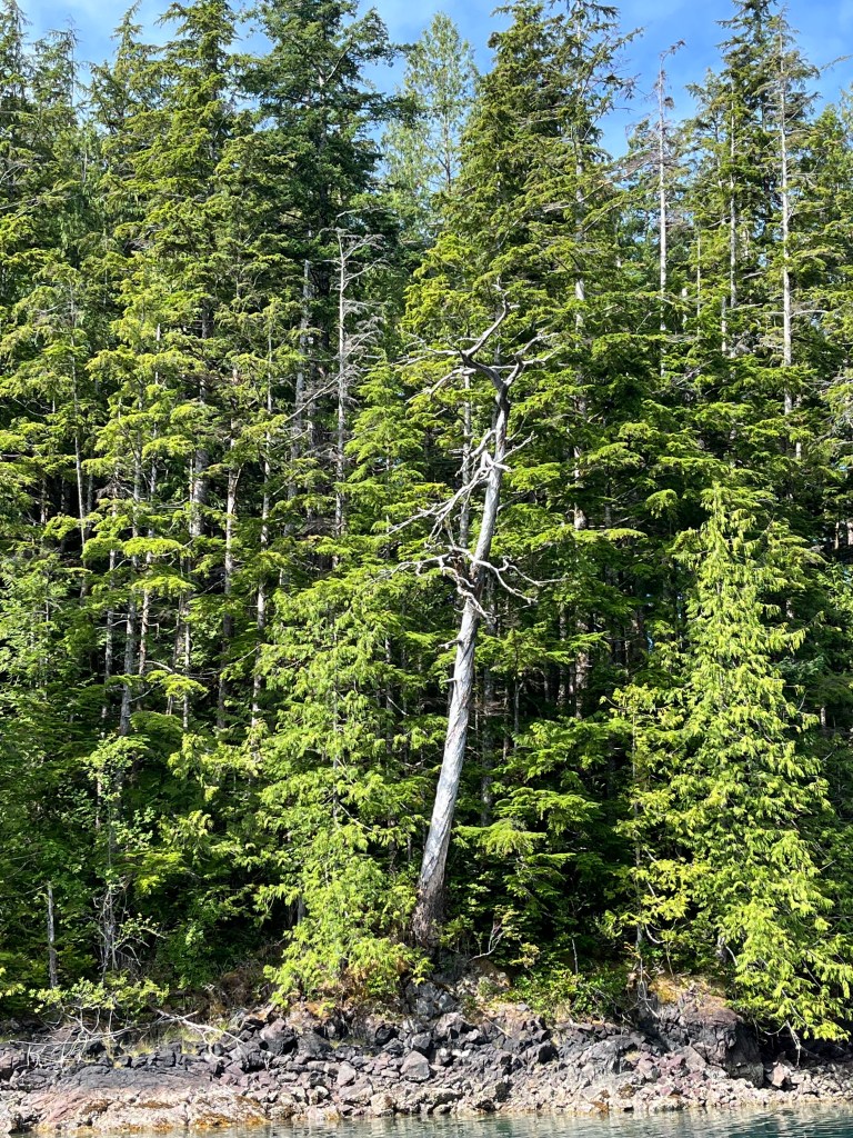
The barrier islands along the coast of Vancouver are far more scattered and generally less wooded than those on Chichagof or Baranof Islands making navigation easier but non-trivial. We’ve observed them so far only under gray, humid skies that shroud the tops of adjoining coastal hills. Perhaps they’re mountains.
In search of an ATM, we assembled Bravo and pressed her into service with motor to check out “town” across from the dock … and came across a Bald Eagle feasting on a what was left of a halibut carcass. We figured the post office at the head of the government dock might have an ATM, but office hours are a leisurely M, W, F … 1330-1630!
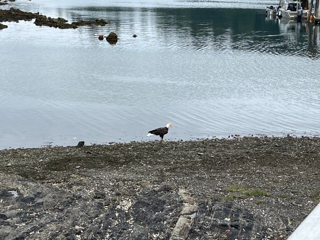
After finding no ATM in town, we motored across to Eric’s Java (below) to confirm he’d be okay with a check (he was) and then returned to Encore.
We walked a similar 0.5km in the opposite direction to explore a “stack” akin to Eddystone Rock and “Eddystone 2” (Hobart Bay) that we’d seen from town and came across a number of Mountain Ash trees loaded with berries. One of them was growing out of a seemingly bare rock.
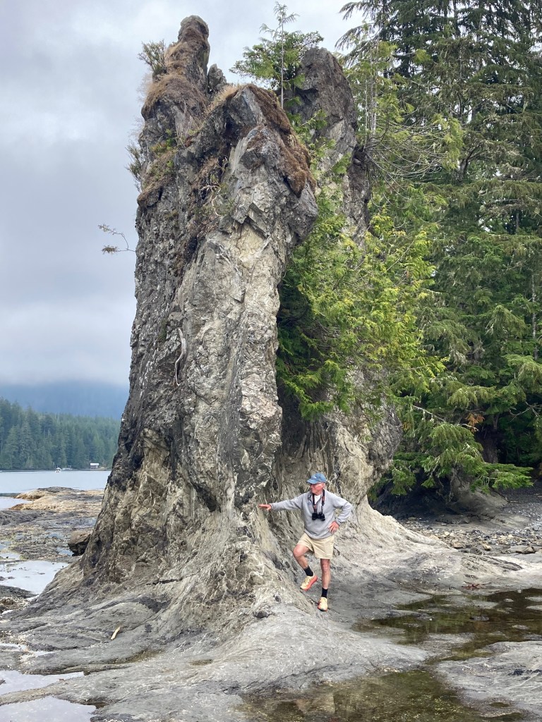


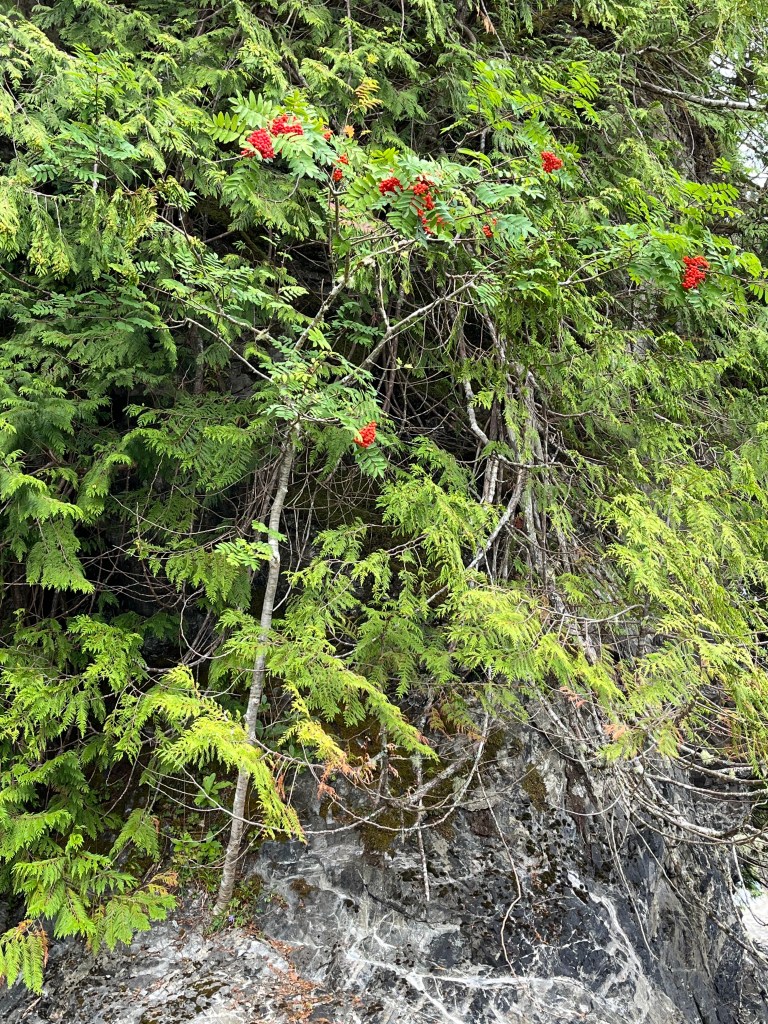

Lots of Mountain Ashes … which apparently can grow from a bare rock!
Wednesday, 14 August
Walters Cove to Dixie Cove (50-03.2N 127-12.1W) and Rugged Point (49-58.2N 127-14.9W)
Leaving Walters Cove by a route different from the way in presented an unexpectedly elevated pucker factor. Planning for a blind turn to port at one point, we had the addition surprise of two sports fishing boats zipping around the corner right at us at close range.
Dixie Cove has both an outer and inner part, and we chose to drop the hook in the inner cove just for a few hours for lunch and then paddled around both. Upon noisily dropping the anchor, we notice scarcely a hundred yards from Encore a sacked out Sea Otter and watched it with binoculars for quite a while before it woke up, no doubt hungry again.

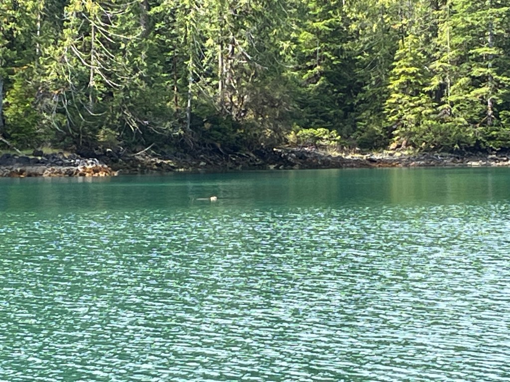
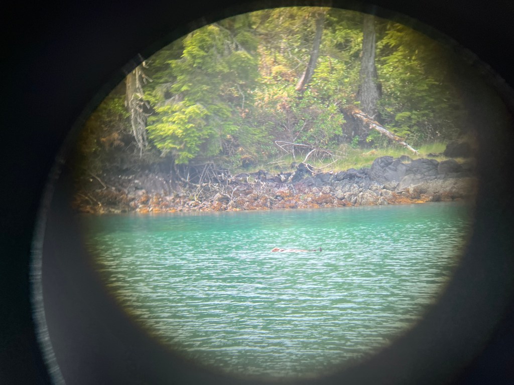
For want of a bigger lens!! Binoculars just don’t cut it.

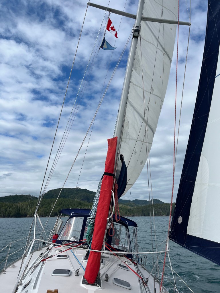
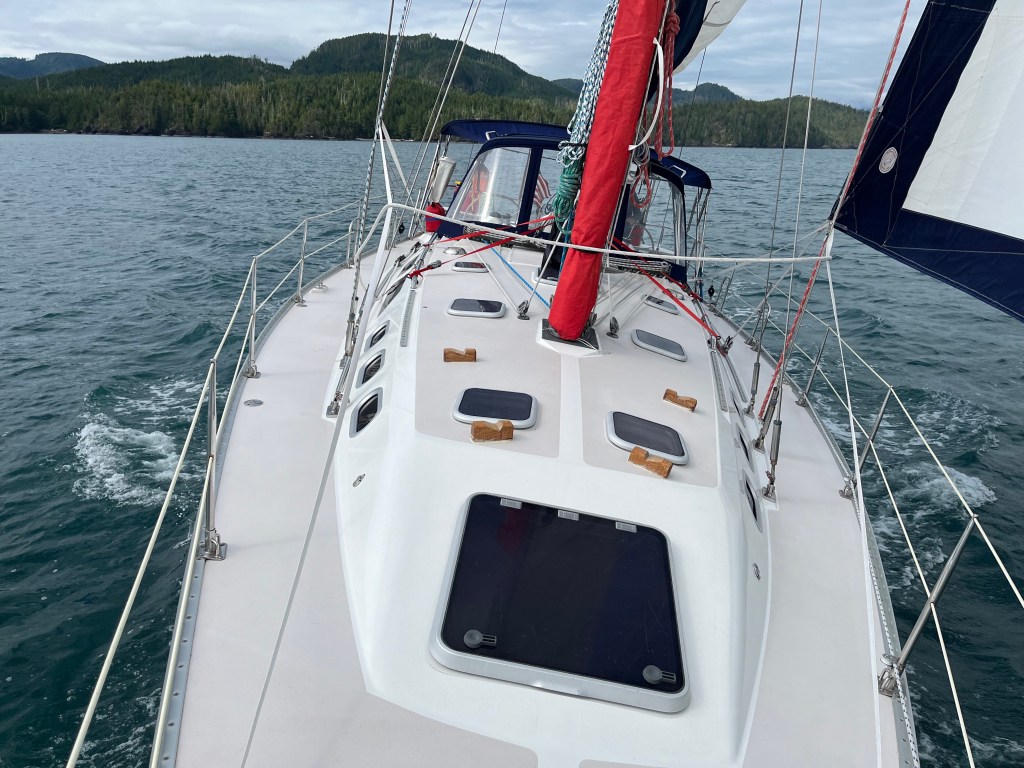
A rare pleasure, we sailed most of the eight miles to Rugged Point.
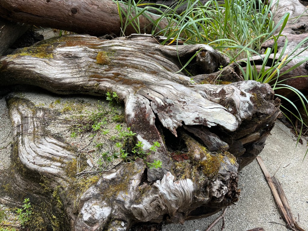
Taking Bravo ashore, we walked across Rugged Point via a Marine Park boardwalk to its incredible beach facing the ocean and saw many small, busily feeding [—— SANDPIPERS] Sandpipers.


Walking back to the north beach, I reflected on the marvelously endless recycling within our natural world: fauna, flora, geology, and hydrology. Pretty amazing. Pretty taken for granted.
The lowering sun afforded a nice 360 video. (video)
Thursday, 15 August
Rugged Point to Nuchalitz Marine Park (49-48.5N 126-57.7W)
Between Gregoire Point and McQuarrie Islets during our short transit between Rugged Point and Nuchalitz Marine Park I landed a Black Rockfish with the yellow guppy and a much bigger fish with a big head and big teeth using the Coho Killer: A Cabezon. At long last, having sorted out field dressing mess-control, I carved out and skinned four respectable fillets whilst standing up for the first time at the kitchen counter opposed to hunched over on the bow or between the lazaret drop-ins aft or in bouncing Bravo.
The 38’ Wayfinder, San Francisco, followed us in to the marine park not long after we arrived having motored around Estevan Point from the south. Retired electrical engineer Peter is single-handing his maiden voyage of Wayward, a new steel cutter-rigged sloop that he finished building at the boat-building coop in Port Townsend. Its salon is bigger and more functional than Encore’s, though it has no aft berth, with lots of head room. Lithium batteries power an induction stove among many other things. Pretty tricked-out boat! He wasn’t sure of his plans heading clockwise around Vancouver but recognized Alaska wasn’t within reach this fall. We talked about our trip and gave him a number of great spots to aim for if he chooses to go for Prince Rupert. Nice chap. He served us tea in a fast-boil electric teapot.
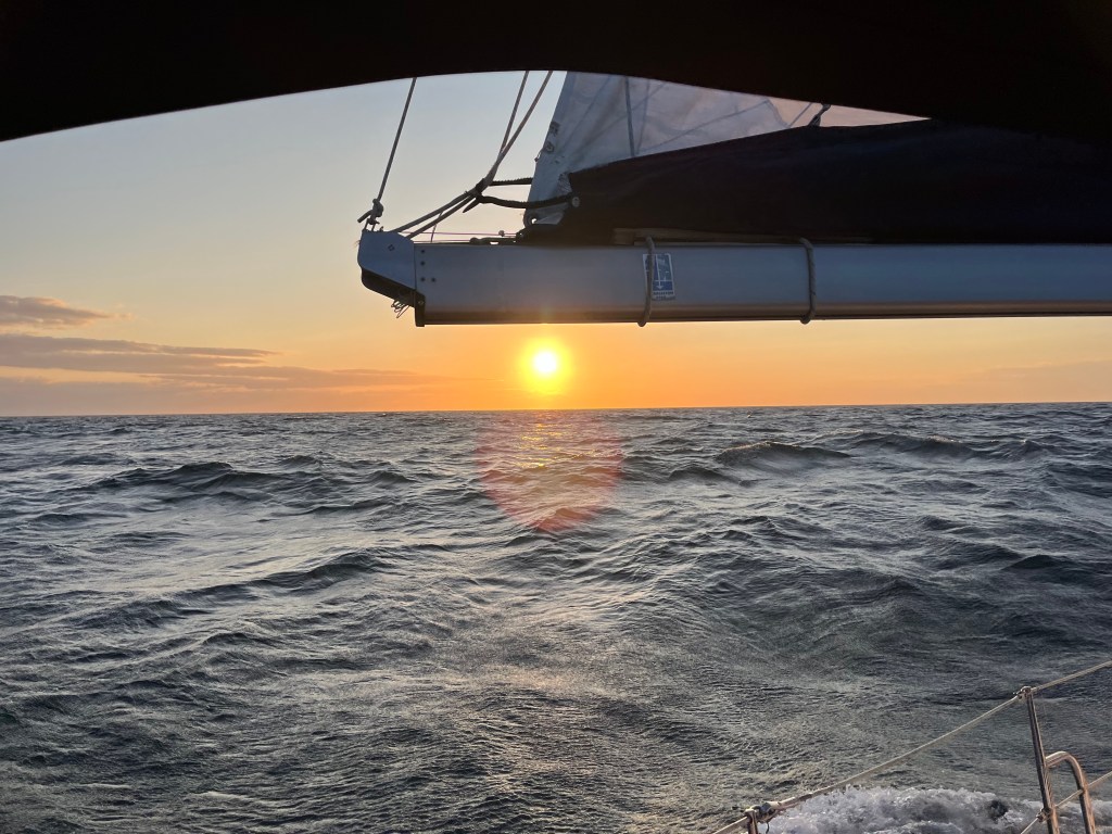
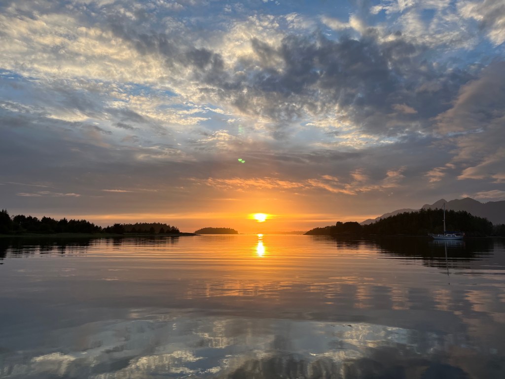
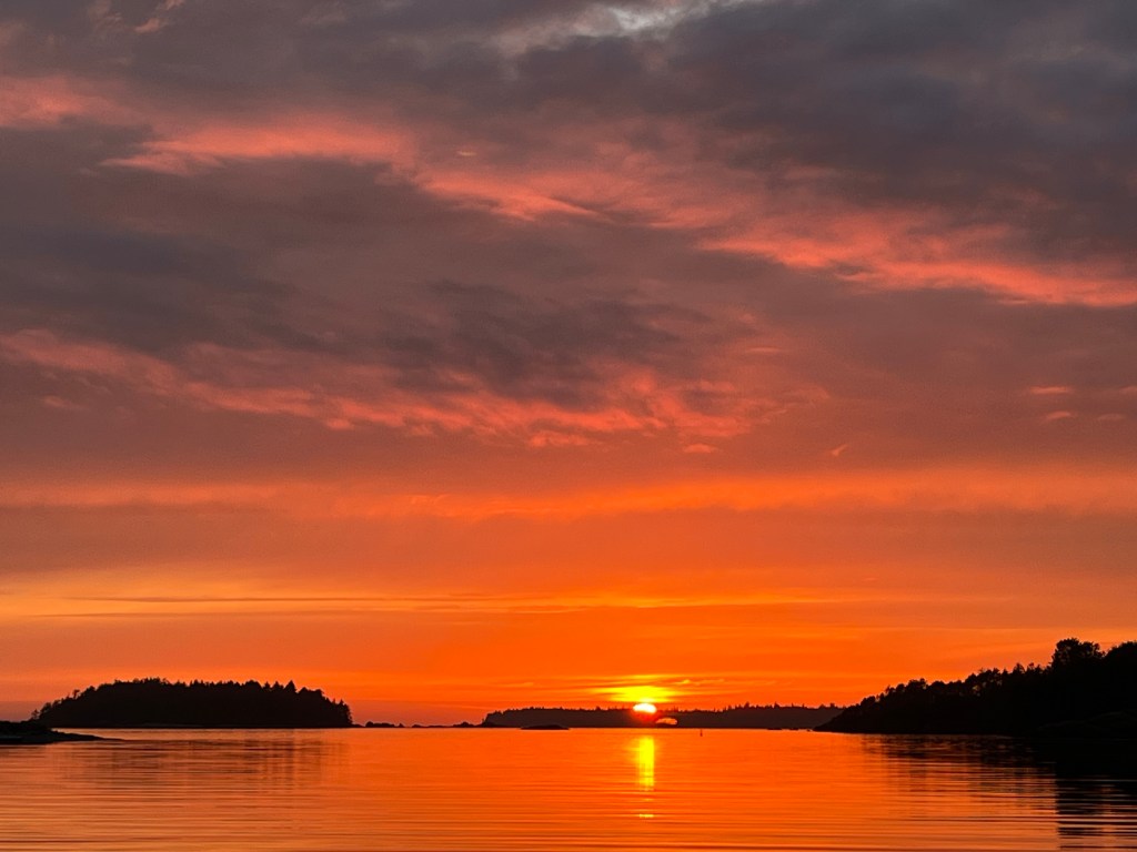
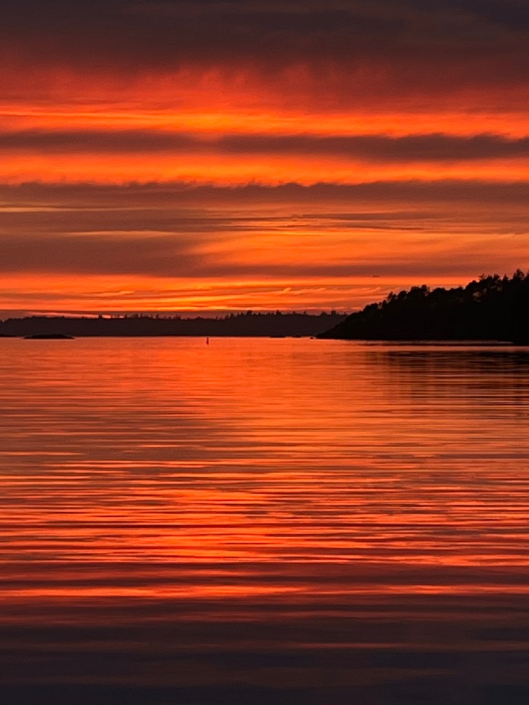
We watched our most beautiful sunset this trip. Too many pictures taken!
Friday, 16 August
Nuchalitz MP to Tahsis: (49-55.0N 126-39.8W)
In search of an ATM, we shifted our sights today to the village of Tahsis, an old logging town that has sadly collapsed with that industry. Waggoner’s Guide says that the Westview Marina in Tahsis is helping keep the place afloat. Having moored there – tres chere – we will agree.
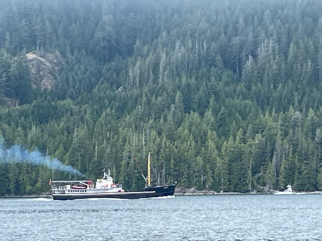
We had the fortune of being passed by Uchuck II, Vancouver BC, a provisioning vessel for numerous small communities up and down the west coast of Vancouver … like Walters Cove, Tahsis (where we are spending the night), etc. For the discerning eye, there’s a similar but much smaller provisioning boat that’s like a Navy Mike Boat in the distance south-bound. The Uchuck II and cousin Uchuck III also deliver and retrieve kayakers along the coast!
Subscribe to get access to the rest of this post and other subscriber-only content.
