Hello from Sitka! A busy several days. This posting is uniquely presented in chronological order which readers may find preferable to the last in first out approach of earlier postings. Here is the sequence following our visit to Hoonah:
18 June – Tenakee Springs, Chichagof Island
19 June – Cosmos Cove, Baranof Island as are the rest below
20 June – Warm Springs Bay via Ell Cove and Falls Cove
-21-22 June – Red Bluff Bay
23 June – Gut Bay (Mickie’s Cove)
24 June -Toledo Bay
25 June – Forevergreen Bay (Puffin Bay)
26 June – Still Harbor – a change in direction!
27 June – Hotsprings Harbor (Goddard Hotsprings)
28 June – Sitka
Tuesday – 18 June
Hoonah to Tenakee Springs – 45nm: 57-46.7N 135-12.4W
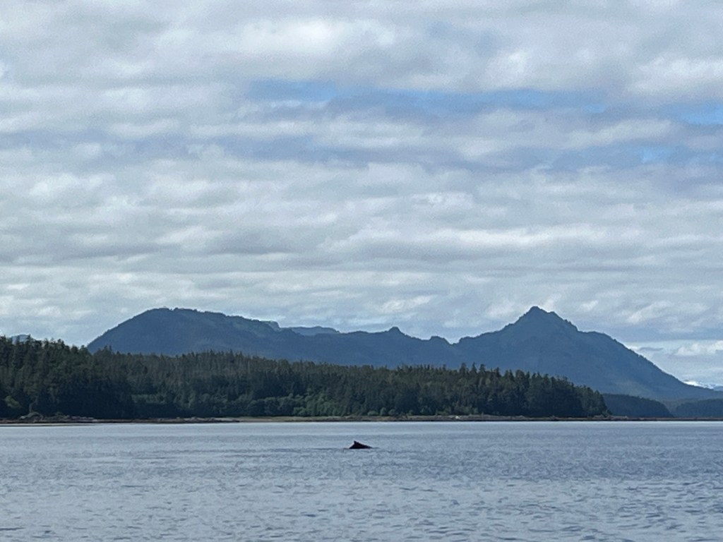
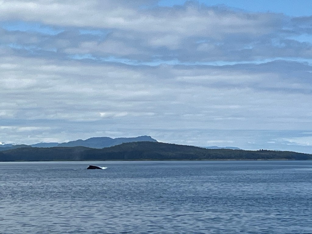
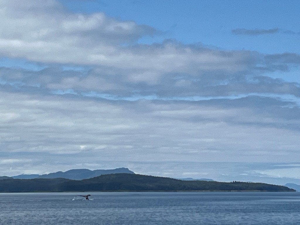
First, on the 45-mile journey to Tenakee Springs, I share a series of photos of one of several ever-impressive Humpback Whales sighted as it sounds. Watching these behemoths never gets old.
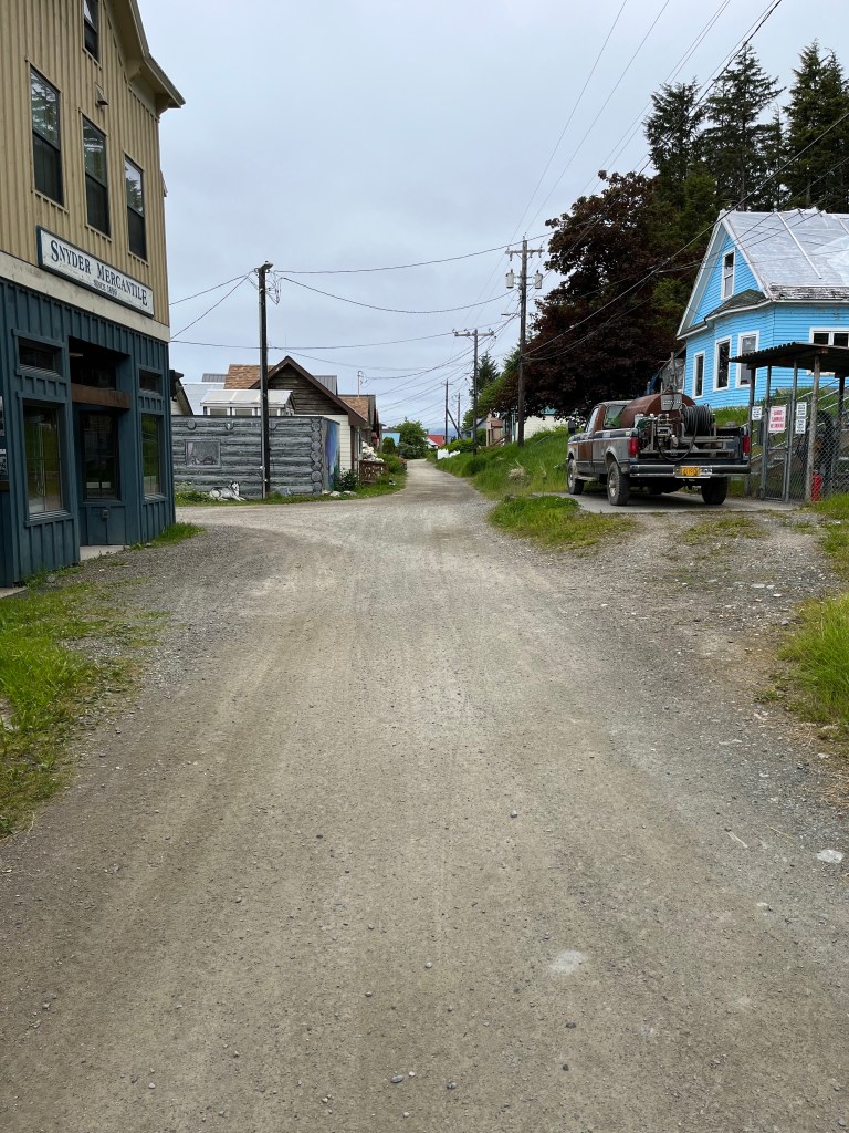
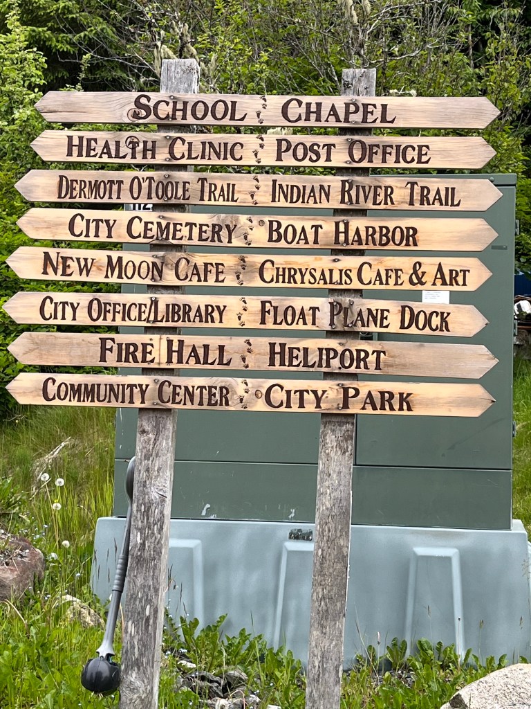
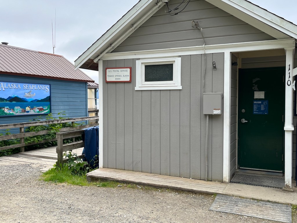
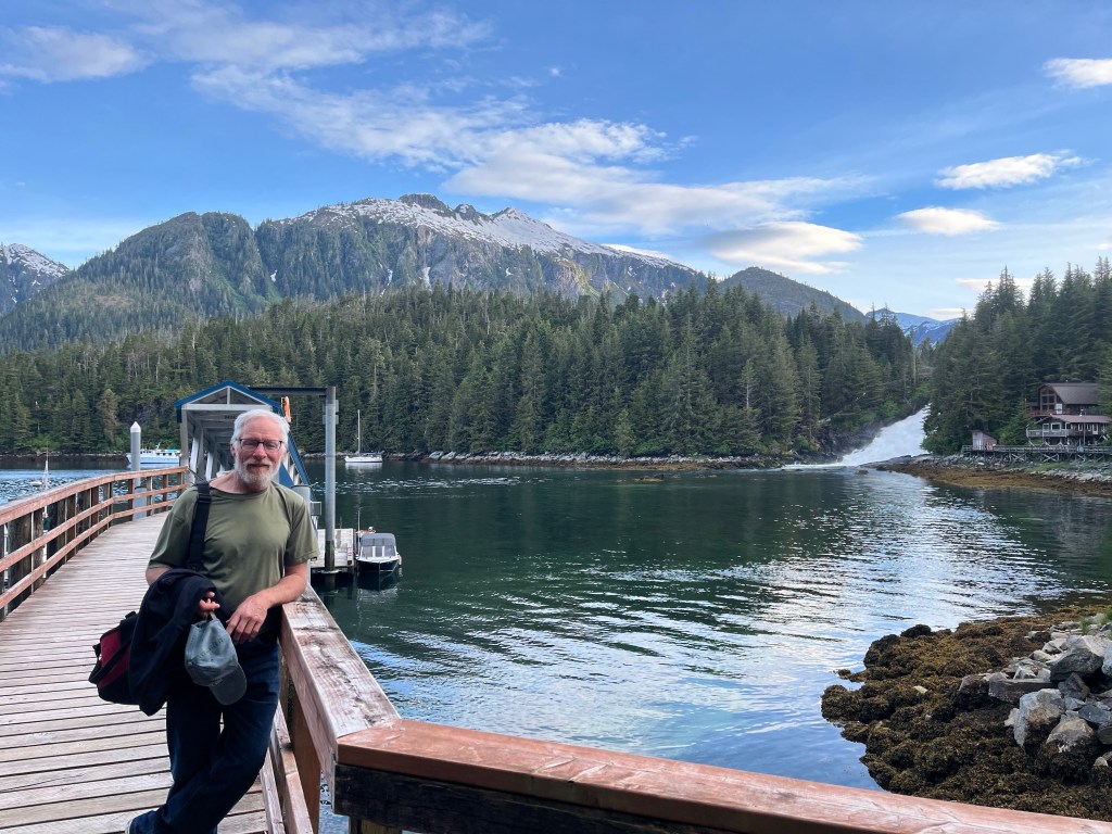
Tenakee Springs is one of the strangest settlements we’ve had the pleasure to visit. Main Street, the only “street,” is a gravel two-track that runs west from the marina on the east side between homes and a few similarly sized businesses on the waterfront to port and the homes and a couple of similarly sized businesses to starboard. It stretches less than a twenty minute fast walk from end to end.
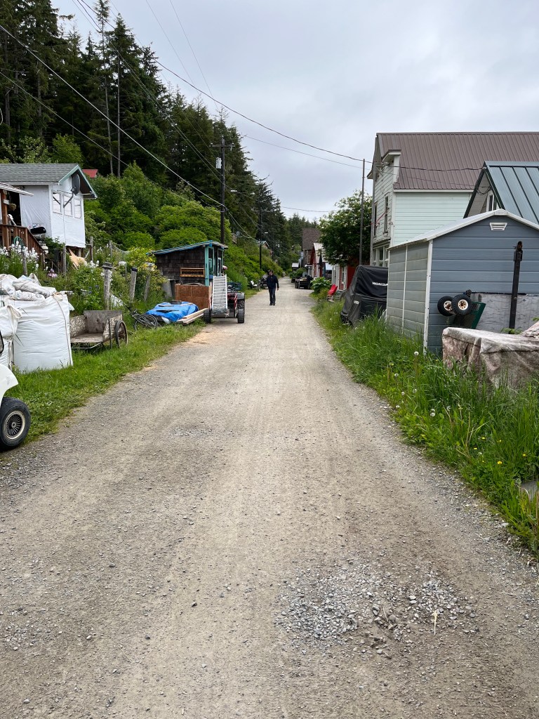
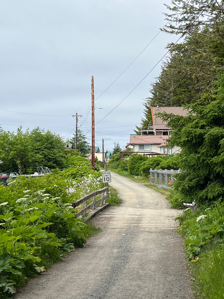
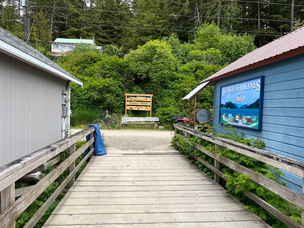
The age range of the homes varies from (likely) the covid era to who knows ago. A favorite past-time appears to be soaking in the one hot spring a few doors west of the center of town denoted by a welcome sign north of the road facing the water at the base of a long dock that terminates at a quite new ferry dock that could double as a cruise ship dock (mammoth) coupled with a heli-pad also on steel pilings. Hot spring hours are strict, suits disallowed – Men: 2pm-6pm, 10pm-9am; Women: 6pm-10pm, 9am-2pm. Of this, we elected not to partake.
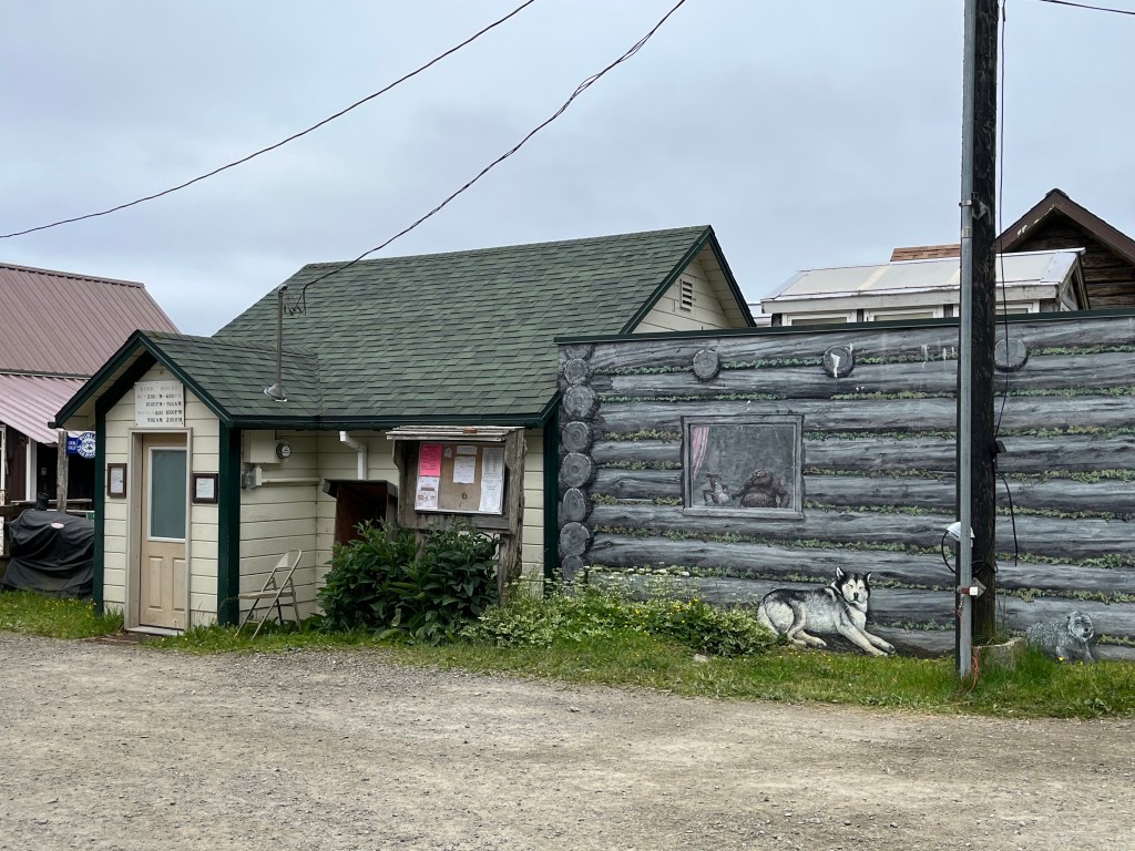


Gardening and deer hunting seemed to be next most obvious pastimes for locals. People are friendly, and at least some of the 65 residents (by census) have second homes here. We met a woman, Lylith, who is the Haines doctor, her husband and two young children who had arrived by boat and another woman who arrived at Tenakee Springs via ferry. Another gentleman, Mike I believe, former USMC, was the defacto harbormaster because he’d been around the longest and was a Marine. Two other gentlemen, stuck to their cell phones on the dock ramp where the free 5G wifi signal was the strongest, sounded like Ukrainians or Russians.
Wednesday – 19 June
Tenakee Springs to Cosmos Cove – 48.4nm: 57-14.7N 134-52.2W
The crab trap yielded three small tanner crabs and seven or eight large sea snails of which we managed to keep five in sea water for the trip to Cosmos Cove at the unnecessary expense of wet tennis shoes during the rough and long transit south that followed – 8.5 hour transit, 8.9 hours on the engine.
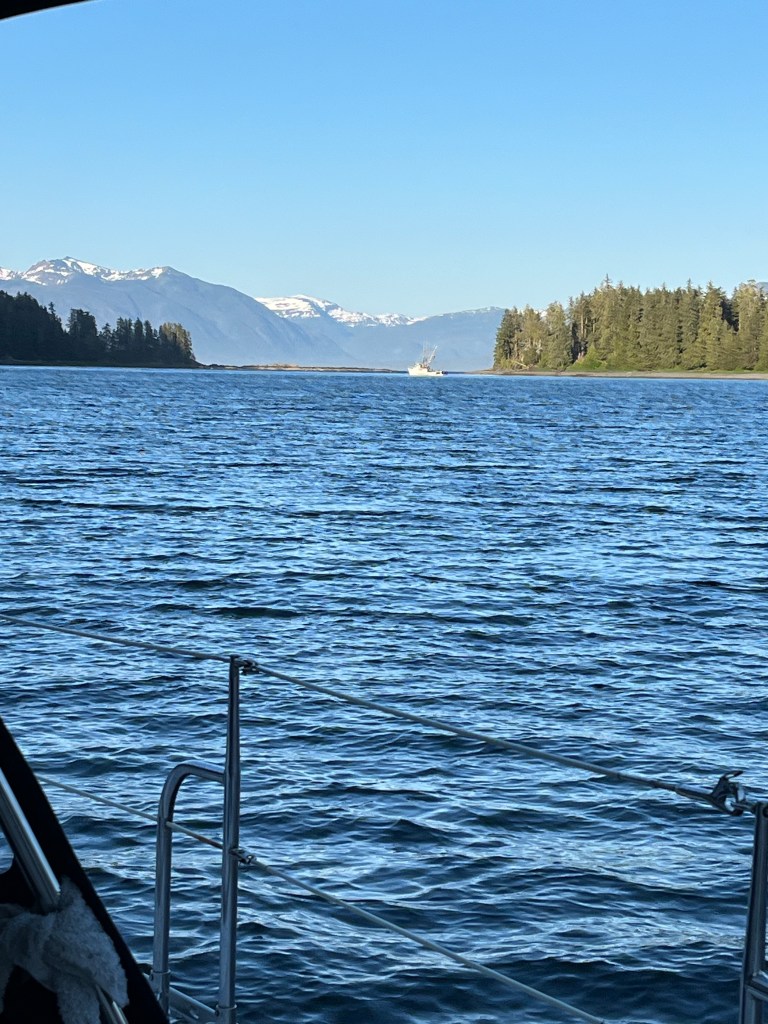
We motored ten miles to the mouth of Tenakee Bay and Chatham Straight with little wind and continued south 33 more miles. Close to the mouth of Peril Strait that separates Chichagof Island (north) from Baranof Island with winds picking up north of the teens, we deployed the jib and began motor sailing into what became one of our roughest but appealing days given mostly clear skies. For these remaining 17 miles we quartered the 3-4 foot seas for a rough but tractable ride kiting along at 6.5kts give or take five.
Cosmos Cove approach – coming!!
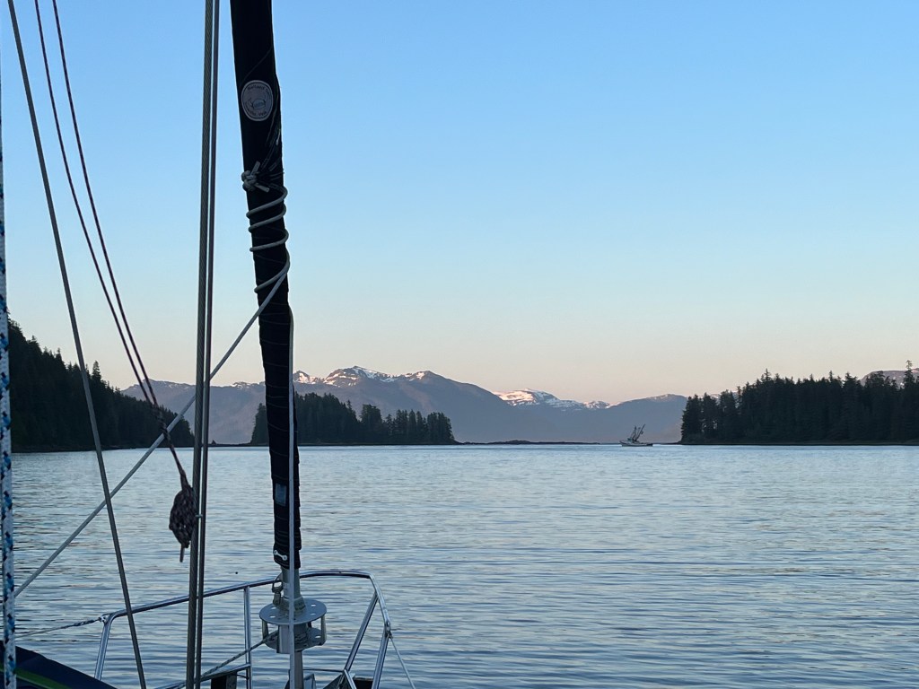
By the time we reached Cosmos Cove, worn out, we were in the vicinity of a diverse fishing fleet with ten trawlers, crabbers, and other fishing boats. We welcomed the settled sea within Cosmos Cove with reduced wind, motored past one of the fishing boats we’d seen duck into Cosmos well ahead of us, dropped the crab trap in 46 feet after consigning the snails to a new home, and stood off a couple of hundred yards or so before dropping the hook for the night.
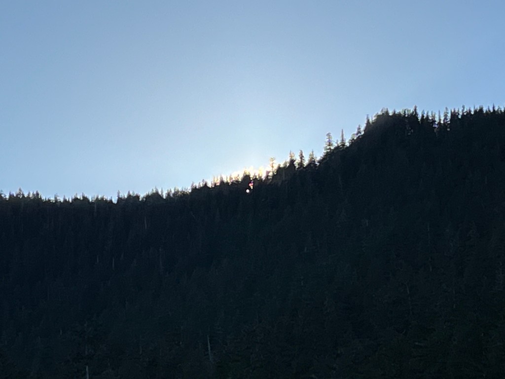
Bird Notes: we were serenaded by a quartet of Varied Thrushes while a Short-billed Gull tried its luck at capturing small fish astern of us as the sun blinked out behind the wooded ridge north of us setting trees afire as it did so. Also: Bald Eagles, Cordilleran Flycatcher, Hermit Thrush, and three Blue Herons which I’ve not reported before despite having seen a few of them.
The fishing boat was headed our way around 8am the next morning to retrieve a singleton crab trap a couple of hundred more yards west past Encore. We watched it recover and check the trap and heard the report from one of two young lady deck hands of “one keeper” before the boat headed to the top of the cove where nearly twenty more traps had been placed. We can only imagine what that harvest did to the crab population of Cosmos Cove. It was instructive to discover that those many traps were placed in water ten feet deep or less.
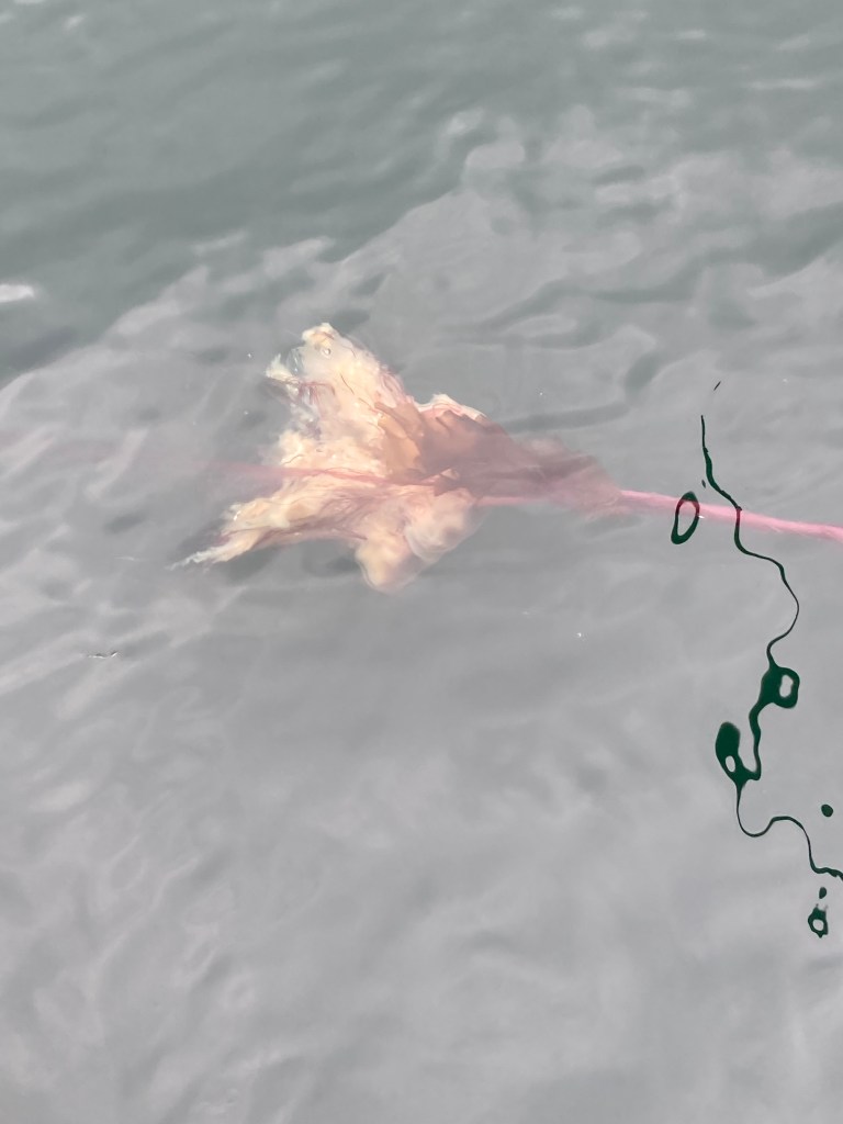
Then a couple of miracles occurred. First, recovering the anchor, we snagged a huge red jellyfish shy of three feet in diameter the long dark red tendrils of which I gently extricated with the boat hook. It turns out these red jellies sting something fierce, an experience I was pleased after the fact to have avoided.
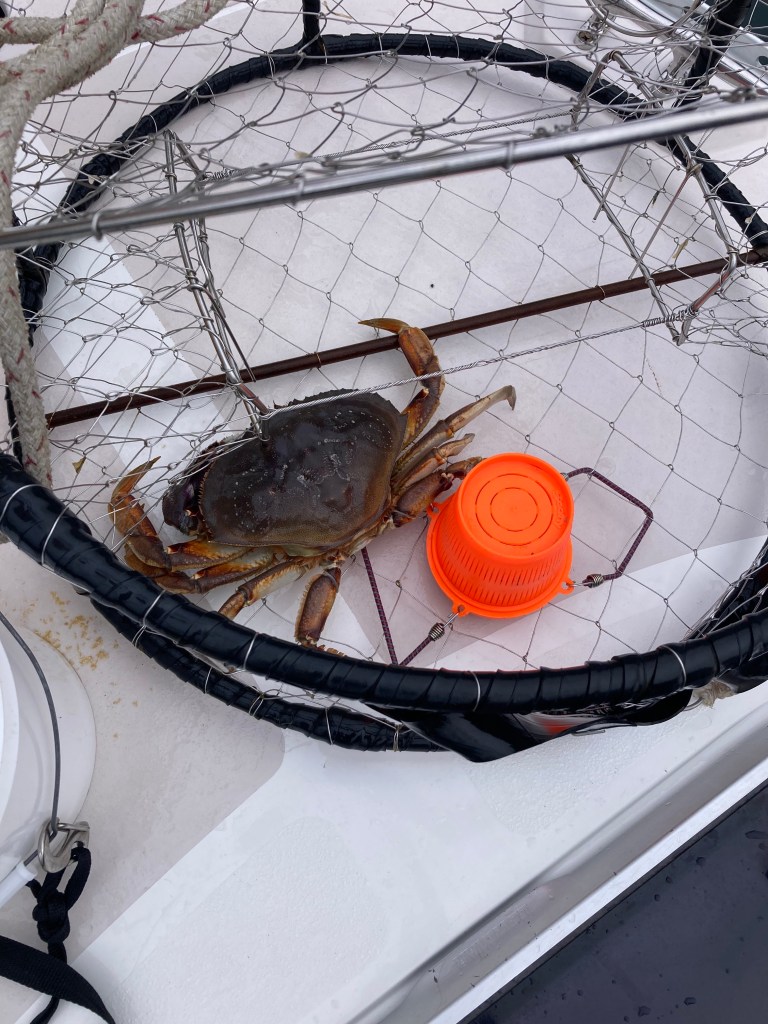
I found two crabs in our trap including a decent female and one definitely keeper male. Dinner! I immediately dispatched and dressed the crab and put it in a bucket of clean salt water before we lurched into the seas at the mouth of Cosmos Cove.
Thursday – 20 June
Cosmos Cove to Ell Cove – 1.7nm: 57-12.0N 134-51..0W
… and then, via Falls Cove, on to Warm Springs – 17.6nm: 57-05.2N 134-50.1W, by way of Falls Cove
First, a couple of thankful observations. It is with immense gratitude that I thank all who have contributed to the paper nautical charts over dozens of decades that are the basis for the digital ones used today. As we ply the rocky shorelines of Southeast Alaska sprinkled with innumerable boat-eating rocks, it is absolutely humbling to think of the nature and extent of cartographers’ work drafting and updating charts that, today, afford us navigational freedom with impunity. Much of the especially careful, detailed cartography has been completed during our lifetime. Our friend and fellow bird-watcher Neil Bogue is one such contributor, and we aim to visit some of many bays he surveyed many years ago.
Elsie Hulsizer wrote a beautiful book, Glaciers, Bears, and Totems, chronicling the three visits to Southeast Alaska she and her husband made in the early 2000’s. We read and have re-read parts of this inspiring book throughout our travels. I discovered that she has recently subscribed to this blog! Hello Elsie and thank you!
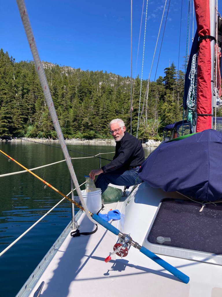
Ell (as in the letter “L” for its shape) Cove is one of a few places we would seek out on a return trip. It was tiny and made especially beautiful by mostly clear skies and practically no wind. The entry channel was 100 yards wide. The main limb was around 600 yards long and the fatter secondary (200 yards) at right angles to the first, 400 yards long. We dropped the hook. Jane read. I fished … with two rods, a jig with which I successfully landed and released a 10” long flat fish (sole, flounder, halibut – I should know which but do not), and a spinner that garnered nary a nibble. An explosion of little moon jellies was impossible to capture on camera.
We made plans to depart, primarily under sail power (both sails first-reefed), at the onset of the ebb at 13:17 to help carry us south after first swinging by Falls Cove for a glance at the 300-400 foot falls that cascade into the cove.
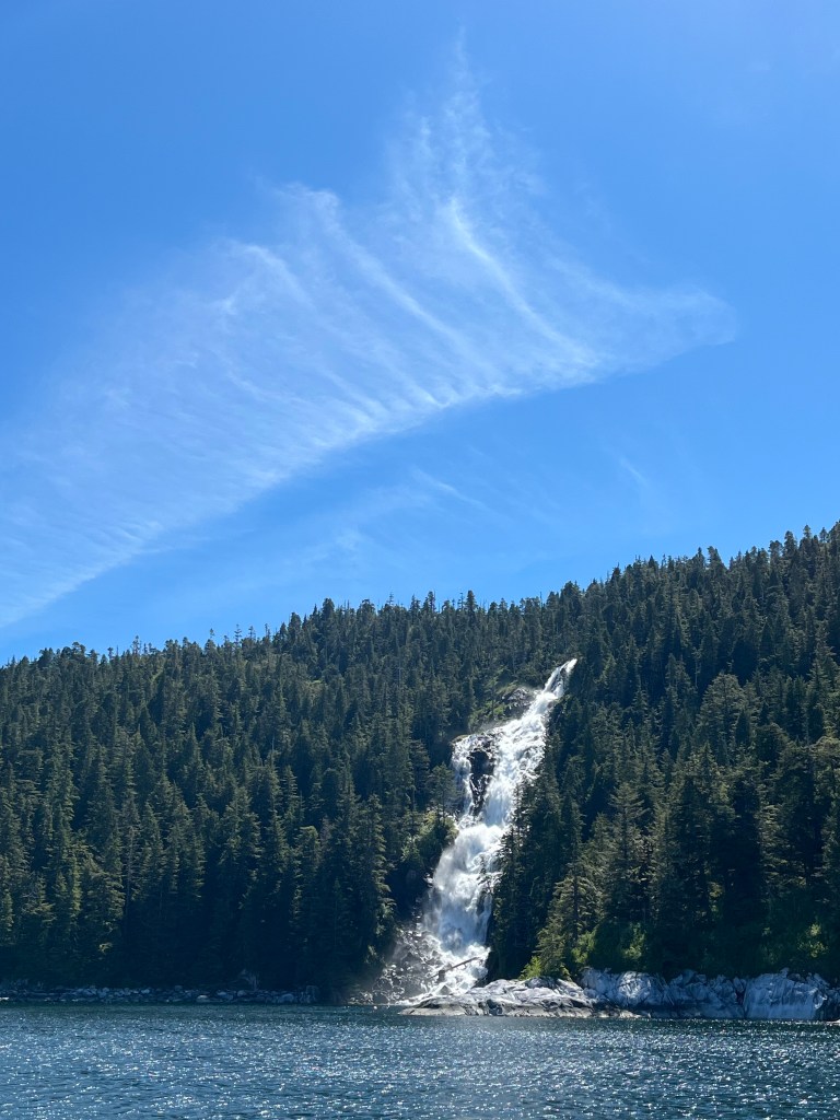

Falls Cove shot far Falls Cove shot near
Jane sailed the first eight mile leg all the way to Admiralty Island and I sailed the second, detouring around a south-bound tug in tow mid-way across. The two-legged trajectory nailed our entry into Warm Springs Cove on a fast reach. Tada!
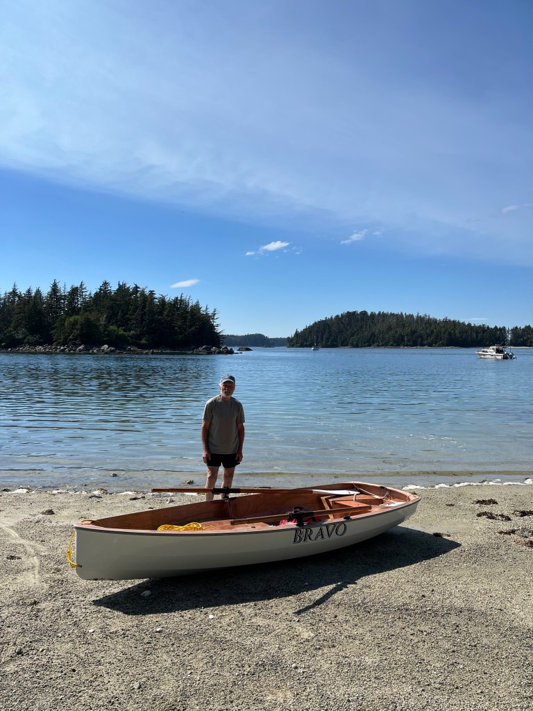
Finding the large state-maintained dock packed (not unusual says Waggoners) near the base of a thundering waterfall, but rigged for a dock landing, we immediately shifted gears, dropped the Delta anchor with chain in 50’ and affected our first stern-tie in a year 300-400 yards south of the state dock. This required Bravo, which we assembled in record time and used only the motor. It was slick. Pulling Encore astern drew her to within a boat-length of shore in just 25 feet of water but enough to deal with a -2 foot tide the next morning.
After a most delicious dinner of Dungeness crab and garden salad, we motored Bravo past the roaring falls to the dinghy dock and enjoyed a very hot soak in a large tub in the west of three adjoined bath houses.
Warm Spring Falls
Following that, we hiked the boardwalk a half-mile uphill and above the falls to first visit the respectable lake that feeds the falls and then two rough dirt trails, one near the top of the falls and the second mid-way down.
Warm Springs Lake
The lake must provide terrific fly fishing which I know how to do and miss.
We found two large and occupied hot pools at the end of the higher trail and enough no-seeums to drive us quickly back to the main trial. I dashed to the falls on the lower trail for a quick video moving fast enough to avoid stinging bugs.
Mid-falls – coming!!
Stern ties permit anchoring close to shore.
Bird Notes from Ell Cove: A perfect quintet at Ell Cove: Three thrushes together for the first time, Varied, Swainson’s, and Hermit, a Townsend’s Warbler, and a Pacific Wren. And NO CROWS, nor any other of the more common birds we’ve seen. Later we were joined by a pair of Bald Eagles.
Bird Notes from Warm Springs: A trio of Swainson’s Thrushes walking back from a large-ish lake that feeds the thundering falls. And crows. The morning of our departure, a unique pair of Townsend’s Warblers ashore next to Encore.
Friday – 21 June
Warm Springs to Red Bluff Bay: 56-52.2N 134-47.3W
Happy Summer Solstice! What fun it would have been to have enjoyed this day in Skagway over two degrees north of our present location.
Meteorologists again proved inept. Today was to have delivered us south wind at 15kts based on yesterday’s predictions. That prediction changed this morning shifting to north wind at 10-15kts, which sounded exciting until it wasn’t realized in the least. Having raised the main in eager anticipation of a run south, we motored from Warm Springs and encountered a single digit fickle south-ish breeze over almost glassy seas in Chatham Strait. Out went the jib and we set it and the main for pinching, as if that might succeed in such light air. Aiming to cross the strait as we had done sailing to Warm Springs, we initially headed for Yasha Island south of Admiralty Island across the strait. Within an hour it became clear that goal was unreachable. Given the short remaining distance to Red Bluff Bay, we settled in to drift along quietly in sub-four knot air until boat speed fell to sub-2.5 knots with less than an hour to go at which point we motored.
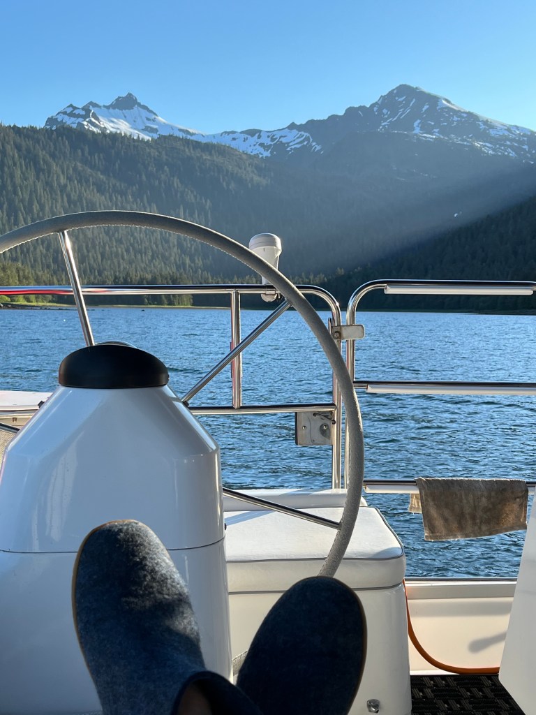
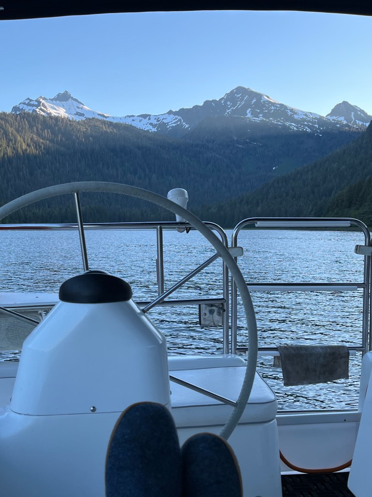
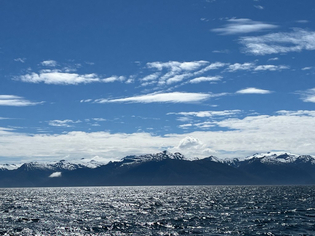
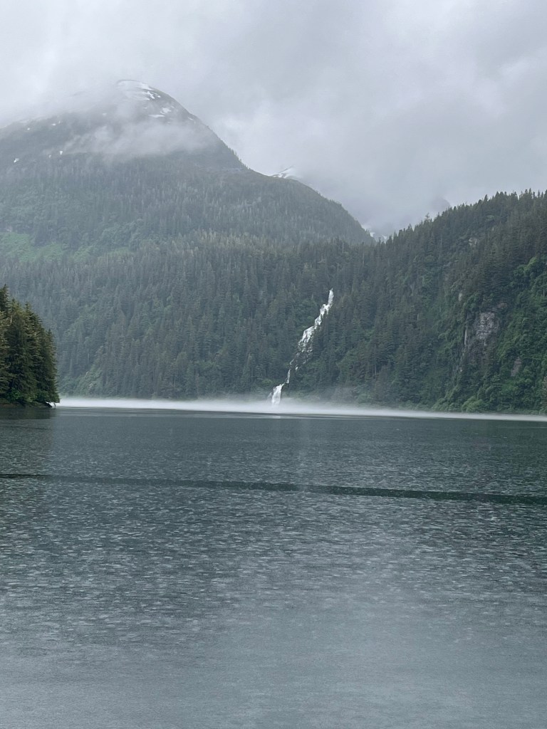
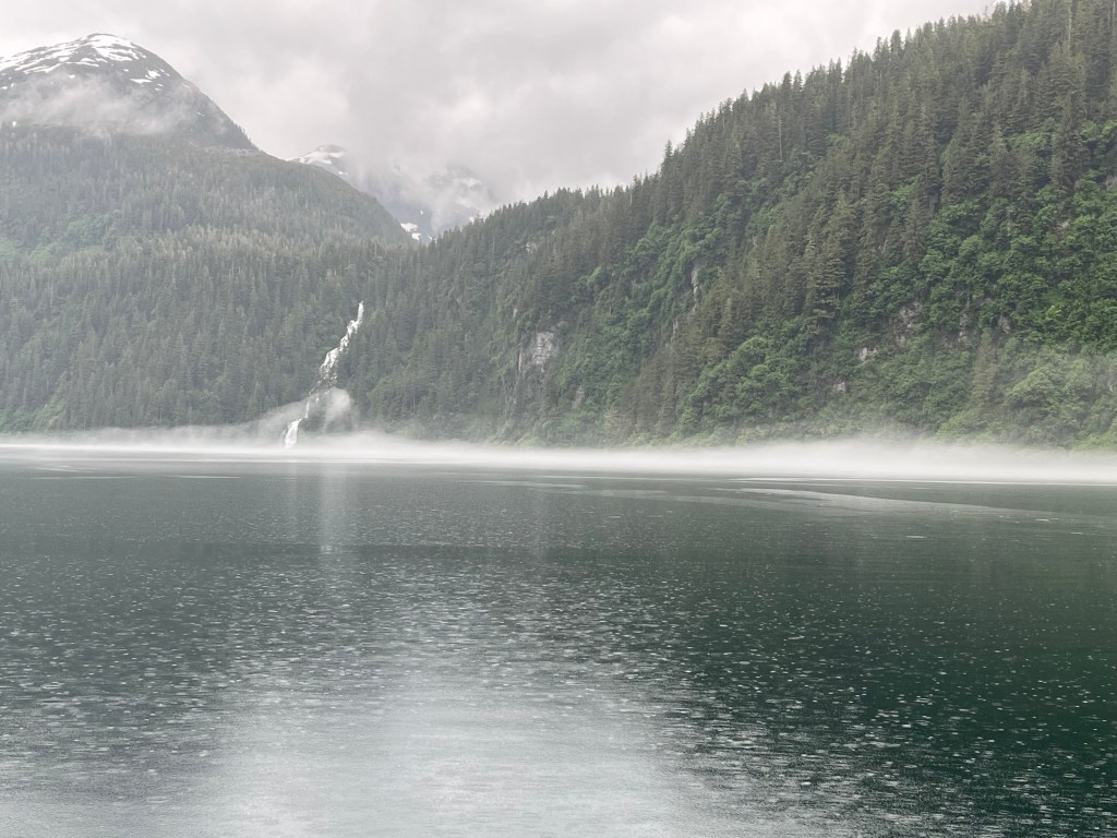
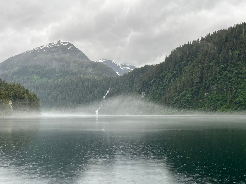
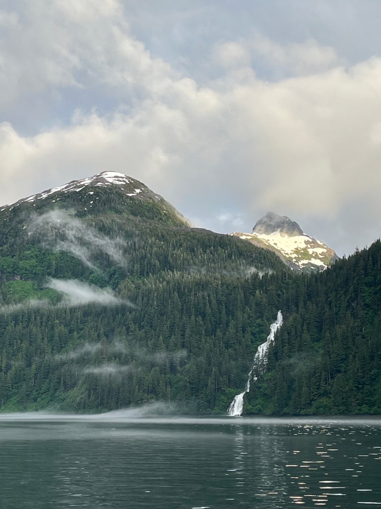
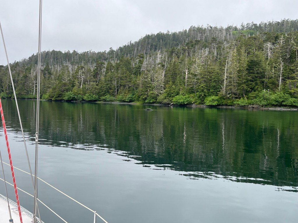
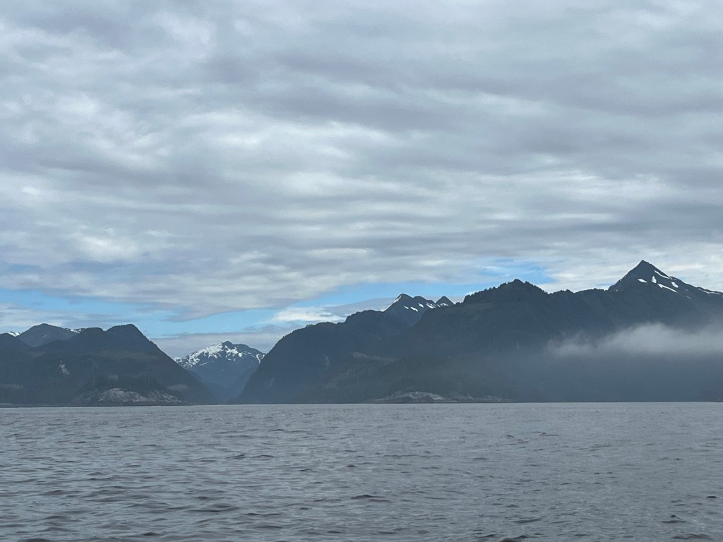
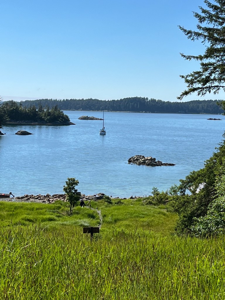
Waggoners and other references tout the unique beauty of Red Bluff Bay. They write of the intriguing largely bare red rock bluffs on the north overlooking a handful of islets guarding and not quite blocking the bay’s mouth, to myriad waterfalls and cataracts of various sizes and heights that come into view as soon as one enters the bay, to the vertical old growth tree-lined granite wall looming over the narrows leading to the inner bay, and finally to the wide green meadows in the southwest portion of the head of the bay which are surrounded by massive snow-dappled mountains thousands of feet tall streaming countless waterfalls. These references do not mislead.
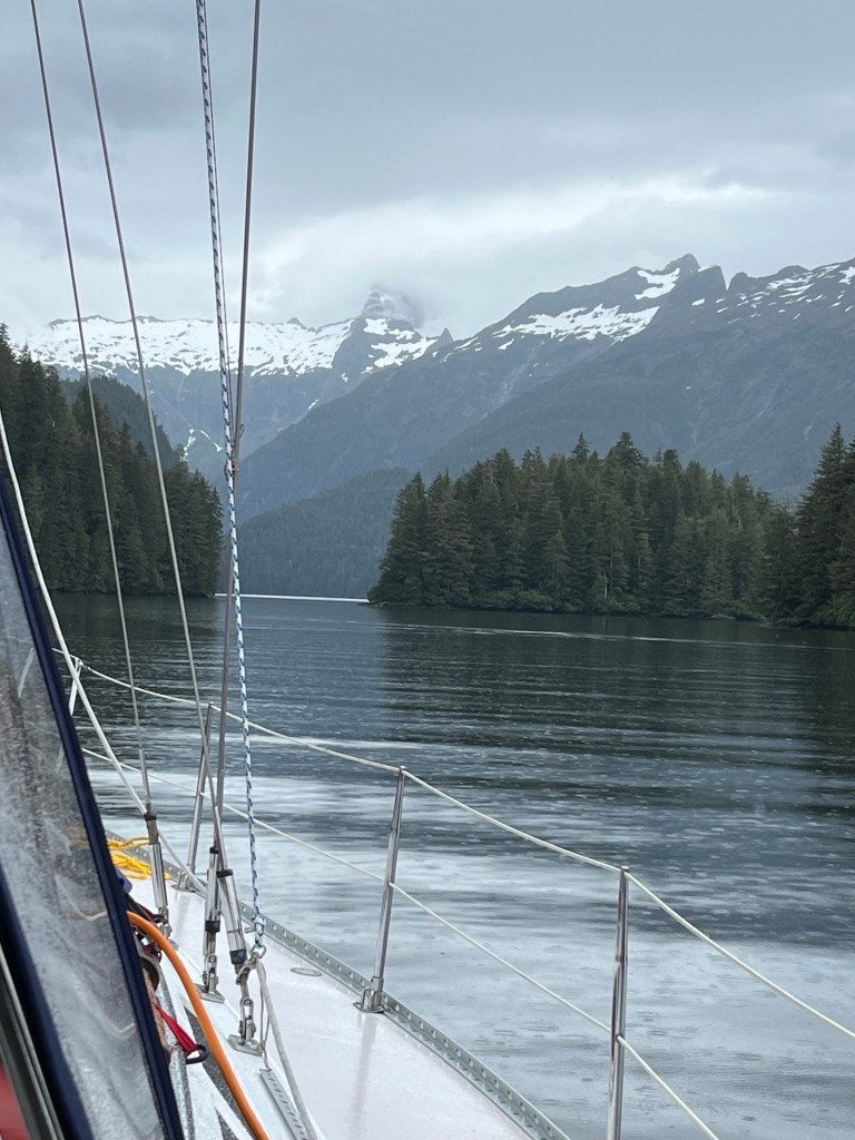
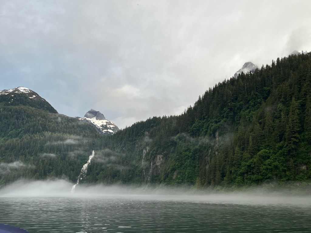

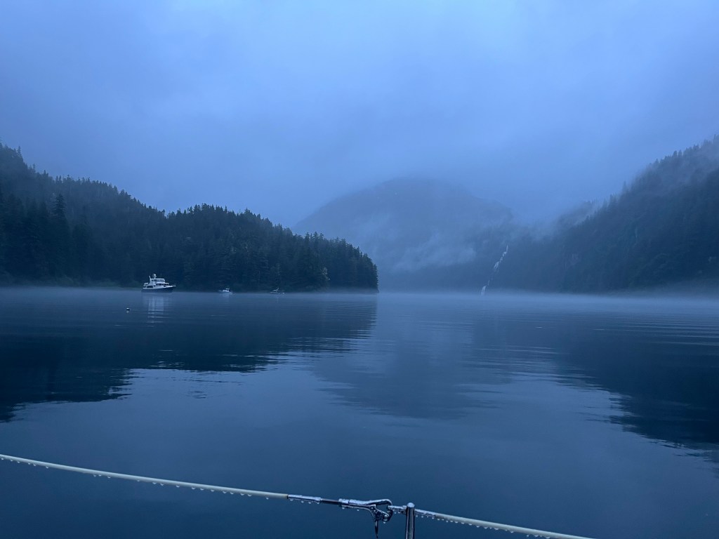
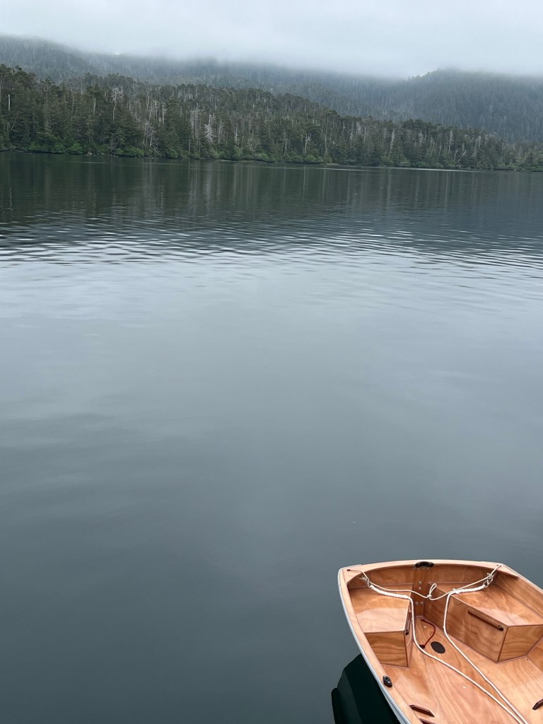
Fog, which formed initially and intriguingly at the base of the massive falls cascading from the lake above the south wall opposite our location and spread over the glassy bay through evening hours as I fished, eventually enveloped the bay completely as dusk fell.
Bird Notes: Marbled Murrelets, Red Loon (not seen for a while), a trio of thrushes – Hermit, Swainson’s, Varied; Pacific Wren; Cordilleran Flycatcher, Bald Eagles, and, yes, Crows.
Saturday – 22 June
Red Bluff Bay layover day. 56-52.2N 134-47.1W
Southeast Alaska is a land of many waterfalls and hanging valleys that account for a healthy portion of them.
0540: I can see my breath in the cabin at 55F while outside it’s 51F. The barometer sits at 1005mb. Light rain fell all night. Observed two soggy Bald Eagles poring over the tide flats hoping for something to eat.
~0800: The stern effectively overlooks the rocks at the mouth of a nearby stream yielding 22 feet of water beneath the keel. We started the engine, cranked in 15-20 of 90’ of chain, and gained wiggle room astern.
Mid-afternoon we opted to motor to the now-vacated initial spot at which we wanted to anchor, checked the crab trap (empty), and both recharged it with herring and relocated it closer to the mouth of the river that empties into the southwest corner of the bay.
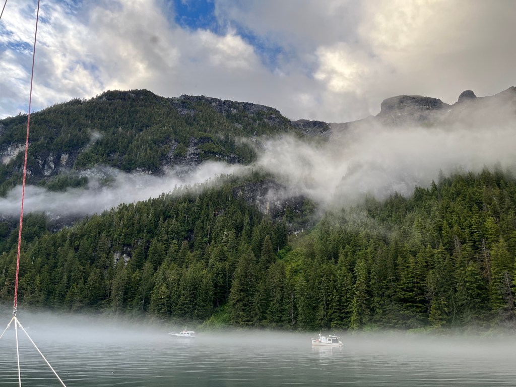
We took Bravo for a spin given the rare appearance of the sun this afternoon first to check out the mammoth waterfall dumping several hundred feet from a lake above then to other parts of the head of the bay. Most of this trek was under oar power because at last the electric propulsion battery gave out returning from the falls.
By nightfall, we had four visitors who joined us nearby at anchor.

Bird Notes: A newcomer to the list – American Dipper, plus Townsend’s Warbler, Marbled Murrelets, Red-throated Loon, the thrush trio, and Bald Eagles.
Sunday – 23 June – Day 60!!
Red Bluff Bay to Mickie’s Cove in Gut Bay: 56-42.4N 134-41.7W
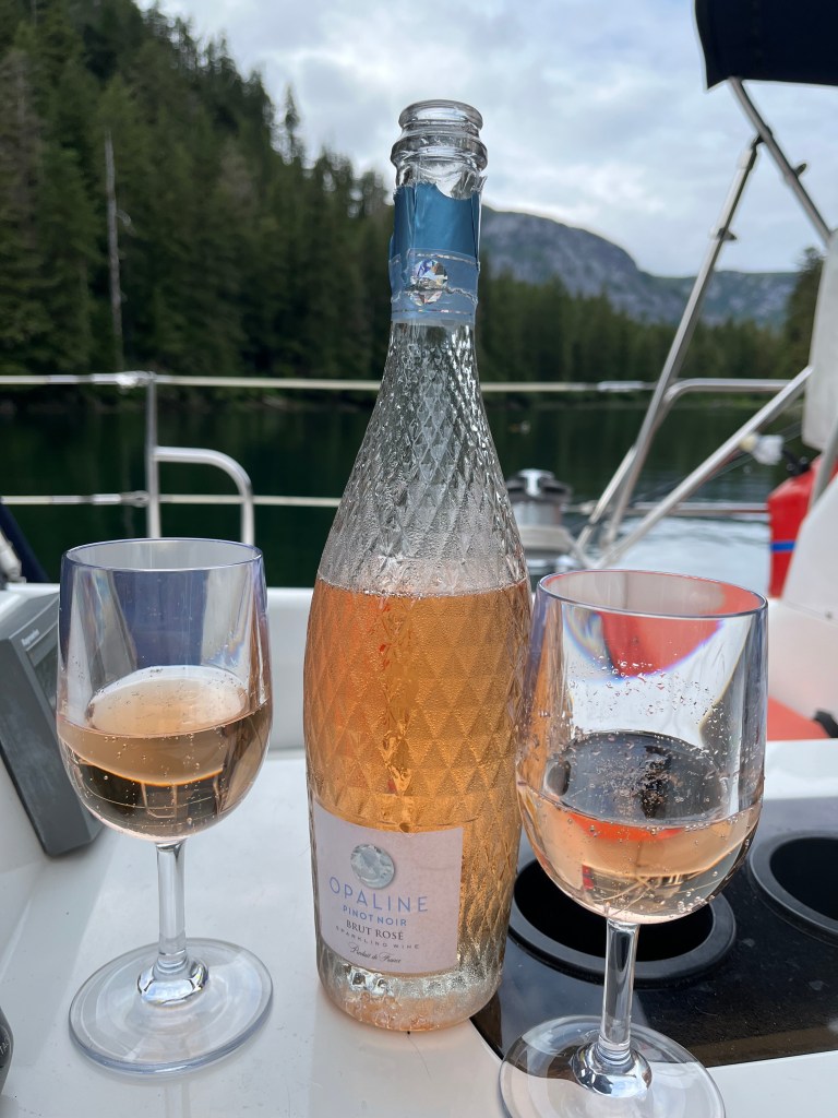
Prior to departure for this unique voyage, our friend Chrys Hansen gave us a bottle of French Opaline pinot noir Brut Rose which we opened this evening to celebrate today, the very approximate half-way mark of a four-month adventure.
If my 2014 MacBook Pro battery lasts through this summer, it will be a miracle.
A typical goal of this “leg” of the trip, today we achieved five hours underway and two and a half motoring … i.e., we sailed four tacking legs on South Chatham Strait and motored only to leave Red Bluff Bay and enter Gut Bay to reach our anchorage.
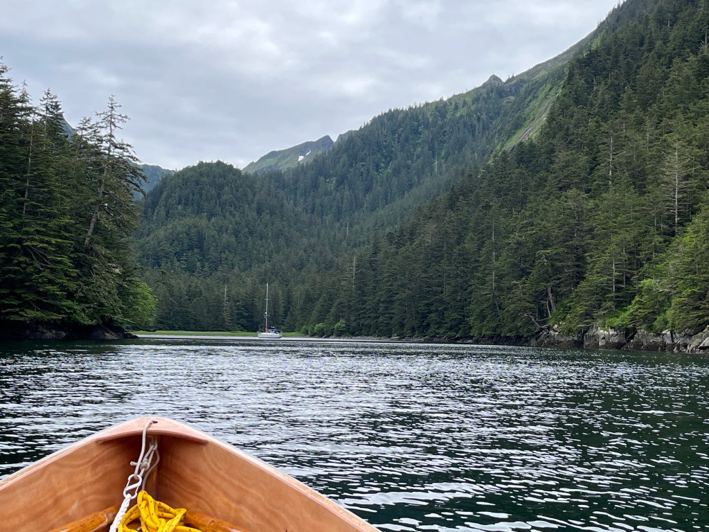
We arrived at the first spot we had in mind only to find an intruder, so we opted to explore the adjacent “Mickie’s Cove,” named on the basis of an interesting, relatively recent tale. In the mid-90’s, a French woman by the name of Parisian Michelle (Mickie) Demai and her partner Thomas (lucky guy) decided to winter over in what Douglass and Douglass have named Mickie’s Cove where we anchored this afternoon. Spending four months of preparing themselves and Mickie’s 42’ steel-hulled sloop Nuage in Juneau, the two traveled from the Alaskan capitol to Gut Bay, dropped hook, and spent the next four months literally iced-in. How nice it would have been had they written a book about the experience! Mickie’s Cove combines the breathtaking high and long waterfalls of several places we’ve visited, the massive glacially carved rock ramparts of east Endicott Arm and Ford’s Terror, the coziness of Boat Harbor, and woods around the tiny bay full of song birds and allow one to, as U.S. Coast Pilot Volume 8 puts it, enter “…this opening of a little bay, between high ridges, with a depth of 3/4 fathom. Small craft can enter this bay at high water and anchor in about 3 fathoms.anchor.” (3/4 fathom is 4.5 feet, a foot too shallow … at mean lower low water … for Encore to enter.)
Not only were we granted some blue sky upon arrival, a small black bear walked along the wooded north shore around dinner time, only our fourth bear spotting and third black bear sighted aside from the two black bears and two grizzlies seen from the road north of Haines.
Both fishing and crabbing at Red Bluff Bay and, fishing at Gut Bay have been busts. Shifted to Dolly Varden guts for crab bait today, so we’ll see what tomorrow’s crab trap haul brings.
Gut Bay 360 – coming!!
Bird Notes: First, I owe an apology to readers. I have erred in reporting two bird species, consistently in one case and in all but one report of the other. I’ve consistently misspelled “Steller’s” in referring the the jay common to the northwest. I discovered this reading the chapter “Explorers” of James Michener’s Alaska (very slow progress) in which he introduces the German Georg Steller (“-er” not “-ar”) as the naturalist who joined Trofim Zhdanko and Vitus Bering on their nearly decade-long voyage to explore “Alaxsxaq” as the first Aleuts of Alaska called the Great Land.
On 20 May, I properly identified the Pacific Slope Flycatcher which I’ve since inexplicably referred to as a Cordilleran by mistake. The Cordilleran inhabits much of the far west east of the Rocky Mountains from Alberta into Mexico.
I almost called out a Robin earlier this evening … along with the other now-common trio of thrushes which would have made a quartet. To the three, add Kingfisher, Ruby-crowned Kinglet, Pacific Wren, Tree Swallows, Short-billed Gulls, Ravens, and Crows, the latter of which I’ll cease listing(!)
Monday – 24 June
Mickie’s Cove/Gut Bay to Toledo Bay: 56-22.4N 134-38.1W
A very early start today (0520) prevented Encore from becoming land-locked at the mouth of Mickie’s Cove. As it was, the depth sounder read 1.3’ crossing the bar. Leaving early also allowed riding an ebb tide south, but it was a day lost to sailing and even much motor sailing given lighter and shifting winds … always toward the bow! What was to have been a straightforward two-tack day across Chatham Straight and back turned into a 5.5-hour underway in rolling seas concluding with 4.8 engine hours despite an ebb tide.
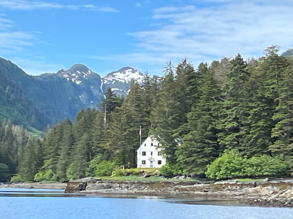
We popped in to Little Port Walker to snap a picture of the long-standing NOAA Fisheries Building there which, a full power zoom, is terribly pixelated to the point of looking like a painting.
Toledo Bay is a small, circular bay accessed via a narrow, shallow channel through opposing rock walls … and kelp. It’s the smallest cove we have stayed in and was reportedly named on the basis of an early explorer exclaiming “Holy Toledo!” upon entering. The pictures and movies will impress. I attempted to take drone shots with son Andrew’s drone. The flight went okay – still terrifying – and the remote controller appeared to operate video and camera shots but nothing was recorded to the drone’s micro-SD card. More operator training needed!
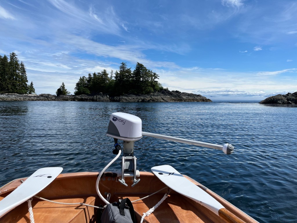
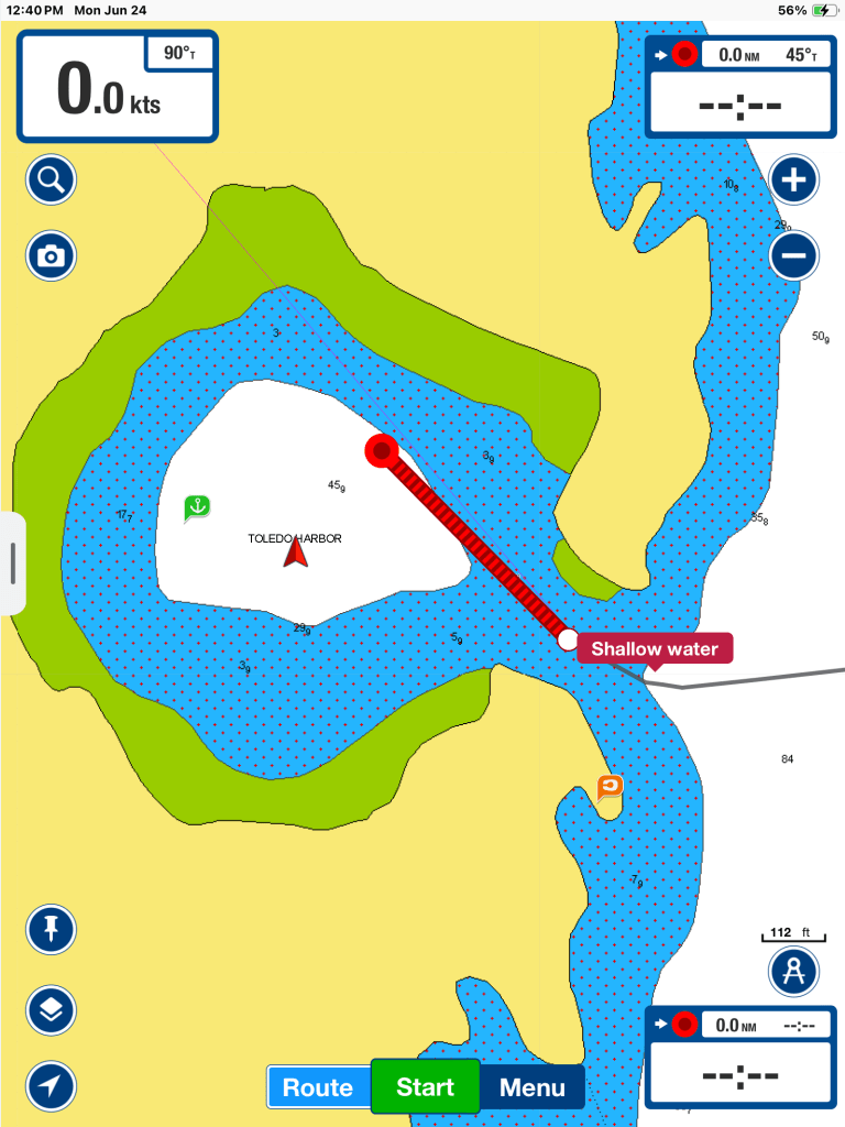
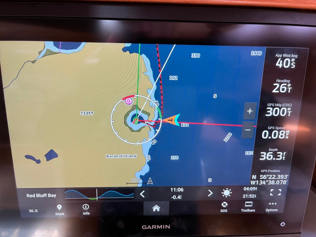
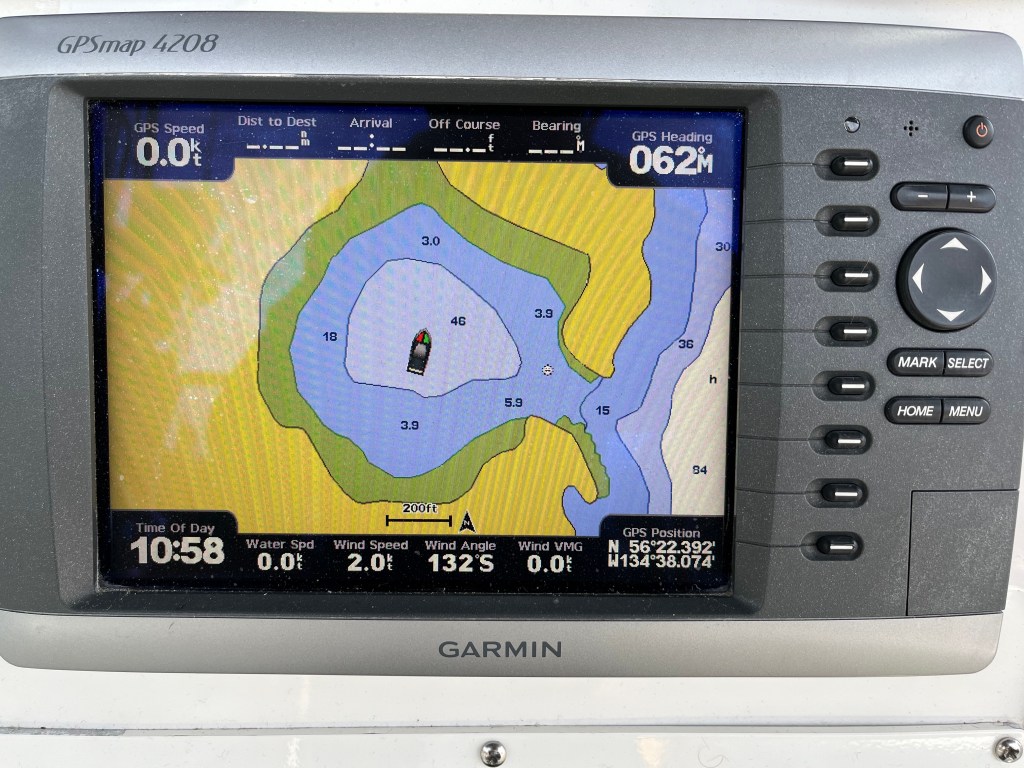
Happiness is redundancy in navigational tools …
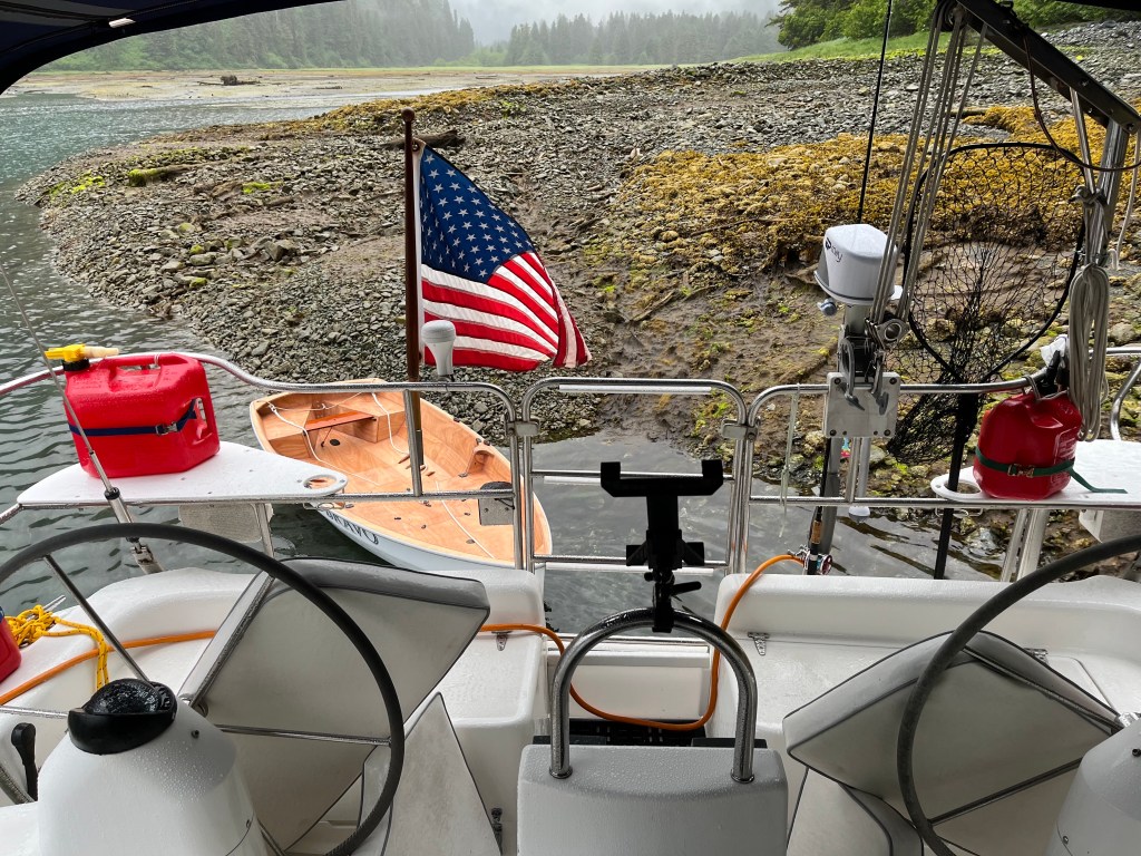
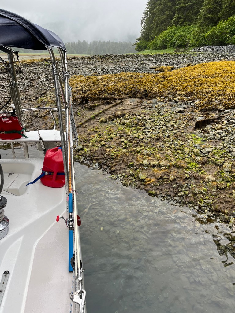
Toledo Bay – low tide Toledo Bay – high tide
We spotted the first deer we’ve seen this entire trip today twice. The doe approached the creek at the south end of the bay at the mouth of the stream that enters there and circumnavigated it clockwise … only to retrace her steps early evening.
I attempted semi-serious Halibut fishing outside the mouth of Toledo Bay in 60-80’ this afternoon. I used a proper lure with proper jigging technique and at the proper tidal state – slack. Three different times it felt as if I had a big fish on, but I realized I hadn’t asked anyone what to expect from a Halibut! I vaguely recall that they take a lure much like a Great Lakes Muskie does at least initially. It feels as if one has snagged an anchor on the bottom. There is no “fighting” in the Trout- or Bass-sense of the word. Each time this was the case. Rod doubled, I would pull and gain a foot, and then whatever I had hooked pulled hard back without much more than a slight shake. My net gains each time were encouraging but minimal, and all three ended the same way the “fish” suddenly broke free, and there was nothing to show on the double hooks. Puzzling. I will ask!
Tomorrow we will taste off-shore sailing again rounding Cape Ommaney at the south end of Baranof Island to reach Puffin Bay on the west side and Forevergreen Cove at its head.
Bird Notes: Quartets and quintets are more appropriate in scale, but sometimes it feels like I’m being treated to very light chamber music listening to so many singing (and tapping) birds in small coves. Today’s list is similar to earlier ones. All three thrushes, Pacific Wren, Bald Eagle, Marbled Murrelets, Short-billed Gull, and Kingfisher. Rarer sightings: Orange-crowned Warbler, Oystercatchers, Harlequin Ducks. And heard, a woodpecker, one of six possibilities according to iBird.
Tuesday – 25 June
Toledo Bay to Forevergreen Cove, Puffin Bay: 56-16.5N 134-46.2W
The crab trap hauled very early this morning, even stoked the afternoon prior with well-fermented fish guts, garnered only another five sea snails, smaller than those at Tenakee Springs. Outside the mouth of the bay the presence of a sea otter afforded a possible conclusion regarding the fate of Toledo Bay’s crab population.
Our earlier departure supported plans to venture around Cape Ommaney, hopefully by sail which was not to be. We motored past the promontory to find it loaded with massive Sea Lions bellowing at one another and observed our first of many Humpback tail-waves at 0755.

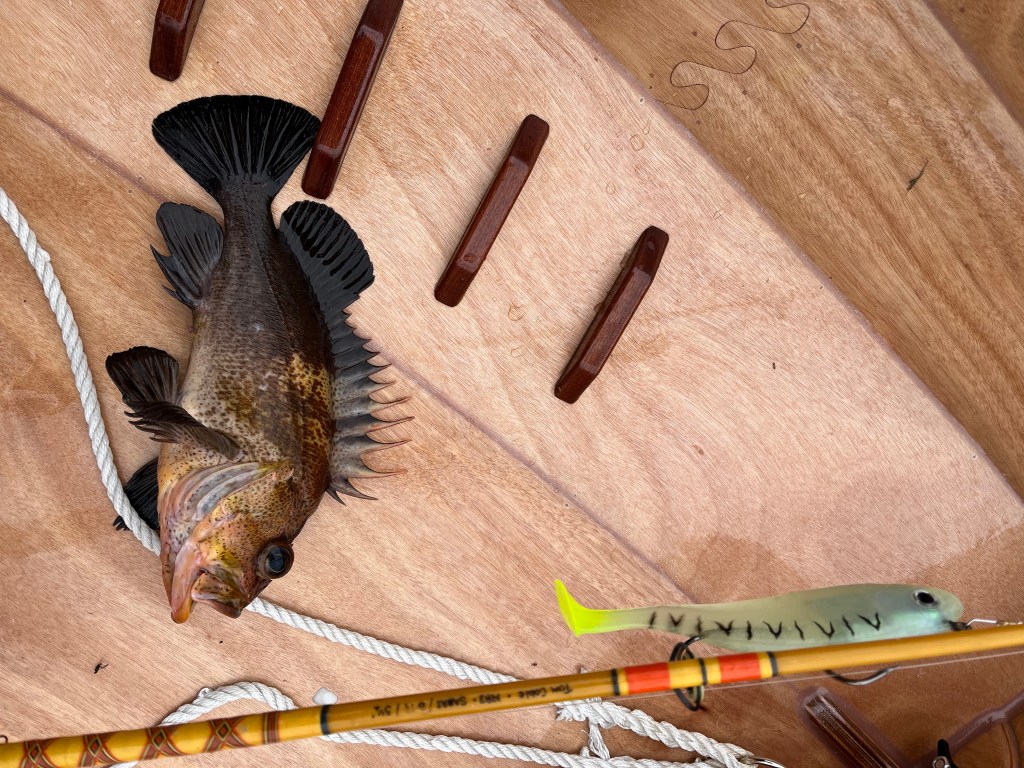
While mostly motoring wasn’t one of them, today, leading through the next morning just out of Forevergreen Cove was yet another day of firsts: 1) We encountered dense fog which was initially on the east side of Chatham Straight which looked rather beautiful on an otherwise sunny morning until it suddenly consumed us. Let’s practice navigating by radar! So we did. 2) open ocean sailing west of Baranof at a mere 2-3 knots because … 3) it turned into another free whale-watching day, so we opted to sail. Nearly two dozen Humpback whales, singles, pairs, and pods, kept us occupied for over two hours beginning before 8am just after rounding Cape Ommaney. Two exhibited “fluke-flapping” (a first) and two others fully breached closer aboard than any to date. And finally, 4) my catching a respectable, first, and most delectable Rockfish in the deepest water I’ve ever fished at the head of Puffin Bay shortly after we departed Forevergreen Cove.
Humpback Whale Fluke Flap
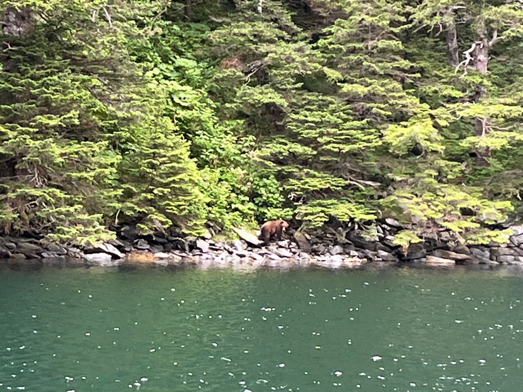
Seconds included seeing another doe walking the shoreline and out of phase with another much larger brown phase Black Bear also ambling and munching grass along the shore of Forevergreen Cove less than 100 yards from Encore.
Gut Bay 360 – coming!!
Bird Notes will interject earlier than usual today because we were welcomed into Forevergreen Cove by a particular vivacious Ruby-Crowned Kinglet belting away well above engine noise near the cove’s mouth. To my amazement, bird songs began a crescendo once we anchored and secured the engine, and I want to use the occasion to again offer thanks to Jane’s friend and fellow rower Cindy Ziobron for suggesting I post these notes in the first place. She visited Alaska years ago and must have known just what I’d encounter! Today seemed to offer a capstone avian performance in this isolated wooded amphitheater backdropped by tall, steep, and greenery-covered peaks pocked with snow. The Ruby-Crowned Kinglet, a bird that always takes me back to pre-teen visits to Summit Creek in Copper Basin, south central Idaho, presented the opening stanza. This particular maestro’s concluding “Too-tweet!’s” were emphatic with three or four repeats, “Too-tweet, Too-tweet, Too-tweet!” which I’d never heard before. Then arose a beautifully haunting, ethereal random bell choir of more Varied Thrushes than I’ve ever heard calling together, six or eight?, embellished by ascending calls of Swainson’s Thrushes, rarer descending calls of Hermit Thrushes, wildly trilling Pacific Wrens, and with staccato interjections by Wilson’s Warblers. The full symphony went on for easily an hour. At 4am I’ve risen hear the day’s preludes, often by the Varied Thrushes, and still hear birds singing well past 10pm at night. Such is clearly a part of the magic of Alaska.
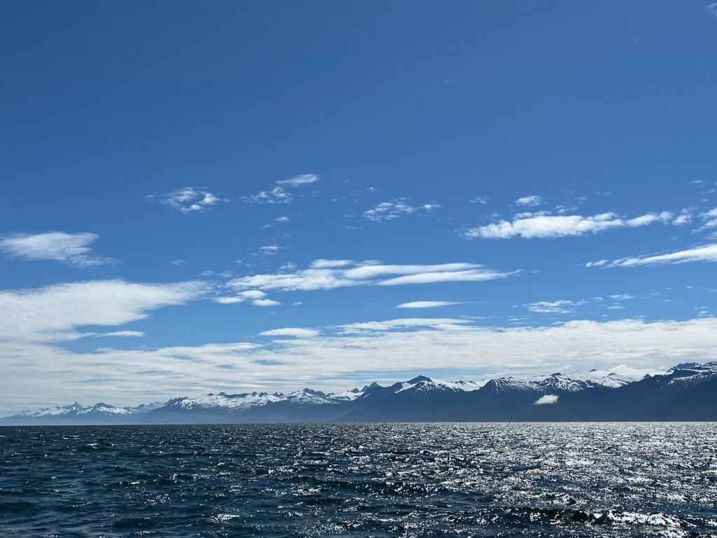
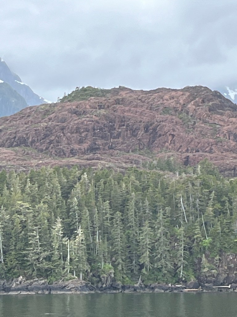
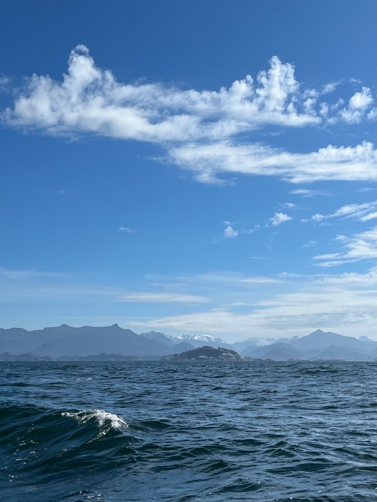
West Baranof Island formed the western boundary of glaciers during the last ice age, so its contours are starkly different from the east side. Additionally, the “green line” where terrestrial greenery begins is four-fold higher above the rocks than any place else we’ve seen. Finally, the smell of the sea was a noteworthy switch from the aroma of evergreens and other plants here. Also of note, the nature of the tidal shift reminds one a bit of the west shore of San Juan Island with scattered rips and small whirlpools but, in this case, scattered among gentle 3-4 foot swells rolling toward shore from various directions.
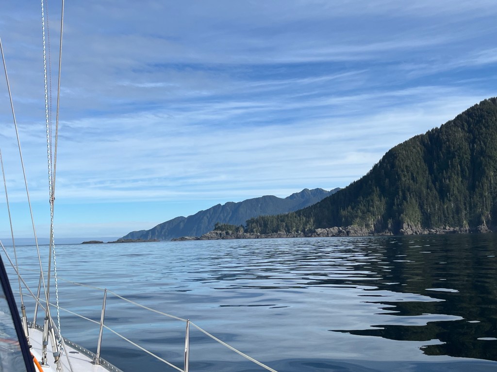
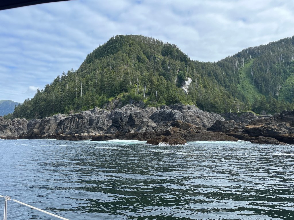
Puffin Bay entrance in the distance (left) and south point (right)
It seems to be the season of jellyfish. Many dozens, equal numbers of white and red, slowly undulate by. A large red one spell-bound me against the dark reflection of evergreens.
Red jellyfish – coming!!
As of tonight, our plans have changed once again. Rather than return to Chatham Strait by way of south Baranof, we will press on north with hopes of sampling the final couple of days of the Sitka Music Festival and then take Peril Strait east, between Baranof and Chichagof Islands, to Chatham Strait, thence Frederick Sound to Petersburg, Leconte’s Glacier, and several more detours before reaching Auke Bay on July 12th.
Wednesday – 26 June
Forevergreen Cove to Still Harbor: 56-32.8N 135-01.5W
Change of plans! Rather than stay at Reanne’s Relief (Cathead Cove), we decided to keep going toward Sitka.
We are thankful for the practice using radar around Cape Ommaney. Before needing it, I took this video of the west Baranof Island coastline.
Baranof Island coast – coming!!
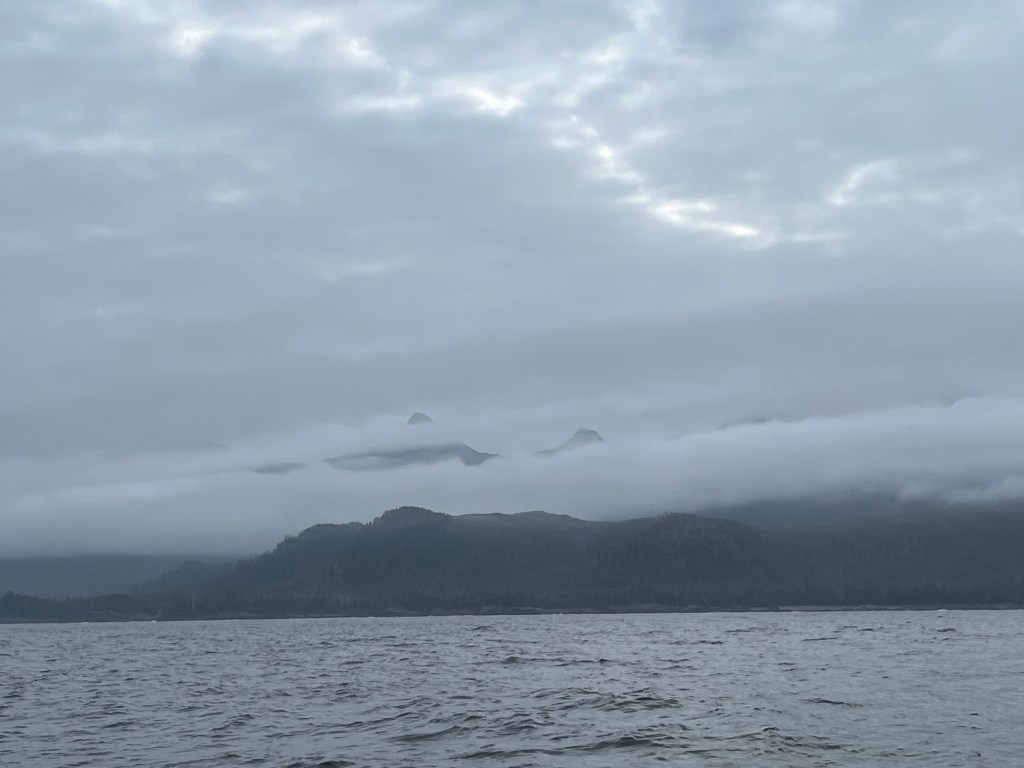
The fog came in for several hours within an hour after leaving Puffin Bay, and we ran with radar again. We beat into moderate winds that grew as we sailed the entire way to Still Harbor. The northwest wind was such that the fast leg, better aligned with the straight-line route, was toward land, so we motor-sailed on the to-sea leg and sailed sans motor back to the coast. This saved us three hours of motoring.
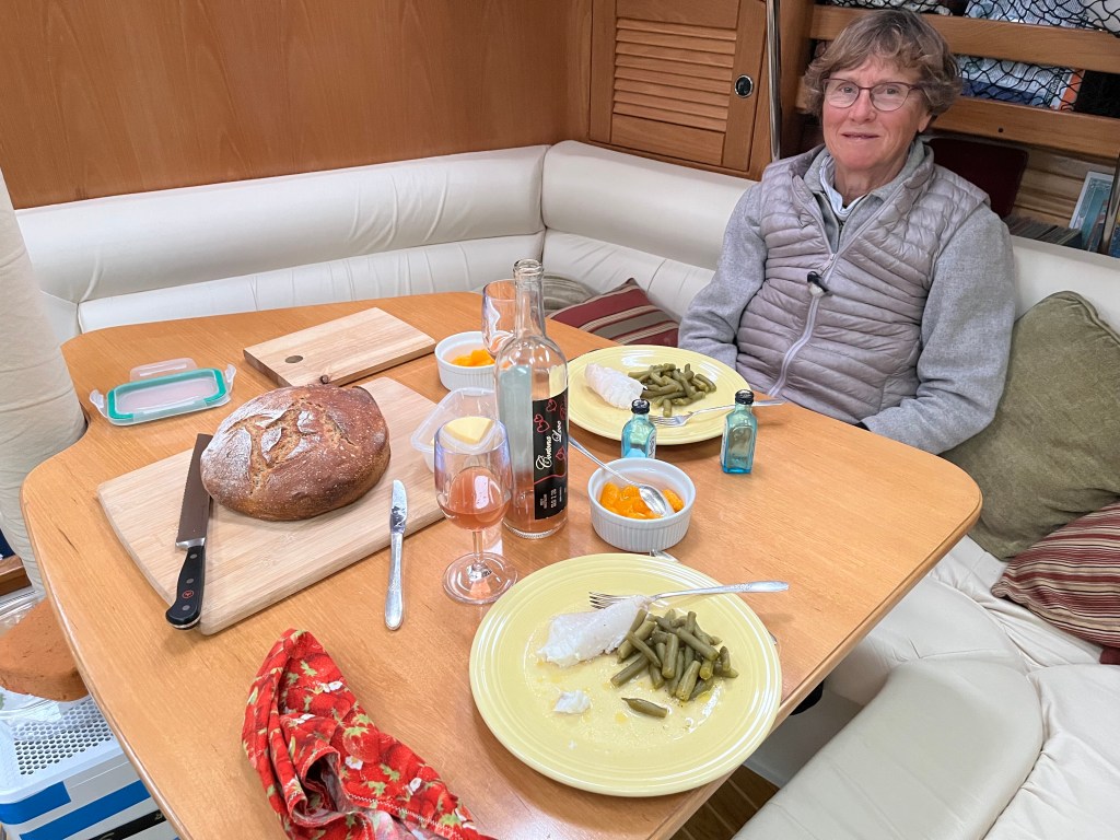
We dined on delectable Rockfish, baked with butter and lemon juice.
Bird Notes: Pelagic Cormorants and petrels or shearwaters or something like those birds zipping by in the fog. At anchor, the usual suspects with the addition of two Oystercatchers and a Greater Yellowlegs. Again thanks to Merlin.
Thursday – 27 June
Still Harbor to Hotsprings Harbor – Goddard Hotsprings: 56-50.2N 135-22.9W
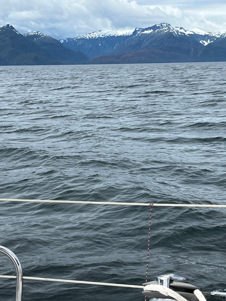
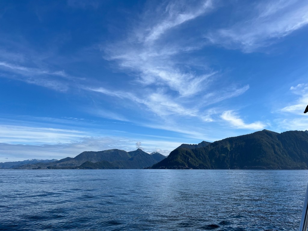
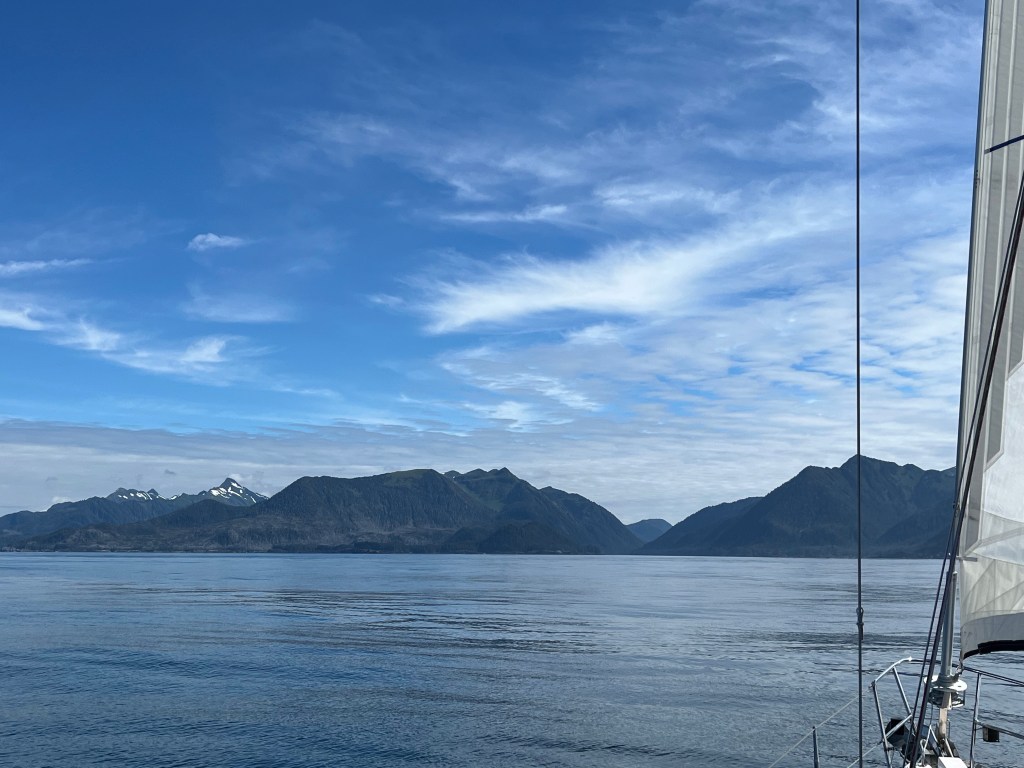
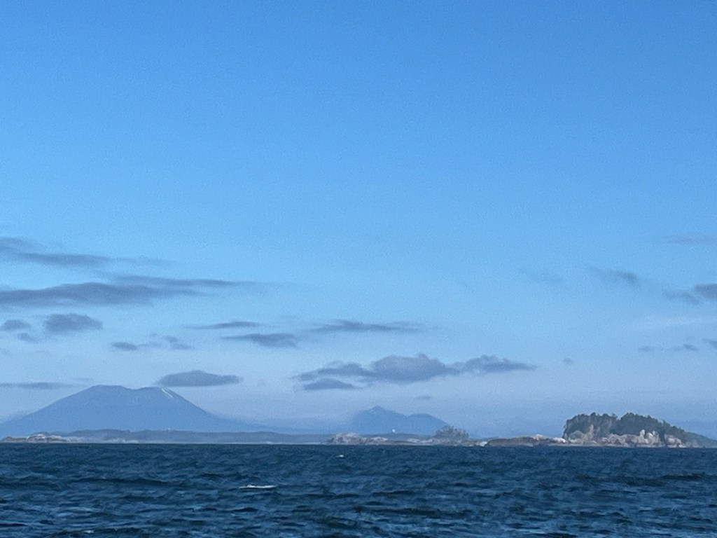
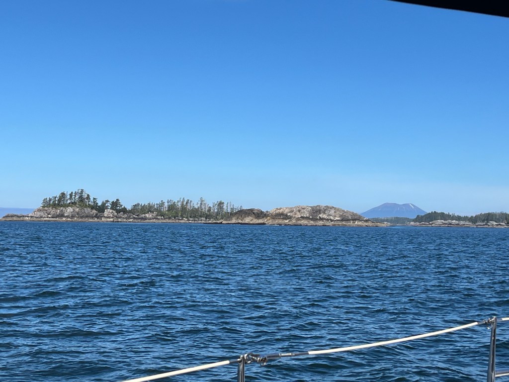
Another rough almost entirely motor-sailing day – fog-free – beating in 4-5 foot seas four or so nautical miles out to sea then back in to the rugged Baranof coastline with 12-14kt northwest winds near-shore and 15-17kt winds offshore. By (motor) sailing, we made better speed through the water (5.5-6kts at the lower wind speed and 6.5-7kts at the higher wind speed) and avoided the incessant pounding without sails up heading directly into the wind and seas with motor alone. Our speed made good was, reflecting on it, not bad at around 5kts. Once in the lee of a batch of islets a dozen and a half miles south of Sitka and an hour from Goddard Hot Springs in substantially calmer waters though lighter air, we sailed pleasantly for an hour and caught an eye of Mt Edgecumbe … named in the 1780’s by Captain James Cook.
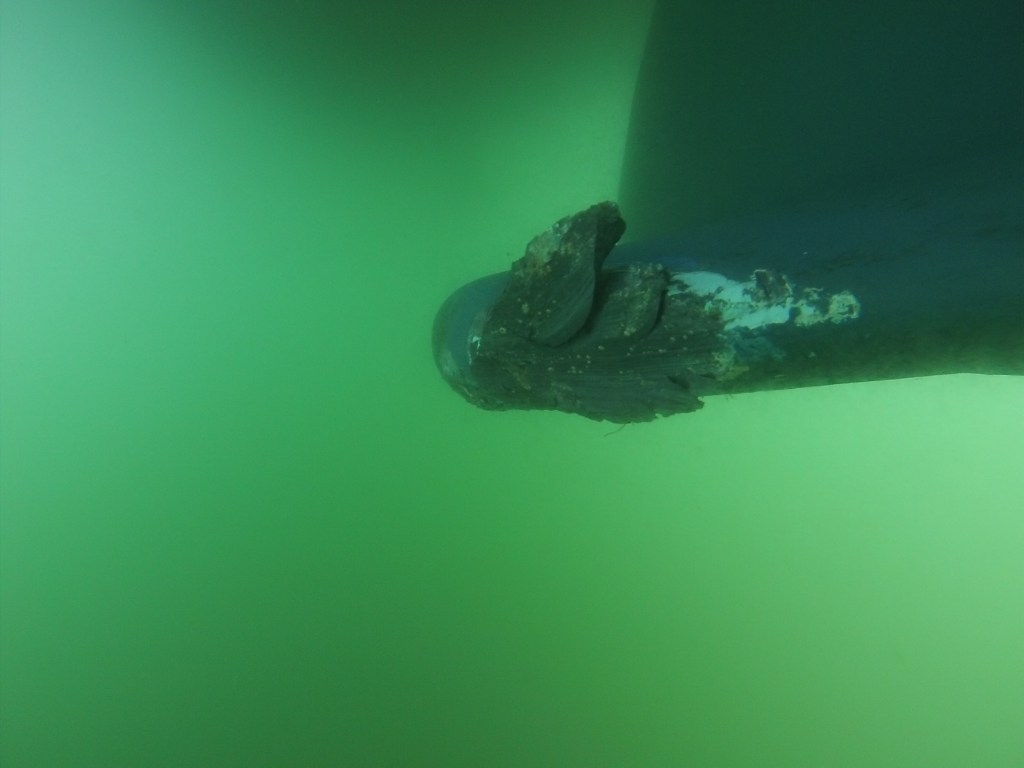
Then trouble. Upon starting the engine and engaging the shaft with some speed, a new unexpected intermittent rumbling was discernible. My first thought was cutlass bearing failure. Donning scuba gear after lunch at anchor (what a process this is on a boat!!), I discovered that the shaft-cutlass bearing was tight but one of the three propeller blades exhibited play which I’ve not seen before. We will inquire of marine technicians by phone when we return to cell service tomorrow. I also took close-up pictures of the keel wing damage sustained at Foggy Bay on 14 May. Pretty substantial. I also examined for damage following the two bergie bit collisions in Endicott Arm and was pleased to see the prow below the waterline to leading edge of the keel was unscathed save for a chip of paint removed right next to the knot log. Sturdy boat AND paint job.
Lead is elastic …
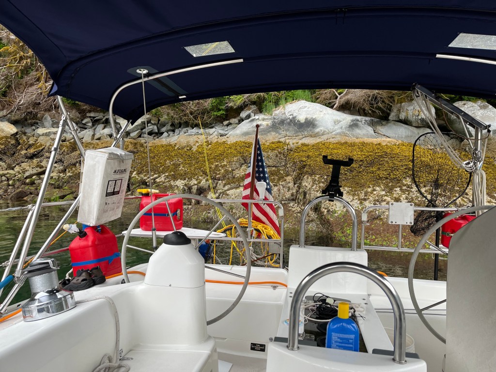
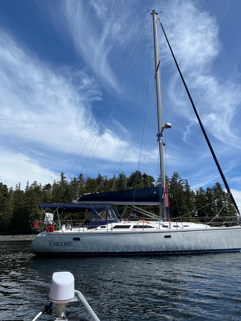
Our trip to the hot spring was a bust save for a cool shot of Encore. Of two nice Forest Service large stainless steel tanks to soak in, the lower was occupied – far too long – by a very noisy family of teenagers and friends celebrating a birthday. The upper tub’s cold water source has dried up leaving 145F water in which to be nicely poached. We didn’t.
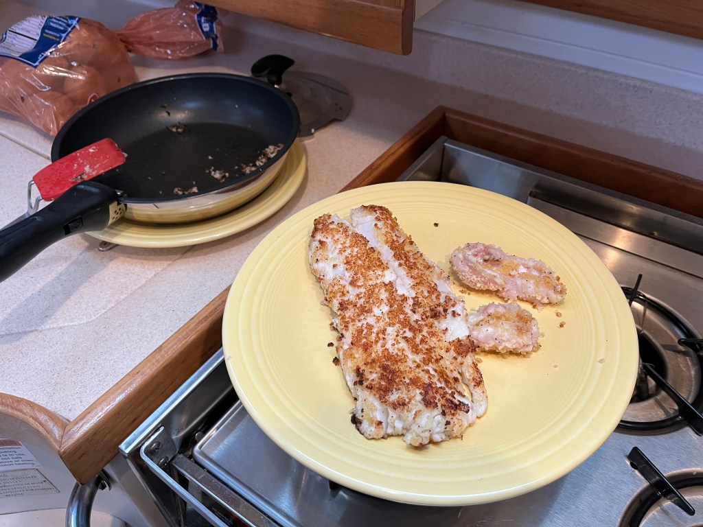
We dined on the remainder of the Rockfish, pan-fried in butter with Panko and lemon juice. Delicious fixed this way too.
Bird Notes: A TUFTED PUFFIN (new bird!) whizzed by us on our last seaward tack first outbound to sea and then, amazingly inbound again permitted a confirmation of the specific identity. Usual suspects were heard at anchor, and I heard a Townsend’s Warbler in the woods walking up above hot spring.
Friday – 28 June
Hotsprings Harbor to Sitka: 57-03.6N 135-21.3W
A DOCK for a change! Won’t say much about Sitka except we’re happy to be here.
We had an interesting radar contact this morning that, at first, we couldn’t see. It was alternately solid and ‘speckled’ and less than a mile away. – a distance at which we should have seen it. In the poor morning light, binoculars enabled detection of a large flock of gulls working over a bait ball of fish. Cool!
I spoke with a Marine Tech on the east coast who knows a lot about Autoprops and is providing me both instructions and will sell me specialized tools to fix the loose blade. How/when is TBD, but soonish. Need to find a diver willing to pull the prop … and order the tool$ to do the work. Might wait until Petersburg or Auke Bay?
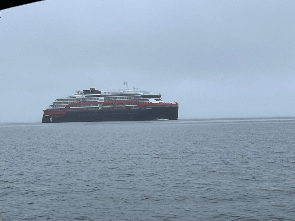
VERY smooth but foggy last 16 miles to Sitka with only light, very damp, very chilly breeze. No pictures save for one of the Roald Amundsen, a very sleek looking small cruise ship flagged in Longyearbyen (Norway … had to look that up) with whom I spoke about channel passing arrangements inbound Sitka.
Bird Notes: I conclude upon our entrance to the Eliason Marina that Sitka is the Bald Eagle capitol of the world.

Ahoy!!
<
div>Thanks, Marc and Jane!!
<
div>You are getting into tufted puff
LikeLike
Epic post! I hope you’re enjoying your adventures as much as I enjoy reading them. Stay safe!
LikeLike
Peggy Watt206-280-8277Sent from iPhone
<
div dir=”ltr”>
<
blockquote type=”cite”>
LikeLike
Thanks for giving Glaciers, Bears and Totems: Sailing in Search of the Real Southeast Alaska such a great mini-review. I’m enjoying your blog/emails tremendously. They make me feel as if I’m back there again. And the photos look just as I remember the places we have been.
I was surprised you didn’t know that red jellyfish sting. I spent a big part of my childhood at Three Tree Point in Puget Sound and all of us children lived in fear of getting stung (not that we let that stop us from going into the water.)
Elsie Hulsizer Elsie Hulsizer writer and photographer Glaciers, Bears and Totems: Sailing in Search of the Real Southeast Alaska Voyages to Windward, Sailing Adventures on Vancouver Island’s West Coast http://www.elsiehulsizer.com/ http://www.sailblogs.com/member/ospreyvoyages/
LikeLike